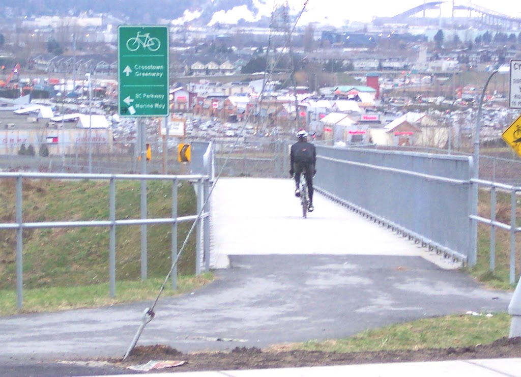
The cycling and pedestrian access to the Queensborough Bridge is a local success story in sustainable transportation.
The “improvements” to automobile traffic flow on the north foot of the bridge a few years ago (funded by the Federal Border Infrastructure Program as part of the Gateway Program and the, yeah, you guessed it, the North Fraser Perimeter Road) were pretty much a disaster as far as traffic-flows go. The commuter backups on 20th Street, 6th Ave, and Stewardson are no better than they were before the project started, almost a perfect demonstration of how you cannot build your way out of congestion. However, the improvements to the “active transportation” routes are great. I can attest to this, as it is my regular bike commuting route to Richmond.
However, several cycling advocates have pointed out as good as the physical improvements are for safety, the route marking is terrible. For everyday commuters, this doesn’t matter. For people visiting the City or trying to find their way through or to our City along this great new infrastructure will inevitably get lost if they follow the signs.
 |
| Like all pictures below, you can click to enlarge. |
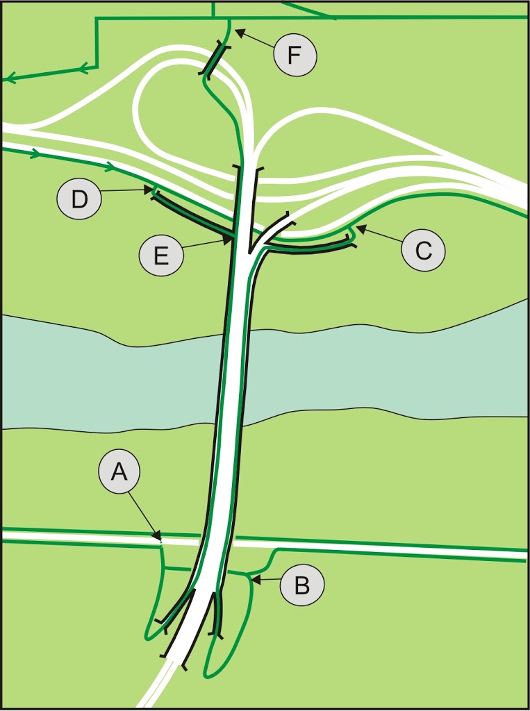
Here is my fancy CorelDraw drawing of the Bridge, green lines are bike/pedestrian routes, white are roads, and the black lines are supposed to evoke “bridginess”. As you can see, the bridge can be approached from any direction by cyclists, and the sidewalks are adequate to allow cyclists to go either way (with a little caution, more on this later). Only the two routes on the west on either side of Marine Way are “one way”. I marked the 6 most important route-marking spots with letters, summarized here.
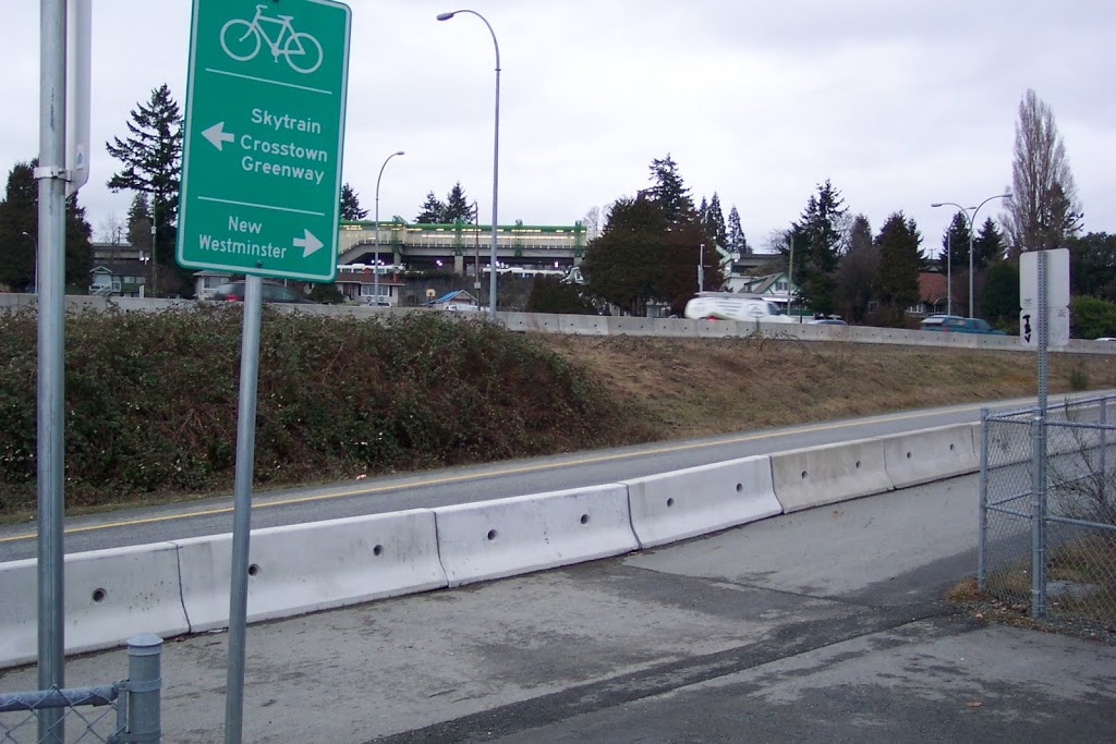
A: When approaching the bridge on the Queensborough side along Boyd Street, you have the option of taking the West sidewalk or the East one. The way the new ramps on the north side are constructed, this is not a decision to take lightly. Here is the sign you will see if you arrive from the West (say, from Richmond):
I’m not even sure what information this is meant to invoke. Take the left path to get to New West? Or go ahead to the next left to get to New West? Well, both routes will take you to New West, but then why have a sign at all?
This is what the sign should look like:
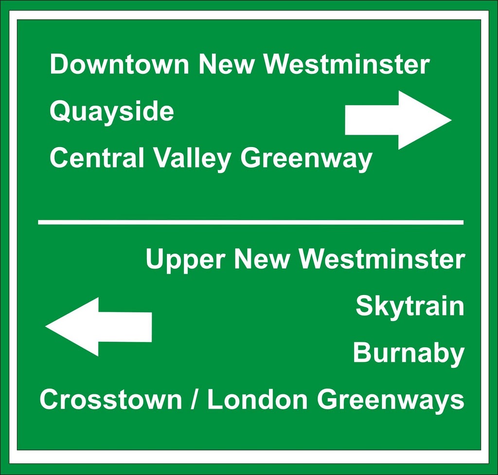
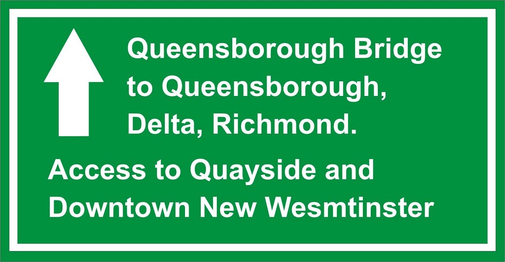
Coming off of the bridge, you approach Boyd and have this information:
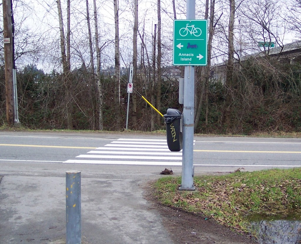
Now, this wouldn’t be so bad if the painted-over word was “Richmond”. That would provide a bit of directions suggestion. But it actually said “Delta”. I don’t know if anyone noticed, but Annacis Island is actually in Delta. This sign is Hellerian in its obtuseness, but not nearly as clever. Here is what is should say:

B: If you choose the lower option at A and head to the ramp to the East sidewalk, or if you approach the Bridge from the East (perhaps arriving from the Annacis Bridge on Derwent Way, or from Port Royal) here is what you currently see:
Not particularly useful, even before the local artistic intervention. It doesn’t even acknowledge the existence of the west sidewalk. Perhaps the sign should be moved down to the decision-making intersection, and another version of the previously-suggested sign installed:
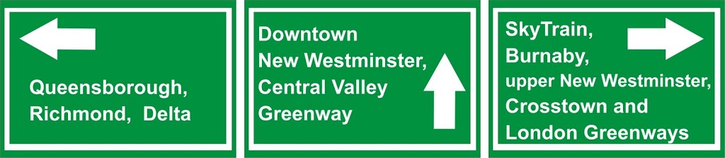
And of course, a similar sign here as suggested on the other offramp to let people know destinations to the west or east once they arrive in Queensborough.
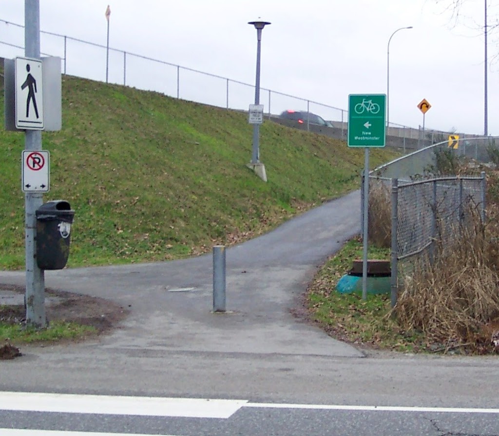
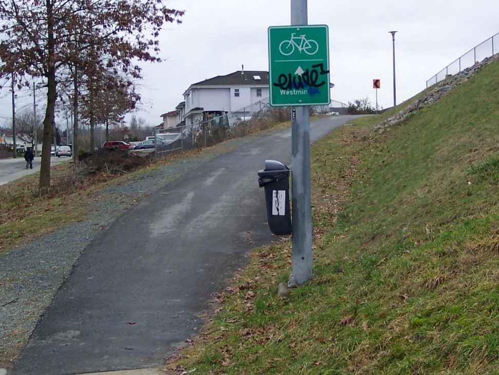
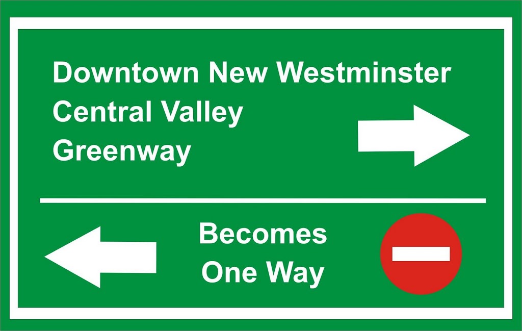
C: This is an interesting spot. When arriving on the designated bike route from New West, here is the instruction you get:
Bike route to where? Anyone riding up Stewardson on the old 7-11 bike route under the Skytrain has not been able to cross Stewardson for more than a kilometre. At this point, they probably have no idea how to get back on that route. Entering the bridge will take them to Queensborough. So here is my somewhat wordy suggestion:
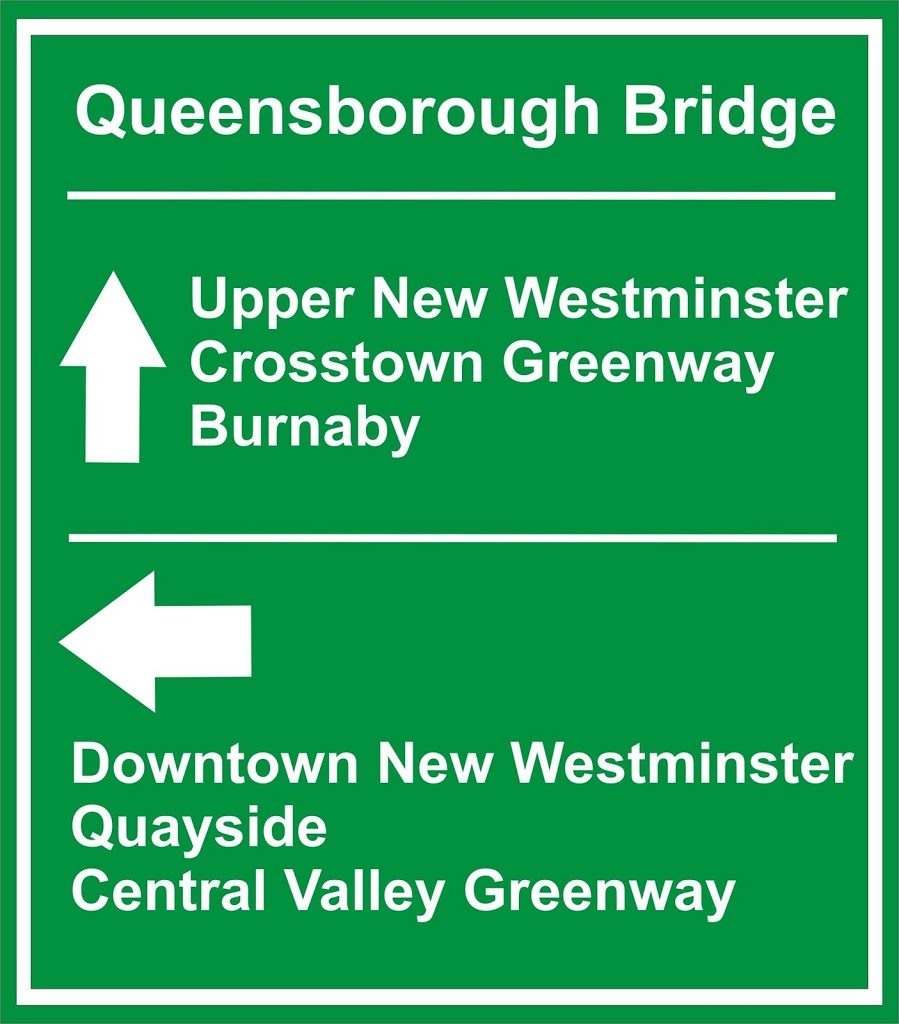
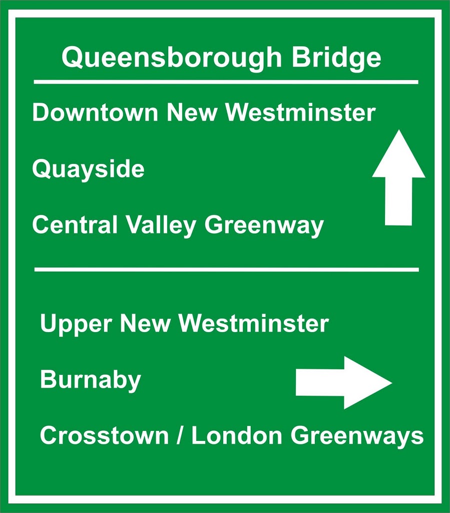
Similarly, people coming off the east sidewalk of the bridge and hitting Stewardson might not be sure where they are at… and this sign is actually not bad, if incomplete:
May I humbly suggest, just so we are all crystal clear:
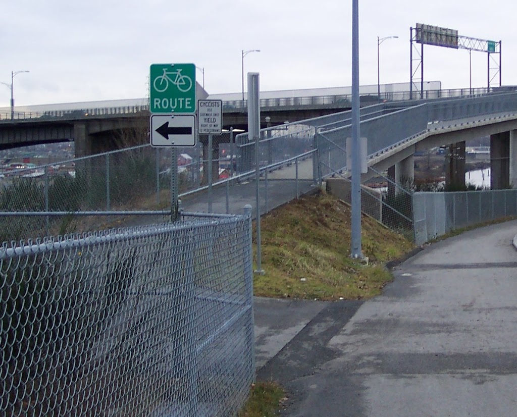
D: Approaching from the West, here is the sign you are presented with:
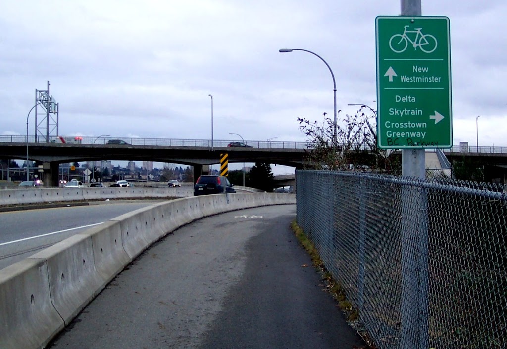
This is curious, as at this point all roads lead to New Westminster, either the West Side, Downtown, or Queensborough. At least here, the graffiti actually increases the amount of useful information on the sign. Approaching from the East, there is no way-marking at all, including no suggestion that the route west soon will become one-way, and you will be going the wrong way on Marine Drive if you go there.
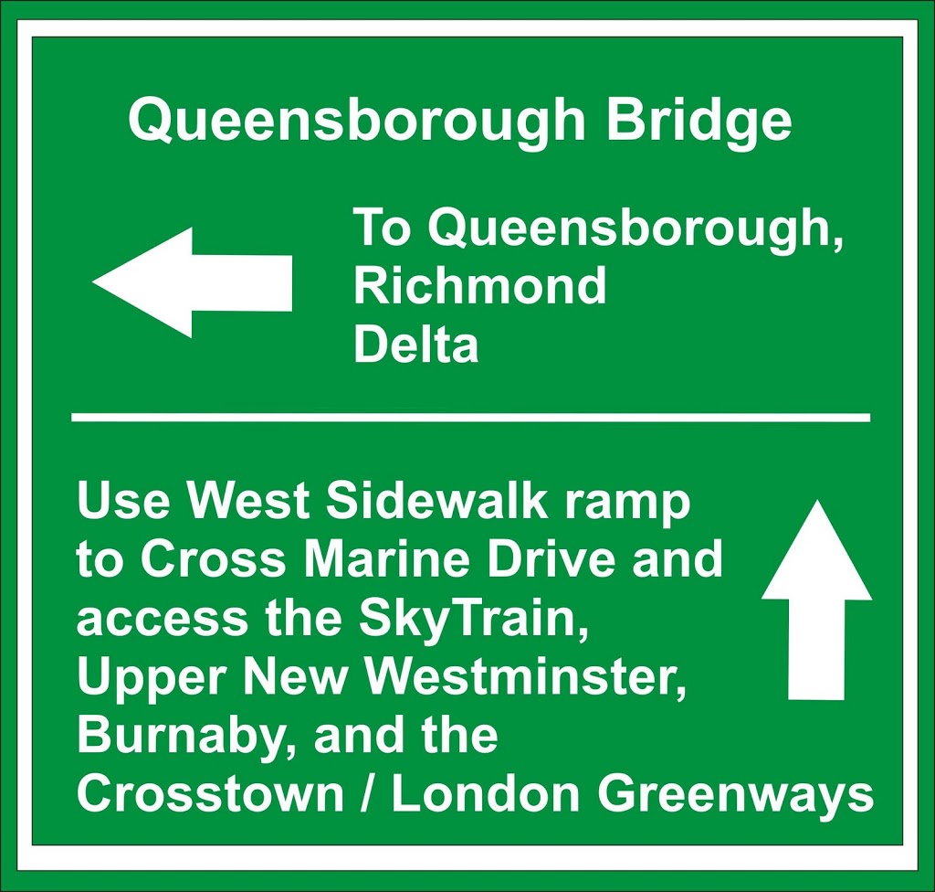
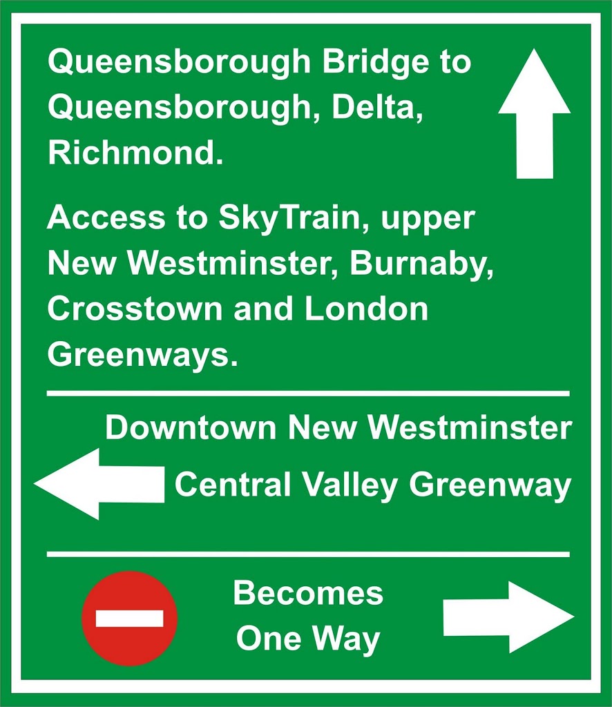
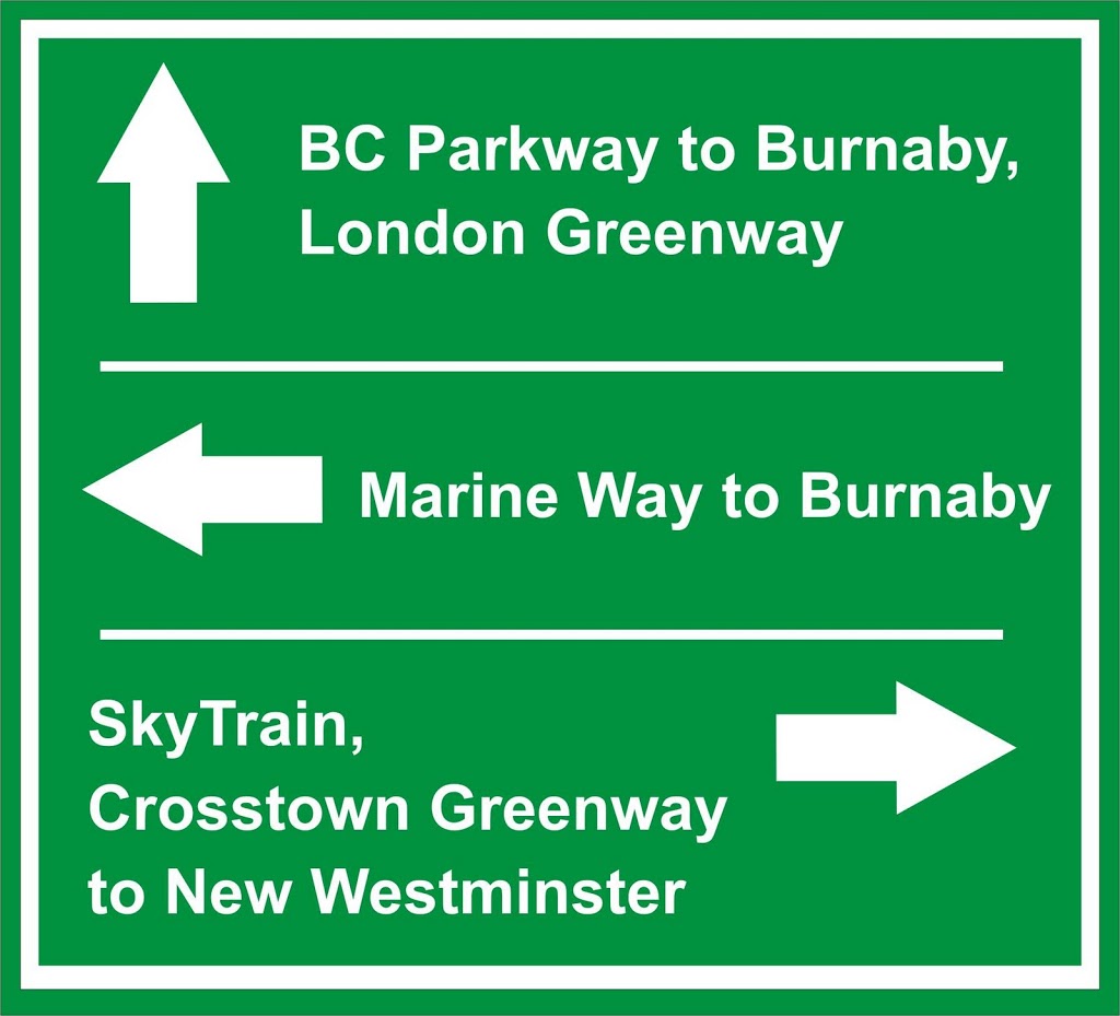
Here, I would suggest a single sign, facing north right where the ramp leaves the sidewalk, so people looking south at the ramp (where they need to make a decision) see this:
People coming down off the ramp really only have one direction to go, so this sign can be pretty simple, but anything is better than the lack of signs they have now:
E: This is a spot where the signs are pretty good, they are pretty complete and correct for those heading up the ramp. If we were going to scrimp, this is where I would keep things like they are.
So it could use some modifications:
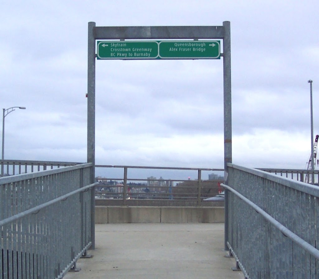
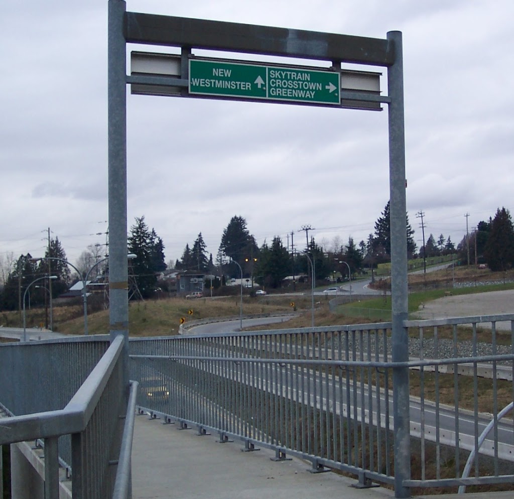
F: Finally, this sign is exactly wrong:
Actually, it looks like it has been rotated 180 degrees, so the instructions are confused. Therefore it is providing no useful instruction either way, and it is the only wayfinding sign at the north foot of the Queensborough Bridge. A couple of million dollars of infrastructure in front of you, and the sign is on backwards. Trust me, car drivers would not accept this. Why should pedestrians and cyclists?
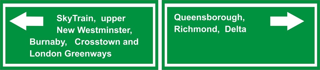
For those coming off the Bridge, there are numerous opportunities. As a minimum, there should be a sign saying this:
However, this area is a major regional pedestrian and cyclist hub, and deserves better than a small green sign on the offramp. This is where the BC Parkway under the SkyTrain and the London and Crosstown Greenways all connect within a kilometre radius. Ideally, there would be a poster-style map located across the road from the bridge offramp, one that showed the quickest route to the major Greenways, and showed where each of those Greenways lead. I think there are better design minds than mine who could put such a poster together. Notably, it was raised during the City’s Pedestrian and Bicycle Advisory Committee summer ride last year that this area a funny bit of infrastructure jurisdiction. The Queensborough Bridge is Ministry of Transportation, the area under the SkyTrain including the BC Parkway is TransLink, and the Greenways are City of New Westminster. Someone would need to get all the parties together and see who would pay for this improvement, and who would install it.
All my suggestions above are just that: suggestions. If you have better ideas or suggestions, Please let me know! If you have stories of wayfinding around the Queensborough, I would like to hear those as well.
Oh, and back to that safety thing on the two-way sidewalks that are not quite wide enough for two-way traffic. Can I recommend we all practice standard trail etiquette?
- Cyclists should yield to pedestrians: That means when approaching them face-to-face, slow right down to walking pace, and come to a stop, holding the rail while they walk by. If approaching them from behind, give them some friendly rings of your bike bell as approaching (NOT right behind them to shock them), and slow to pedestrian speed, and only pass when they give you the right of way.
- Pedestrians: Try to be aware of people on bikes approaching from behind, and skooch over a bit to let them by without snagging your purse, your dog, or your hair. If a cyclist comes up from behind and says “on your left”, that is code for you to move right a little and give them room.
- Uphill traffic has right of way: When bikes are approaching head-on, the downhill cyclist should slow down and give way to the uphill rider. It is much easier to get back up to speed for the downhill rider than it is for the uphill rider, and the uphill rider is much more likely to be travelling at a speed that is safe for crossing.
- Everyone: Try to be aware of your surroundings. And don’t forget to stop at the top, spit off and count how long it takes to hit the water. Gravity is cool.