Ask Pat: Whither bike lanes?

It’s been a while since I answered an Ask Pat question, and there are a bunch of them in the queue, so I’m sorry if I haven’t gotten to yours! I’m a little over programmed right now. All good stuff, just too much! So here we go with an Ask Pat from a guy with a suspicious name:

Patrick P. asks—

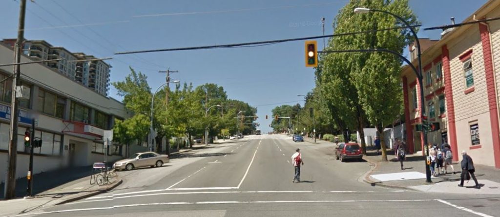
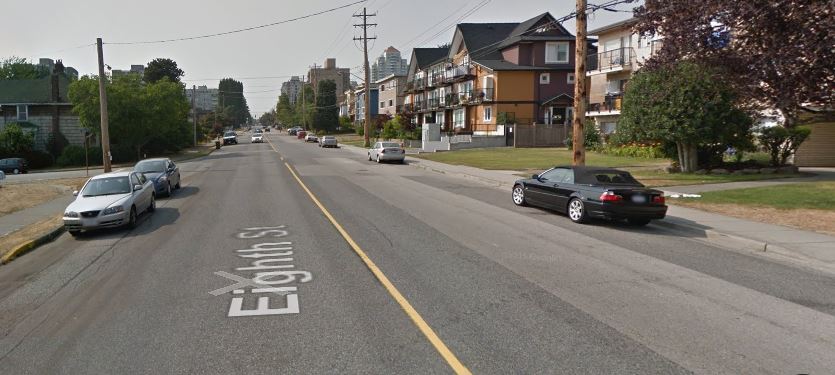
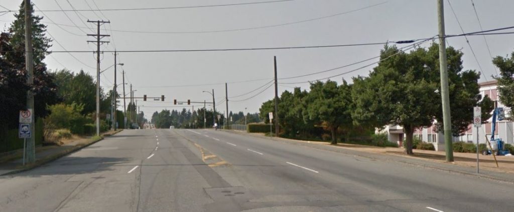
Hi Pat. I find it totally bizarre that while we allow new apartment towers to be built with hundreds of new parking spots for cars, it seems no thought has been given to mitigating all the extra traffic on the road, or to giving people a cycling alternative — or to the impact on our environment. We have no dedicated (separated) bike lanes, and my bicycle commute to central Burnaby has been a challenge as there are no signs indicating a safe route. Moreover I am very worried for the safety of children like mine who want to get around town by bicycle.
Are there any plans to make our city more cycling friendly, particularly around shopping areas? What can I do to help?

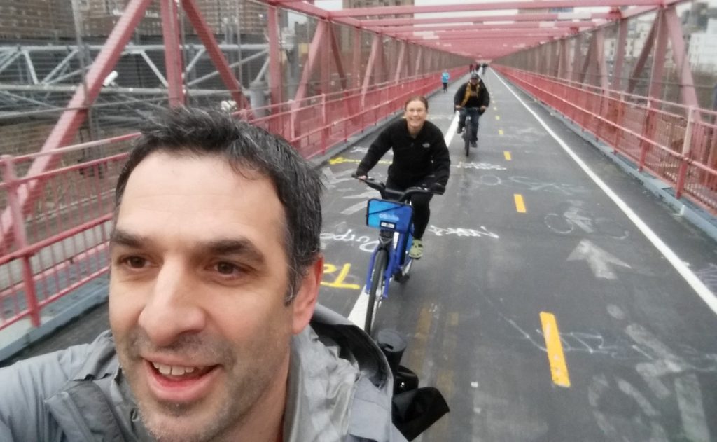
I hear you. As a person who rides a bike for recreation and for daily chores, and tries to commute by bike as much as I can, with a partner who commutes to Burnaby every day on a bike, I know we aren’t yet where we should be as far as cycling infrastructure. Short answer to Question 1 is yes, answer to Question 2 is way down below at the bottom of this post, so fix a cup of tea, sit back and enjoy (or just scroll past all the fluff to the bottom couple of paragraphs)

There is a strange thing about traffic in New West: it mostly isn’t us. Two great statistics that tell you about our traffic problem is that the City has the highest percentage of its land dedicated to roads of any municipality in BC, and that New Westies drive less and own fewer cars per capita than the residents of any municipality in BC (with the exception of the City of Vancouver). Yet traffic is our #1 problem, because people like driving through New West. Presumably, they like it because they don’t have better options, not because of the nice views or the friendly demeanor of our residents.

So in that sense, if we have a car traffic problem, it isn’t the people living in towers on top of SkyTrain nodes. The extra 300 residents with (following our demographic trends) 200 more cars, used only 50% of the time, are a drop in the bucket of the 400,000 cars a day (a number I do NOT have a source for, but a number used anecdotally to describe our through-traffic for rhetorical purposes by virtually everyone) that ply our streets. There is an entire political conversation about whether parking minimums for new developments are good public policy, but I don’t think that is where you are going with your question.

Arguably, providing more housing alternatives in New Westminster (including those towers on SkyTrain nodes, and “missing middle” family-friendly housing forms) will act as a disincentive to people commuting through our City, by providing people better options that living to the east of us when they work to the west of us (you can change either of those directions to point to the same problem). The entire model for the Regional Growth Strategy and Regional Transportation Plan is based on that idea – compact, transit-friendly, mixed-use development as opposed to car-centric sprawled single-use development. New Westminster is (IMHO) leading the way for this development model regionally, and is, unfortunately, still straddled with the traffic impacts of neighbouring communities not talking as active a role in changing how they develop to suit the regional vision.

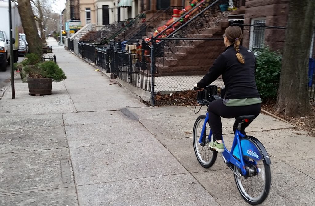
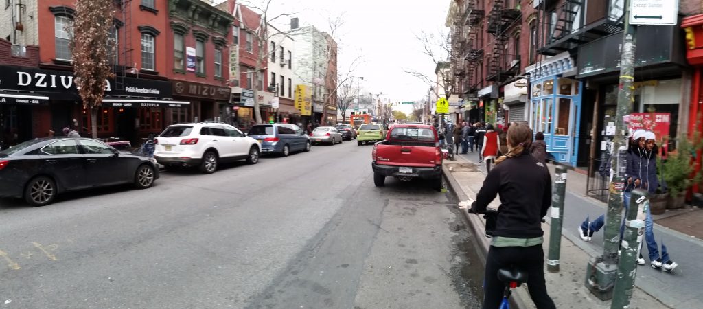
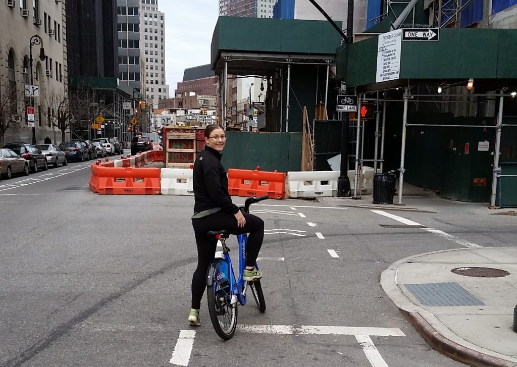
But you live in New West, work in nearby Burnaby, and want to be more comfortable riding your bike to work and to shop. Even better you want to feel safe sending your kids off to school riding their bikes. You (and I’m not just saying this because of your great given name) are part of the solution, and are fortunate to have the opportunities in your work/life/health/etc. to make that choice. The City should be making it easier for you.

I think we are, but perhaps not as quickly as either of us would like, through implementation of our new Master Transportation Plan. Passed before I was elected (although I served on the advisory committee), this plan represents a monumental shift in how we, as a City, are going to look at investing in our transportation system.

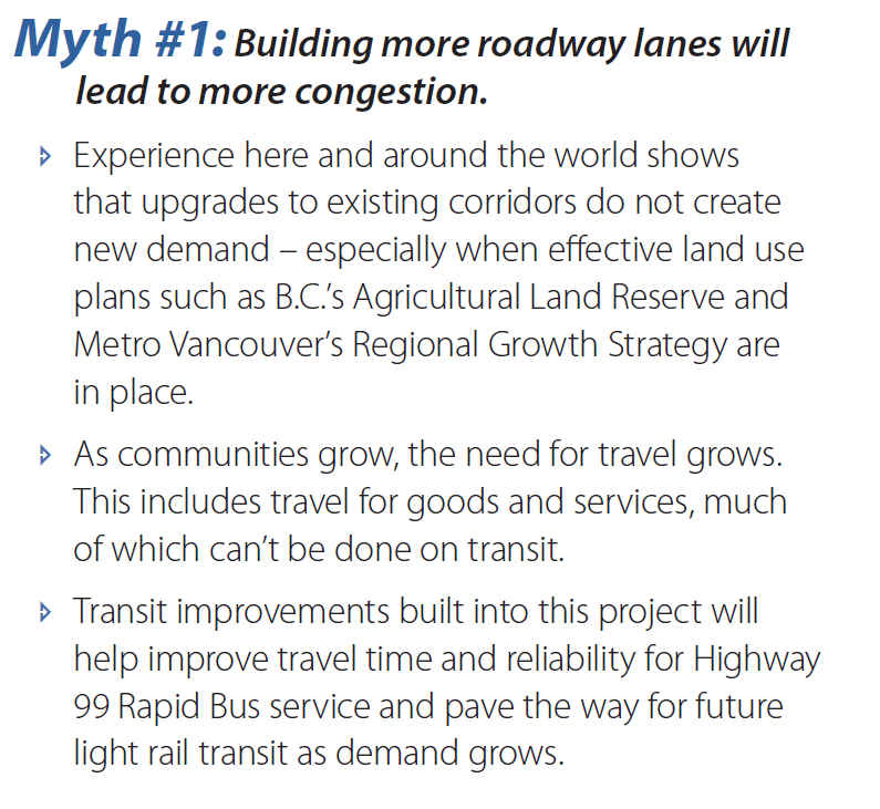
First off, it places active modes at the top of the priority list:

heirarchy

To me, that means we are going to spend less on making the asphalt smooth, and more on making the sidewalks, bike routes, and transit system operate better for all users. To you and me, that may seem obvious; to enshrine it in a master planning document means we are charged (us elected types and staff of the City) to do it, and put our budget where out mouth is.

What does this look like on the ground? For the first time, New Westminster is investing in green paint. It has taken a bit of time, and in the first year of MTP implementation we really invested more in primary pedestrian and transit accessibility (we are aiming for 100% accessible sidewalk curb cuts by 2018, and 96% accessible bus stops, which leads the region on both counts). We have also staffed up a bit in our transportation department to expand our ability to plan and deliver these projects. This next phase does include some significant cycling improvements.

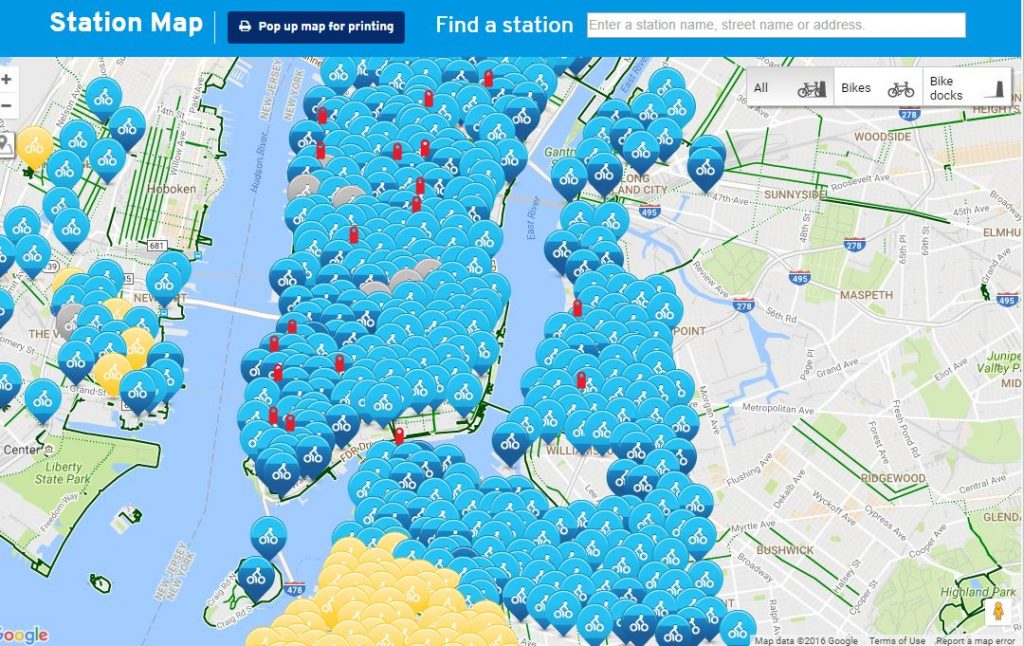
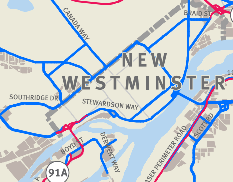
We have already identified some “quick wins” for cyclists, where a bit of engineering can make a few key links on our established greenways work better. You will see things at 20th and London Street, 7th Ave between Moody Park and 5th Street, under the Queensborough Bridge in Queensborough, and between Braid Station and United Boulevard (for a few examples) right away. A few other slightly more challenging issues (a hill-friendly bike route connecting Downtown to Uptown) are being worked on, as are designs for the Agnes Greenway, and an extended greenway from Braid Station to Sapperton Landing Park. Safe Routes to School and Safe cycling to school are also high on the priority list.

As an aside, you probably have no idea how much that green paint costs. On a square-foot basis, it would be cheaper to do engineered hardwood. But we will probably save long-term on maintenance.

The best I can offer you is small relief in the immediate future, with a long-term vision towards a properly developed integrated and complete bike network. It is going to take a few years, but the MTP gives us the vision, and I think Council has the political drive to make it happen. When compared to Vancouver, we are a small municipality with a limited budget, so multiple separated bike lanes and the assorted infrastructure (lights, signs, paint, paving) to make them really work ideally, are an expensive prospect. I can’t guarantee they will arrive tomorrow, only that this is the direction we are headed, and I’ll be advocating for our budget allocations to suit the priorities we have set through our MTP.

If you think you have good ideas about cycling infrastructure needs in New West, there are two ways you can help.

You can apply to join the advisory committee in the City that works to make New West a better place for cyclists, pedestrians and transit users: ACTBiPed. I happen to chair that committee, and served on it for a couple of years before I was elected. I think we have managed to make it an effective group where staff and community members work together on “big picture” strategies, and also take time to dig into the detailed design elements of new infrastructure to assure they work for active transportation users. The City is receiving applications right now for 2017 Committee appointments, and you can get all the info you need to apply right here.

If working within the system doesn’t satisfy your needs, you can also get involved with the local HUB Chapter, who advocate for better cycling infrastructure and funding, locally and at the regional level. New West hosted their AGM a couple of weeks ago, and it was great to hear about the work being done in the local chapters across the region. The local group is also instrumental in getting elementary school kids trained to ride their bikes safely, running cycling safety and skills courses with the School District. They are also a very helpful voice at the table when we are making decisions about cycling infrastructure in the City. You should become a member, and then decide if you can give them your time, donate them some money, or whatever combination of the two fits your lifestyle the best!

Finally, you can ride your bike, and use SeeClickFix when you run into problems, to let City staff know that good cycling infrastructure is wanted, and bad cycling infrastructure is noticed, by residents of the City.

We are working on the MTP, on making this a better place to ride a bike, but we could always use more motivation from our residents!

on the commute.

The Ides of August was hellish for people trying to get home from work. It was a hot day by Vancouver standards, without much of a breeze, but the sweat on the brows was more caused by a series of incidents where cars unsuccessfully tried to share space with one another.helltraffic1

However, on a hot day like this, one incident causing delay often cascades into a series of other incidents as people become less patient, less rational, and the natural dehumanizing effects of being in a car get people treating everyone around them, the people they share a community with, like their mortal enemies for having the gall of trying to do the same thing they themselves are doing because aaaAAAARRGGH!

helltraffic2

I commute by car, by transit, and by bike, depending on day, weather, schedule, and lifestyle factors. Yesterday, I was fortunate to have taken my bike into work, so my commute home was relatively stress free. I have to admit a bit of smugness enters the mind when you are relaxed on a bike, enjoying the weather, and pedaling softly by a long line of single-occupant cars, which almost offsets the self-hatred I suffer every time I am in the car, stuck in a line, and see some much happier person riding their bike past me. However, having been that person stuck in a car, stuck in traffic that I am also a part of, it never occurred to me to blame the person on the bike for my physical predicament, or my mental state.

So yesterday, I am riding east along Westminster Highway near the Nature Park during this traffic chaos when I see something new to me. I am exposed to Richmond Drivers on a daily basis, but this was a little over the top. There was a line of about six or seven cars just rolling down the bike lane. It is almost as if the drivers had decided that two lanes were not enough, and had, en masse, decided this is a three lane road, passing the vehicles stuck to their left. At some point, a group of about 4 were stopped at a light, and I rolled past them. This might have been a little untoward, but after all, it is a bike lane – no sharrows or bus stop or shared parking space or right turn lane ambiguity here, and I was on a bicycle.

This was too much for a guy in a 4th generation Camaro Convertible with the ginormous Polska Pride flag decal covering the the hood. He took the opportunity to suggest to me in no uncertain terms, that I should not be riding my bicycle “on the road”. I saw this as a great time to remind him that I was, in fact in a bike lane, as evidenced by the nearby signage, and that he, in fact was also in the bike lane, without a bike, so I may have been in the right here.

At this point, he started into a lengthy screed, which was about 40% profanity and about 60% Bruce Allen “reality check”, neither of which were probably appropriate for the 8 year old in the passenger seat to witness. The short version was that bicycle riders don’t buy insurance, they should not be on the road, and that I, although obviously homosexual, engage in unwholesome acts with my mother.

I rode away from him and his impotent rage, and generally enjoyed the rest of my ride home. I did so, however, once again wondering what it is about driving a car that dehumanizes us. Why do we behave in a line of cars like we never would in a line at a bank? Why do we feel a car allows us the threaten and intimidate other people, be they children or senior citizens, and yell racial and homohpbic epithets that we would never do at a public park, on the beach, at work or in a mall? Outside of actual war, is there any other group activity we volunteer to engage in where we so publicly and unabashedly hate the people we are surrounded by? Why do we even do it?

Also, what is this strange fascination with attempting to license bicycles like they are some sort of parallel with cars? As His Snobbiness (slightly profanely) reminds us: you don’t need a commercial pilot’s license to operate a car. Bicycles present pretty nearly no risk whatsoever to drivers, passengers, or public property, except for some risk of scuffing the paint on their car, for which ICBC will make the person at fault pay. Even if I did buy insurance attendant to the risk I present to third parties (which would surely cost a few dollars a year relative to the risk I pose when I shuffle down the road at 100km/h in 2,000lbs of steel), do I think Mr. Polska Camaro is suddenly going to see me as a legitimate sharer of road space and afford me respect?

Yet for some reason, otherwise seemingly rational public servants from Toronto to Vancouver suggest there is some problem with adults riding bicycles that licensing can somehow cure. They aren’t too sure what the problem is, and have a hard time tying this solution to it, but they need to be seen to be doing something about the bicycles, because people in bicycles are not angry enough.

Let’s all try to get along, folks. Autumn is nearly here.

Mobi

The long-anticipated and irrationally-political Mobi bikeshare program has finally launched in Vancouver. I hope it works, but have my doubts.

Regular readers (hi Mom!) will remember that I went to New York City around Christmas time last year, and had a chance to try out their massively successful bikeshare program, product-placemently named “Citi Bikes”. The experience not only made me a fan of bikeshare- but changed a lot of my misconceptions about what bikeshare is. As I see many of my own misconceptions being repeated in the Vancouver media (social and otherwise) around Mobi, it is worth discussion.

Citi Bikes operate on short-term rental system. You can pick up a bike while walking by a station, and ride for up to 30 minutes (or 45 minutes if you have an annual pass) before you need to check the bike in again at any station. You can buy a day pass for $12, which gives you unlimited rides within 24 hours, or you can buy an annual pass for $150 and use it whenever you feel the need.

Now, 30 minutes seems a pretty short period of time to rent a bike, but that is the entire point of the system. If you want to rent a bike for a couple of hours to noodle around Stanley Park, or for a few days to add biking adventures to your vacation, then a private bike rental company is still the best option for you. Bikeshare is not about replacing other bikes, it is about expanding your walking distance and facilitating multi-modal trips.

I can probably explain better by talking about the day we spent in Brooklyn and Manhattan using Citi Bikes:

  • We walk the block from our place in residential Bedford-Sty to our nearest Citi Bike Station. After about 5 minutes of paying for a day pass and checking the bikes out, we were on our way east along brownstone-lined streets.
  • About 20 minutes later, we were at Barclay’s Centre where another Citi Bike station was awaiting. We dock the bikes and hang out a bit at the sprawling plaza. The dock also has a digital map kiosk, so we orient ourselves and plan the best route to the Brooklyn Bridge before we check out a couple of new bikes.

Barclay

  • Near the foot of the Brooklyn Bridge, we dock the bikes. We grab a coffee, then wander over to the bridge. The pedestrian/bike walkway is packed with tourists, so we slowly walk across enjoying the sites, the crowd, the experience, without abandoning bikes at one end we need to retrieve later, or feeling like we needed to drag them along.

brook

  • We spend an hour or two wandering around China Town and Little Italy, then hop on a Citi Bike to loop around the Bowery to the Village. Some places were better for walking, some better for riding, and we made the choice. village2
  • After some more meandering, we check out another set of bikes and cross the Williamsburg Bridge. Back on the Brooklyn side, we quickly swap bikes to get ourselves an extra few minutes, then head through Williamsburg to find a brewery.

bridge

  • After a tasting and a meal and some wandering about loving the vibe of Williamsburg, we found a nearby station and mapped out the best route home to Bed Sty as the sun was setting. Probably being a 40-minute ride at an easy pace, we figured we would need to swap out bikes half way. We didn’t know about the “Citi Bike Dead Zone” in the Hasidic part of south Williamsburg, but managed to find a station with 5 minutes to spare. If we had downloaded the Citi Bike App, we could have avoided this peril.

wilmsbg2

  • Back at our base station as it was getting dark (the Citi Bike has built-in front and rear lights run by a generator in the front hub), we checked in and walked the block home with time enough to catch a great Sousaphone-Accordion trio.

sousa

A nice 8-hour day, about 7 bike station stops, we probably covered 20 kilometres on bikes, just to connect up our fun walking spots. We never fussed with a bike lock (or a helmet – more on that later) or worried about bike storage or security, and were left with nothing but a pocket full of access codes.

slips2

That is just a tourist experience. If you live and work in the service area, the Citi Bike can change the decision you make every day when you walk out the door to run an errand or meet a friend. Walk for 15 minutes? Bike for 5minutes? Wait for 5 minutes for the bus? Screw it, I’ll just drive? The magic of bikeshare is that you don’t have to worry about the hassles inherent in the “Bike for 5 minutes” choice: you don’t need special clothes, you don’t have to fuss with locks or worry about bringing the bike back with you if you have a multi-stop trip planned. Bikeshare, when working properly, is like having a bunch of moving sidewalks around that can cut your walking time in a third, with no more hassle than walking.

The ease and functionality of Citi Bike relies on several things, though, and New York gets them right.

Stations need to be ubiquitous. Within the service area of Citi Bike, you are never more than a 5-miunte ride to the nearest station. They also manage the bikes well, in that I think there was only one occasion when we arrived at a station and found it empty of bikes. Fortunately, the on-line app and maps in the station kiosks have real-time measures of how full the stations are, allowing you to plan at the beginning of your rental. How ubiquitous? Look at the map of Manhattan and Brooklyn:

Citi

Bikes need to be Euro. By this, they need to be durable, friendly, simple, and built for casual use. Citi Bike rides are bomb-proof and a little heavy, but run like a Swiss watch. The transmission is internally-geared with a twist-shifter, the chain is in a case, so no grease or oil splatter problems. The wheels have full and deep fenders to keep the spray off, and to keep toes, cuffs, or scarfs out of the spokes. The pedals and seat are wide, flat and grippy so no special clothes are needed. There is a unique-sounding bell, a big basket for groceries, and front and rear lights are always on thanks to the nifty generator in the front wheel. They aren’t specifically elegant, and won’t win any criterium races, but they are the right tool for the job.

slow2

The payment has to be simple. Similarly, the kiosks for Citi Bike are simple to use, but have a ton of utility. It takes only a few minutes to buy a day pass using a credit card, and once you are in the system, it takes literally seconds to check a bike out (check in is as easy as park-it-and-walk-away). I could see how an annual passholder would be walking down the street, see a kiosk, and, on a whim, check out a bike to get 6 blocks down the street faster. As a bonus, there are digital maps to show you your location that allow you to zoom out to other station locations, which (as a super-double-bonus) serve as wayfinding tools for all tourists who happen by, not just Citi Bike users.

You can’t have a helmet law. Everything above about the need for the system to be easy, fuss-free, and comfortable is tossed by the wayside when you add helmets. Citi Bike is successful because it accommodates street clothes and on-a-whim decision making. Aside from the (not insignificant) yuck-factor, helmets significantly increase the hassle factor, and change the math on that walk-for-15/ ride-for-5/ wait-for-bus math. The kludged Vancouver solution (ugly, uncomfortable, dirty helmets that are likely more of a choking hazard than actual brain protector) stands in contrast to everything that makes Citi Bike work.

street2

The most significant stat about Citi Bike is that they have, since summer of 2013, had more than 25 million rides, with no fatalities and no major injuries. Manhattan and Brooklyn are not famous for their excellent roads or courteous drivers – the roads are crowded, potholed, and at times chaotic, and Citi Bike users are (reportedly) every bit as chaotic as other users. Many are novice riders, and very few wear helmets. Bikeshare is safer than driving, and Manhattan, it is safer than walking. The statistics are the same for bikeshare systems across North America. Part of this is intrinsic to the bikes: upright, slow, stable, comfortable, and visible. Part of it is the demonstrated phenomenon that the best way to make cycling safe is to put more bikes on the road – areas with bikeshare systems have been found to be safer for those cyclists not using bikeshare systems. Helmets Laws are not only a deterrent to use, they are demonstrably unnecessary for the inherent risk.

So I wish the best for Mobi. I’m not sure there is a sufficiently saturated market outside of downtown and the Commercial-to-Kitsilano corridor to provide the effective station saturation you need to make the system work, but within that area all of the pieces for success are in place. However, until we grow up and have a rational re-evaluation of the province’s silly anti-cyclist helmet law, I am afraid the system will suffer from lack of appeal. And that would be a shame.

Ask Pat: 8th Street

Pedestrian asks—

What is the future of 8th Street? Reading through the Master Transportation Plan I believe that I’ve spotted some inconsistencies. For example, on page 90 8th St is noted as a Great Street and that with a consistent 30 metre right of way it could become four lanes from Downtown to the Burnaby border. There is also discussion of potential bus priority access. However I don’t see any other reference in the MTP to 8th Street being a Great Street. Further, 8th St is classified as a Local Collector. According to page 136 Local Collectors should only be two lanes.

Can you provide more information that would correct these inconsistencies? What does bus priority access mean anyhow?

For what it is worth my personal perspective is that the current width of 8th St creates an artificial barrier in the Brow of the Hill neighbourhood. Further, the absence of a boulevard on the East side of the street and no street trees make for a lacklustre pedestrian environment. I’d hate for the street to be widened, making the problem even worse. With Fraser River Middle School opening up this fall, and developments at 4th Ave wrapping up around the same time, now is the perfect time to clarify direction.

In the short term: not much. There is no capital plan or budget right now allocated to changing the streetscape of 8th Street. There will be a few crossing improvements (Dublin, 7th Ave) and some local improvements as development occurs (like in front of Fraser River Middle School), and these will be informed by the long term vision provided by the Master Transportation Plan.

There is a typo on the MTP that may be causing some confusion. The reference to 8th Street being a “Great Street” on page 90 is wrong, as the Great Streets map on Page 108 and the entirety of Section 4.4 make no reference to it. This makes sense, as aside from a few short stretches, there is little retail on 8th Street, and there is little chance of it becoming a primarily commercial corridor like 6th Street or the other identified “Great Streets”.

As you point out, 8th St. has some other characteristics that don’t necessarily match the designated use. In the MTP it is designated as a City Collector road, but it has many of the characteristics of an Arterial, although the street varies in use along its length. The disconnect between how the road is designated, how it is designed, and how it works, is shown on the following table (all info from the MTP):8thtable

So outside of the MTP, recognizing there are no immediate capital plans changing the road, and to your point of it not being a very friendly road (dare I say “pre-Stroad”?) right now, what can we envision for the future of 8th St.?

lower8th
Google Street View, no permission sought.

The portion below Royal is exceptionally wide (more than 20m curb-to-curb in some spots), and is predominantly a pedestrian space, despite various attempts to corral and displace pedestrians to “get traffic moving”. This is the only part of 8th that has traffic volumes within the “City Collector” ideal – less than 8,000 vehicles per day. Everything about this tells me we should be reducing the driving width of this street, and improve the pedestrian realm. The massive daily flow of students between the New Westminster Station and Douglas College shouldn’t be crowded on a narrow sidewalk while waiting for pedestrian lights to change. The City should not have built the Anvil Centre (or allowed Plaza88 to be built) in such a way that parking garage entrances and loading bays disgorge into what should be a pedestrian-first place, but that ship has now sailed. This doesn’t mean we can’t think about re-allocating underused road space and shifting priorities to active users.

mid8th
more Google Street View, not sure how legal this is.

The portion between Royal and 6th Ave is essentially residential, although traffic counts here are higher. It operates as a true “collector” in the sense that the adjacent local roads dump traffic onto 8th as the route to the regional road system (be that Royal Ave, Canada Way, or wherever). The 15-m curb-to-curb width is still pretty wide for a two-lane road, and parking is both free and plentiful. A few curb extensions at important intersections (3rd Ave, 5th Ave) help improve pedestrian safety, but the open road feel definitely encourages travel speed greater than the regulated 50km/h, which combined with expansive asphalt and a general lack of trees, adds to the “barrier” feel you mention. There are some planned improvements around the new Middle School, but I doubt there would be any desire or political will to expand this road to 4 travelling lanes. The traffic doesn’t warrant it, and the impact on the livability of the community would be profound.

upper8th
but hey, Google just took these photos without asking permission…

The portion between 6th and 10th is harder to peg. The lanes are a bit chaotic, parking intermittent, and at more than 20,000 vehicles per day, the traffic is pushing the upper limits of what an Arterial should be handling. This is one of the main connections from the Brow and Uptown to the regional road network (Canada Way), so I guess it isn’t surprising that the end of all the collectors is a logjam. At the same time, it has a High School, one of our most frequented parks, some high-density residential areas, and our largest commercial centre. It is crossed by two Greenways and is frequented by a large number of seniors. It is a mess, and likely the most Stroad-like road we have in New West, but solutions here are difficult to find. There will be re-writing of the interface with NWSS when the new school is built, but I don’t see much other relief any time soon, mostly due to vehicle load.

Finally, Bus Priority Lanes are just that: lanes where B-line type buses can have priority over traffic uses, although not specifically bus-only lanes, as they may share space with right-turning cars or general traffic in some locations. They come in several flavours, but are not common in urban areas of the Lower Mainland. Highway 99 has them approaching the tunnel, and East Hastings through Burnaby has a version of this. They might be considered in the future for 8th if traffic loads increase to the point where congestion seriously impacts bus operations, but I do not think we would consider installing more asphalt to make them happen.

ASK PAT: Car allowance

Mark asks—

Hi Pat

A question regarding the recent council compensation recommendations, specifically the car allowance. Given the city and council’s vocal support for increased transit spending, reducing traffic in the city and it’s occasional touting of how great the city is in terms of transportation mode share, why would council (well, you at least since we’re on ask Pat) support a flat payment for automotive use?

Given their advocacy on the matter, council members should be leading by example on this. The city has excellent skytrain and decent bus service, and is well connected regionally. Why not give councilors transit passes to cover their travel?

Of course not all commitments can be met by transit, and yes councilors should be free to expense appropriate mileage (or taxis, rentals, car shares, etc) related to their duties. But simply giving councilors money for their automotive expenses runs counter to what the city and council is pushing for.

Appreciate your thoughts and the time to reply, and thanks for keeping up the blog.

Yep, I agree with you. The “car allowance” is a stupid idea for a City of 15 square kilometres, with the densest transit coverage and highest alternative mode share of any community outside of downtown Vancouver, and a Master Transportation Plan that takes priority away from the private automobile as the primary form of transportation. We have a Mayor who walks to work, one Councillor who never drives and a couple others (including me) who make it a point not to use a car to get around within town. A “car allowance” makes no sense.

Of course, it isn’t a “car allowance”, or even the HR-preferred vernacular “vehicle allowance”. It is a “transportation allowance”, as we can use it on any mode we like. We can top up a Compass Card, hire a taxi, gas up our car, get a Modo membership, or buy replacement tires for my bike.

Of course, it isn’t even a “transportation allowance”. It is $100 we get to spend on whatever we want. We are not required to provide receipts or justification, so this is little more than a taxable top-up of our salary. As a Councillor, I will get $1,200 more per year above the “base salary”, and whether that adequately compensates me for the transportation cost related to my job is kind of secondary (which makes it different than our other expense allowances, because they are actually backed up by policy guidance and we need to provide receipts and get them passed by HR, just like any expenses you might accrue in your regular job).

This issue arises from the once-every-term review of Council remuneration, which is always a sticky point. I don’t want to get into a long discussion about how much elected officials should get paid here, because that is pretty philosophical topic with wide differences of opinion, and wasn’t your question. However, it is apropos to discuss what a good governance model is to determine how much elected officials get paid. The decision we made this spring was, in my look at it, more about approving the process than the numbers.

When it comes to local government in BC, it is up to the Mayor/Councillors to determine their own pay. This is a direct conflict-of-interest that is not only permitted under the provincial law regulating local governments, but required by it! In that context, good governance requires that Mayor and Council don’t make a capricious decision and write their own cheques, but that they permit the professional staff in their HR and Finance departments to determine an appropriate process to determine appropriate compensation. The best we (and by “we”, I mean citizens and elected types) can hope for is that the process is transparent and defensible. Where both transparency and defensibility break down is when one or more elected official tries to supersede or run around that process, be it for personal or political reasons.

The process we have in New West is that every 4 years, HR staff compare the wages and benefits of elected officials in New West to those in comparable cities – a collection of other Lower Mainland municipalities, excepting the biggest (Vancouver, Surrey, Richmond) and the smallest (Bowen Island, Anmore, Belcarra) and do regression analysis on several statistics (population, budget, size of Council), with the guidance being to keep our Council firmly in the middle. Between those every-4-year adjustments, annual increases are indexed to CPI. You may suggest a better system, but HR has explained their rationale through reports, find it defensible and transparent. The process made sense to me, in that I could understand the rationale, could follow the numbers and do the math, and it made sense, so I supported it.

As for the “vehicle allowance”? I don’t like it, think it is a bad idea for all the reasons you state. However, respecting the process that provides good governance makes it hard to pick and choose the results of that process. HR and our external consultants determined what constitutes fair compensation based on a policy guideline that was, essentially: do what other similar Cities do. Apparently “car/travel/transportation allowance” is now part of that. We could have rolled it into the regular wage and compared across the municipalities and come up with a wage number that is $1,200 higher per year, but HR determined that making it a taxable expense makes more sense from an HR perspective.

I’m not sure raising a stink and pulling apart that process is the appropriate way to manage my discomfort about the symbolism of a “Car Allowance” in 2016 in New Westminster. How do I do it without calling into question the process – one that I have essentially been at arms-length from to reduce the conflict of interest created by the legislative structure – and not opening the door for a very political discussion with everyone making whatever adjustment suits their specific desires, political position, or special idea? I would argue of all the decisions we make as a Council, this is one where our personal politics need to be ignored, and the decision made (effectively) by staff.

So I don’t really have an answer to the “Car Allowance” question (at least not one I could come up with and propose in a reasonable timeline), but it is clear my personal political opinion is that it is a bad idea. This is something I am thinking about as I think our entire organization at City Hall needs to do a better job walking the walk when it comes to Transportation Demand Management. We are asking residents and businesses in the City to adapt to a more sustainable transportation system, but are slow to adopt progressive change as a corporate entity. Obviously, that argument is easier to make if us elected officials take a position of leadership. I’ve put this issue on my To Do list, and hope to have a better answer for you prior to the next time we go through this exercise.

ASK PAT: Begbie redux

Sleepless asks—

Hi Pat,

I asked a question about train whistle cessation last year, which you answered on November 25, 2015. See: https://www.patrickjohnstone.ca/2015/11/ask-pat-whistle-cessation.html .

It is now six months after I asked, and four months into the new year, and the trains are still whistling away merrily downtown. In fact, the amount of whistling appears to have increased since the Front Street reconstruction project started.

I just noticed an update on the CNW web site (http://www.newwestcity.ca/database/files/library/Train_Whistle_Cessation_Update___May_2016(1).pdf), stating that: “formal application
for whistle cessation may need to be delayed until the Front Street upgrade is complete in August”. That is an additional eight month delay on a project that has already been delayed for almost two years!

In your previous reply, you stated that you are starting to question how the City sets timelines, and I couldn’t agree more. Why does every project undertaken by the city get delayed by months or years? Isn’t it time to have a long, hard look at the city’s planning processes and investigate why they keep failing to deliver projects on time?

Actually, since that conversation I have had some discussions with people in our engineering department regarding transportation projects and timelines, and I am slightly more sympathetic towards their challenges. Especially in regards to some areas where I have a specific interest: active transportation, transit, and accessibility issues. I don’t want to get into details here, but there are some resource issues internally, and some of the priority shifts that the new Council and the new MTP are demanding mean we need to spend a bit more time steering ship and little less time motoring ahead… the ship of government steers slowly, I’m afraid.

That said, many projects are moving ahead in a very timely manner. The Parkade east-refurbishment / west-removal project is pretty much on schedule despite a few early hiccups, and the Mews work is similarly looking like it will be completed reasonably close to on time, and on budget. Moody Park playgrounds, numerous smaller transportation projects, and policy work around Heritage Protection and the Tree Bylaw, things that are less visible but very staff intensive, were completed in a very timely manner. I wish I could say the same about the Begbie Crossing.

However, the Begbie Crossing work, along with the other whistle cessation projects, is not completely under the control of the City. The rail companies are replacing the rails, the level crossing treatment and the controls. They operate on their own schedule based on their own needs. Council commonly gets updates from Staff, and I am confident that we are doing everything in our power to get this project completed. I still hope the Begbie work will be completed by August.

However, you do raise the bigger question – why does it seem that projects always take longer than expected, not less time?

First off – and I don’t think this is unique to New West, but has become the default in our crazy busy hyper-competitive construction market – is a general industry trend towards overpromising and underperforming . Remember, most of this work is not being done by City crews anymore, the majority of it is contracted out. With many things on the go, it is hard to oversee every aspect of an operation – careful management of the Critical Path takes resources, which brings us to a problem more about New West.

We are a City of 66,000 people, relatively small in the great scheme of things. However, our expectations are the same as those for the residents of the larger cities that surround us. We have lots of things on the go right now, and a relatively small staff managing them.

I think some of this falls on Council, as we often create new initiatives before we see the existing initiatives completed. In my short time on council, there has been not just a “yes we can” ethos, but a “Yes we should!” ethos. Setting priorities is sometimes difficult, but never as difficult as slotting something new into an existing set of priorities is. If you look at our recently-completed Annual Report, you can see that we have set a clear set of priorities, which should help both staff and Council better coordinate our desires, which (in theory) should help us hit more deadlines. So I have taken to asking staff, when new initiatives come along, how they fit into our existing strategies, to assure we are not putting last week’s priority aside to address this week’s.

Which circles me back to the first point – I’m not sure we are doing that bad a job. Whistle cessation is definitely lagging behind, for many reasons outside of our control. The 4th Street Elevator is a notable timeline fiasco, and there is a great story to be told about contractor vs. designer vs. inspectors on that one. However, there are many other capital works, from road repairs to sewer and other utility work, that is coming in on time. We had a recent report to Council from SRY about the Whistle Cessation progress, on Queesnborough and Quayside, and it looks good.

I’m sorry the project that is having the biggest effect on your day-to-day (or more night-to-night) life is so stuck in purgatory. All I can do is continue to ask staff where we are with the timeline, and reinforce that this is a priority for the City and for Council. I hope you can get a good night sleep soon!

Chumps

I wrote most of the following this morning on the New West Facebook Group “Rattled about Traffic in New West“, on a whim after reading this story, and wondering if people are connecting local traffic problems to the regional transportation logjam. I figured it was worth repeating here…

From before I was elected, I have said that New Westminster’s traffic problems are not solvable by New Westminster. We simply cannot accommodate the hundreds of thousands of through-drivers every day and maintain safe, livable, pedestrian- and business-friendly streets. The two ideas are mutually exclusive.

The solutions are regional. We need to give people east and south of us better options than driving along our surface streets every day. Regardless of whether you love or hate “TransLink”, an expanded, reliable, and well-integrated multi-modal public transit system is fundamental to providing those options.

That is why New Westminster supports the Regional Growth Strategy that calls for compact multi-use development near transit nodes, and why we are leading the region in this development model. This is why we support Transport2040, the regional transportation plan, and are seeing results where New Westminster residents use transit more than any others per capita. This is why our Mayor is working so hard with the Mayors Council to implement the 10-year capital plan for our region’s transportation work – it is really the best option we have towards addressing our afternoon traffic jams. It isn’t “Us vs. Them“, it can’t be. We need to work together as a region, and the plans I have linked to above are examples of the region working together, putting aside parochial complaints, and seeking regional compromises that will support us all.

And that is why this weeks ‘announcement‘ is such a betrayal. If you care about traffic in New West, you should read this article in the Sun and ask what the hell the provincial government is doing playing the entire Lower Mainland – the economic engine of this province – for chumps. And for how long will we accept that?

ASK PAT: Heavy rail

Tom asks—

Hi, loving your blog!
Bit of a general question: Do you think heavy passenger rail, of the type found commonly in Britain or Switzerland, could ever be useful in the Lower Mainland, and as an international connection for Cascadia?
Thanks for your time.

It already is! The West Coast Express is a pretty successful heavy rail transit system right here in the Lower Mainland and run my TransLink. By “successful”, I mean it is reliable, popular, and regional-development-defining. There is a debate about how to assess the financial success of the service, as they do pay a significant lease rate for the CP tracks they use, which requires the service to be subsidized from TransLink general revenue. But subsidizing passenger rail for the larger societal benefits is the norm in Europe, not an exception.

Of course, there are also rail connections to the rest of Cascadia, even if they are not really operated in a way that makes them “commuter” friendly. I would suggest until we develop widespread electrification of rail and the economics of aircraft travel are adjusted to match the environmental impacts, there simply isn’t the population density or economic model to push more rail through the challenging Cascade Mountains. Maybe the next generation will fix this.

There may be more potential in the nearer future for commuting in the Fraser Valley, though. There has been an activist group in the Lower Mainland for more than a decade fighting to get more rail service South of the Fraser. Over the years, “Rail for the Valley” have discussed the use of heavy and light rail options, specifically along the old Interurban rail corridor. This electric rail line used to operate between Vancouver and Chilliwack via New Westminster before the rails-to-rubber movement stripped it of customers and land back in the middle of last century (see Who Framed Roger Rabbit for more context).

It is clear that the long-range development model for the Fraser Valley is one that would support a heavy rail based commuter transportation system. Cities like Abbotsford are buying into the Smart Growth model of building denser urban centres with mixed uses and pedestrian and transit amenities. This is partly driven by economics working better for cities trying to deliver services, but mostly because the ALR continues to limit their ability to spread out as their populations boom. Extending the “Cities in the Sea of Green” motif could see Langley, Chilliwack ,and Abbotsford town centres connect to Surrey’s new “hub” via the existing rail corridors to King George or Scott Road.

This would really open up economic potential for those communities, and indeed for Surrey and the rest of the Lower Mainland. However, that is not the path we are on. Instead, we have spent $5 billion (and counting) on building freeways to get cars in and out of the Valley, and it appears the Provincial Government is dedicated to that path. Meanwhile, even the most modest of public transit improvements in the Lower Mainland are stuck in a funding and planning quagmire because one of the three levels of government simply refuses to show leadership or foresight.

A region-defining development like this would need a sense of vision. The Local Governments have shown similar vision, the federal government is ready to step up and fund bold initiatives like this. But much like any poorly-functioning transportation system, there is a piece in the middle that just doesn’t allow the connection to happen, and gums up the whole works.

Is it a good idea? Yes. Will it happen in the foreseeable future? No.

ASK PAT: Front Street trucks.

Brad asks—

During Front Street’s closure over the past couple of months, trucks have been re-routed to Columbia and Royal. This doesn’t seem to have had that bad of an affect on New Westminster’s traffic (at least, to my eye), so what are the thoughts about banning truck traffic from Front Street entirely? Can this be visited when the Pattullo Bridge gets replaced? Front Street isn’t part of TransLink’s Major Road Network, so we shouldn’t have to ask them, right?

Although I agree the “Carmageddon” promised by Front Street closing has not arrived, there has been a shifting of trucks to Columbia Street, and anecdotal increases in trucks on Royal and 10th Ave. The City is collecting data on the traffic during the closure in order to get good numbers on the shift, and that report is not available yet, but preliminary info seems to suggest about a 30% increase in trucks on Royal. There has also been a diversion of trucks to Columbia and 10th Ave, but these three increases do not add up to the number of rucks that used to ply Front Street. It is pretty clear that a large proportion of the tucks that were on Front Street have, indeed, gone away. Presumably most of them have gone to the $5 Billion of freeways we have built for them over the last decade, as the Lord Kevin Falcon intended.

Front Street is not in the Major Road Network, but it is a designated truck route. To change that, we need agreement from the Ministry of Transportation and at least consult with TransLink. The current policy is that trucks routes cannot be removed unless appropriate alternatives are offered. So if closing Front Street to trucks means we need to allow 24/7 access to Columbia Street, then it is probably not a good deal for the City.

Capture2

If the closing of that route means accepting a measured increase in Royal Ave and 10th Ave, then perhaps it is a discussion we should be having as a City. However, to have that discussion, we need some solid numbers to support the cost-benefit, and those numbers are being collected. Of course, this ends up being a political discussion – the people who live on Royal are not going to like it, and it will do nothing to make people feel better about the Qayqayt school transportation situation.

Offsetting these reasons to avoid the discussion, people need to go down to the Front Street right now and look around. I think we can, for just a moment now, have a vision of what could be. I’m not even talking about removing trucks from Front Street, I’m thinking we should explore the possibility of closing Front Street to all but local traffic. Build the Mews, turn the rest into greenway, parkland, open space for any of a thousand public uses we have not yet imagined. I don’t want to close Front Street to traffic, I want to open it for the use of human beings who aren’t dragging tonnes of internally-combusting metal around with them. There is a huge amount of space there, let’s start to dream.front

The primary argument for keeping trucks in Front Street is, of course, “Goods Movement”. The Gateway Council, the Port, the BC Trucking Association, and the Ministry of Transportation make the argument that the regional economy relies on free-flow of trucks along Front – this route is critical. This assertion will not likely be supported by any measureable dip in the regional economy caused by this 6-months closure. But don’t bring facts into this discussion.

Fitting the use of Front Street into the context of the larger Pattullo replacement strategy is important, as is fitting it into the model for the Brunette overpass replacement, which is an ongoing discussion between Coquitlam, New Westminster, and the Ministry. There are well-connected regional voices continuing to reiterate that New Westminster is a through-route, not a community, and are planning with this in mind.

Even as New Westminster aggressively pursues a smart growth strategy reflecting the Regional Growth Strategy; even as we push towards building a compact, mixed-use, transit-oriented community where most commuting and shopping trips are by foot or transit, reducing the need for expanded road capacity; even as we take a leadership role the region in meeting the mode shift goals of the long-term regional transportation vision, those very goals are challenged by our tacit acceptance that our community must play second fiddle to the commuting needs of outlying regions.

We have been leaders in planning and development to reduce our reliance on the traditional transportation models, we are becoming leaders in our transportation policy, but to see the benefit of those changes here at home, we may need to stop leading by example, and start forcing our neighbour’s hands.

Does the region need trucks on Front Street? No. Is there a better way to make use of that 5 acres of public space in New Westminster? Yes.

The rest is politics.

Myths and Lies

There is a lot going on right now in the transportation file in the Lower Mainland, both good and bad news, and I can hardly keep up, never mind blog about it. So while the local radio stations stoked anger a couple of weeks ago about another TransLink “outrage”, I had something completely different to get angry about: this “Fact Scheet” produced by the provincial government in regards to the Massey Tunnel replacement project:factsheet

After venting into a Word document, I put it aside and relaxed. Writing is good therapy, and I figured I would edit it up and make use of it later. Anger abated, back of mind, life goes on. Then last week I was triggered to pull it back out by this post by Transportation Economist Stephen Rees (someone you should be reading – his knowledge and insight are unique and powerful), and his writing:

I must admit that when I read it I became almost incoherent with rage.

Amen, Brother.

Why “rage” about a seemingly innocuous two-page fact sheet produced to hard sell a key government project to the business community? Because almost every proclaimed myth-busting point presented on this definitive piece of Government paper is a lie. A stinking pile of bullshit that anyone who has spent any time learning about transportation policy in the western world over the last three decades can smell from a mile away. And it is printed on Government letterhead. I’m angry that either people in the Ministry of Transportation don’t know it is all bullshit, or they do know and are still willing to publish it. I’m not sure which is worse.

That last paragraph may seem inappropriate to some of my readers (Sorry, Mom!), but please let me assure you, I use the term bullshit in the strictly technical sense of the word. And someone needs to start calling this government out on their lies.

The “myths” hit the news two weeks ago when the Minister presented his case for a 10-lane bridge to the relatively receptive audience of the Richmond Chamber of Commerce. At the event, he was suggested to have “busted” some myths about the project, being spread by what he called “rumour-mongers, conspiracy theorists and those with apparently ill-informed opinions”.

Let us look at the Myths seemingly busted:

myth10

If we define “The project” as a 10-lane high level bridge, then clearly it is not the only solution to the problems presented here. Traffic congestion in the tunnel has been demonstrated to be getting better, not worse, over the last decade, and the Ministry’s own data shows that 87% of vehicles in the tunnel are cars (almost all single-occupant) while more than a quarter of the *people* going through the tunnel are in the 1% of vehicles that comprise the inadequate transit service through the tube. Providing better options for only 15% of the people who use the tunnel would virtually end congestion, leaving a bunch of money left over to finish the work to make the tunnel earthquake safe again. Saying “we need to do something” is not the same as saying “we need to do this thing”. This project is not needed. Myth not busted.

myth9
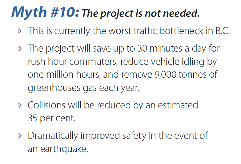
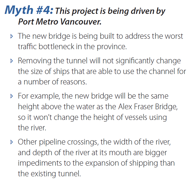
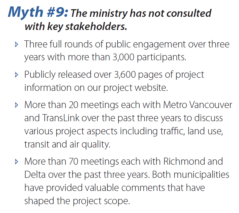
There is no doubt the Ministry has talked to many people, but to say they have “consulted” is quite the stretch. The City where the majority of the project has taken place is claiming they have not been listened to, and are not in favour of the project, the regional government is opposed, as are all of the local governments (save one). No defensible business case has been presented answering for the project. The parts of the “3,600 pages of Project Information” that referred to costing and SWAT analysis were redacted.

One way to tell that “consultation” has not occurred: No aspect of the plan has demonstrably been changed to address the concerns of people consulted since this 10-lane bridge solution was first presented to the public. They started with a 10-lane high level bridge solution, and ended at it. Myth not busted.myth8

They are right, no Federal Review is required by current legislation (assuming that other accessory projects like removing the old tunnel and re-routing of the BC Hydro line that uses the tunnel are separate projects). This is because the gutting of the Canadian Environmental Assessment Act by the Harper Conservatives in 2012 significantly cut back on Federal Review guidelines. Myth busted, but probably not something to be proud of.

myth7

What a steaming pile this is. “keeping traffic moving to reduce GHG emissions” is a perfect example of bullshit: it’s not wrong, it’s just stupid. Ways to reduce GHG impacts of transportation have been studied to death, and yes, idling reduction (depending on conditions) can reduce gas consumption per kilometre, but it does not reduce GHG emissions anywhere near as much as dozens of other available techniques, including modifying trip-making choices, increasing vehicle occupancy rates, shifting (freight and passengers) to more efficient modes, compact community planning, etc. etc. – policies that are directly undermined by this very project! Claiming that “free flowing traffic” induces transit use boggles the mind. The other “improvements” and “enhancements” listed here could easily be funded at a fraction of the cost of building a $3.5Billion bridge, without the boondoggle hanging over it. Why is planting a tree contingent on laying asphalt, what does one have to do with the other? Myth not busted.

myth6
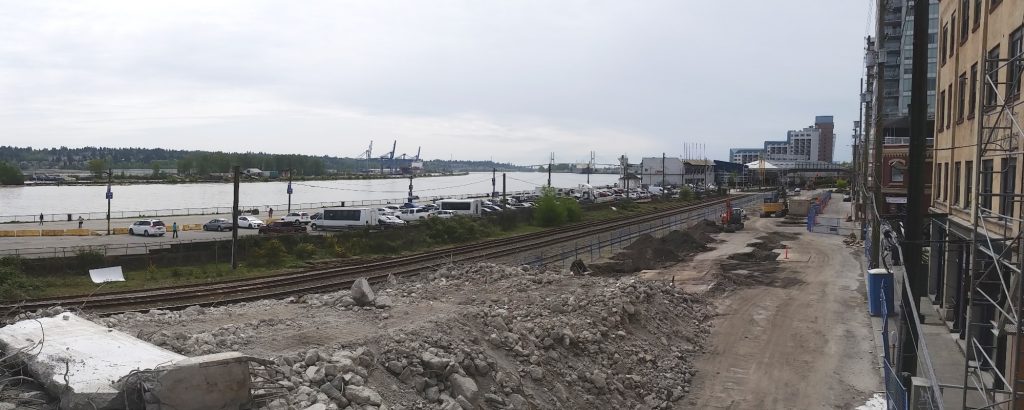
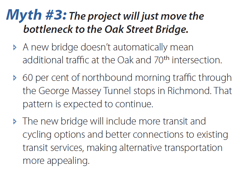
This may very well be true. But you know what is cheaper than building a new tunnel and cheaper than a new bridge? Making the infrastructure you already have work better. One of the more galling parts of this entire project is that no-one seems to be looking at the opportunity cost of a $3.5Billion infrastructure investment – what real improvements could we build to the regional transportation system with that kind of money. Perhaps start here.  Myth busted, not that it is relevant to the argument.myth5

Seriously. The Ministry is arguing that the route that now has 4 lanes will be congested on opening day if it has 8 lanes, but will allow free-flow until 2040 if it has 10 lanes. Chew on that for a bit. Just let the magical thinking sink in. Then remember, these are the guys who projected traffic demand for the Port Mann. Myth not busted.myth4

There is a lot of creative work here to not directly address the assertion that is being made. The bottleneck is irrelevant to this point (as we know there are too many other more affordable ways to address a bottleneck that is 85% single occupancy cars). The height of the Alex Fraser is irrelevant as well, as that is not currently a limit to crossing the tunnel. The word “dredging” is not raised at all in this retort, nor the evidence that deeper dredging in the river is a long-established goal of the various port authorities and port operators on the south arm, or that the tunnel is currently the largest impediment to a deeper channel. Myth not busted; Myth deftly avoided.myth3

This is the “myth busting” that caused Stephen Rees the most rage, because it is completely separated from reality, the reality that he has spent a distinguished career studying on two continents. There are no transportation planners, transportation economists, transportation engineers, or rational human beings who believe that more than doubling the capacity at the tunnel will not increase traffic congestion at the Oak Street Bridge. Their denial of this basic reality is simply a lie. To get the count of “60% stops in Richmond”, they had to count all of the traffic leaving the 99 to go on the East-West Connector and the Knight Street Bridge as being “Richmond” traffic. And yes, those routes will also become more congested, calling for more future “improvements”, because of the induced demand this project will bring (more on that under Myth #1). Myth not busted.

myth2
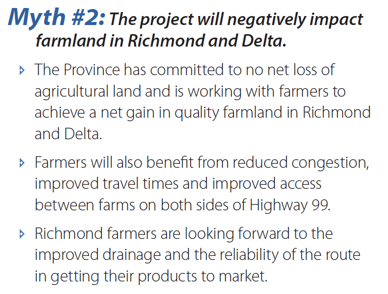
Did you know that Highways are allowed in the ALR? Much of the South Fraser Perimeter Road is actually in the ALR, no exclusion necessary, just compensation paid to the property owner who has his acreage bisected or cut off. So the Ministry can put the entirety of this project on ALR land and claim “no net loss” of ALR land- although admittedly it is hard to farm asphalt.

I cannot find any evidence (outside of Ministry pieces like this) that farmers on either side of the river support this project, nor does their business case or other consultation material explain how putting hundreds of acres of farmland under asphalt could result in “net gain”. I have read stories of farmers expressing concern about various aspects of the project. I have also heard farmers speaking about the increased pressure on farmland, the inability to afford to farm on farmland with price speculation pushing up farm land prices because of projects such as this which encourage auto-oriented sprawl in valley communities. I have also read about the Port buying up farmland in Richmond to build cross-docking facilities that will be linked to this project with shiny new roads. Myth not busted.

And to top it all off:

myth1

This is pure, unadulterated bullshit. If the Ministry of Transportation can show us an example (from their alleged “experience here and around the world”) from a growing industrialized economy where adding highway capacity has not resulted in increased highway use, they should bottle it and sell it to Los Angeles, or Dallas, or Houston, or Atlanta, or freaking Hanoi. This magic solution to congestion will pay off better than LNG. That increased capacity equals increased congestion is such a well-established concept in transportation planning that it is actually called The Fundamental Law of Road Congestion by the people who study this stuff as an academic discipline. To deny this is to deny gravity, or evolution, or the atomic model. Myth not busted, but supported by a Fundamental Law.

On this blog, I’m trying to be solutions-based. I often write things that sound critical as a search for solutions, as a way to force myself to look deeper at issues, do some research, understand the counter-arguments against my point, so I can do a better job when I have to make a decision. The Q2Q bridge is an example where I am less and less certain about how to move the project the more I learn about it. Although I am still hopeful we can find a good solution, I am increasing cognizant through stages of planning and public consultation of just how complicated a project it is, and that no matter what we do, someone isn’t going to like it. And I’m trying, really hard, to stay realistic and evidence-based on this project. When I point out numerous flaws to one specific approach, it isn’t just to be a boo-bird or support “the forces of NO”, it is to challenge assumptions and try to understand *if* the idea will work, which is often easiest to do by figuring out why it won’t. That is, I suppose, a result of my training in science, where we work to find reasons to reject null hypotheses. Or maybe I’m just a detail-mining jerk.

Then I get confronted with a project like the Massey Tunnel Replacement. This is a project with no reasoned justification, no supported business case, no alignment with any other regional plan or transportation initiative. It is a megaproject that stands in opposition to regional growth plans, regional transportation plans, and provincial and federal GHG reduction plans, and will undermine them all. It’s a bad idea at a bad time, badly presented for bad reasons. It is a bad idea so bad even most of the arguments against it are bad, but are still better than the arguments for it. And this is why I get angry even writing about it.

That is what your money is building, folks, a 10-lane $3.5Billion concrete edifice to bad ideas, now being bolstered by bald-faced lies by people you are paying to tell them to you. If you are not angry about this, you need to start paying attention.