Gong show

The Minister of Transportation plans a “groundbreaking” ceremony for the Massey Tunnel Replacement, complete with big yellow getting-things-done machines. The fact this “groundbreaking” is not related to any actual work being done on the Massey Tunnel Replacement and the main contracts for the construction work have not yet been awarded is apparently not important, in this exciting pre-election time. Nor was the fact the “groundbreaking” in front of big yellow getting-things-done machines was held 9 km away from the actual tunnel. This “groundbreaking” was going to require some pretty long shovels, but I guess it is long shovel season.

There were protesters at the event, but not many. The “groundbreaking” was early in the morning, pouring rain, in the middle of nowhere and announced with only a few hours warning, so I’m surprised any made it at all. They were irritating enough that the cops were called and the “groundbreaking” had to be moved indoors (read that again).

Quoth Minister Stone:

“We absolutely respect the views, the opinions of folks who do not support this project and we respect their rights to make those views known.”

The Minister reiterated that, despite a few protesters, the project is widely supported, based on three years of consultation with First Nations, Local Governments and other groups. However, noticeably absent from the “groundbreaking” were 21 of the 22 mayors of the region, or anyone representing the City where half the project is located. Even the MLA for the riding on the south foot of the tunnel was absent.

Coincidentally (?), many of the mayors were only a few kilometres further away from the “groundbreaking”, as they were assembled at King George Station announcing that they want people to think about the real regional transportation crisis when they vote in May – long term and secure funding of transit improvements to match the region’s vision for transportation in the decades ahead. Perhaps they feel less “consulted” about regional transportation issues than the Minister suggests, becasue 21 of 22 Mayors in Greater Vancouver are opposed to this project. The Mayors of this region are a notoriously disparate group of characters, and rarely agree on major policy issues or investment priorities, especially when it comes to transportation. We have Mayors who are former NDP MLAs and former BCLiberal MLAs. We have Mayors who are strong supporters of the federal Conservative Party, and those closely aligned with the Federal Liberals and NDP. Despite this, the Mayors (excepting one – which makes me expect if Mayor Jackson was a dentist, she would be that one-in-five recommending sugary gum) are aligned on this issue – they have a clear vision for the region for which they are responsible. They all agree that this massive expense by the province is a bad idea.

They have been “consulted”, they said no. Yet here we are.

I’m not sure if this “groundbreaking”event was paid for by the Ministry of Transportation or the Liberal Party (Ministers are having a hard time telling the difference these days) but the Minister made it clear that this was an election announcement, and that the only way to stop this $4 Billion (and counting!) boondoggle that is not supported by the Regional Growth Strategy, the Regional Transportation Plan, The Official Community Plans of adjacent communities, the Mayors and Councils of the region, or (so far!) the Federal government, and flies in the face of all good public policy in regards to sustainable transportation, climate change, regional land use policy or protection principles for the Fraser River and adjacent RAMSAR protected wetlands, is to vote to get him removed from the job of standing in front of yellow tractors for TV cameras to create the illusion that he is getting-things-done.

As a contrast, here is a clear and principled position of someone ready to help our region define and achieve its goals:

“I think the Massey replacement is a vanity project that is not a priority for the region, it is not a priority for the local mayors… The region wants their regional projects to go forward.” – John Horgan.

The choice is clear.

Ask Pat: $1 Transit?

Terran asked—

Hey Pat,
Hope I’m allowed to still ask questions even though I don’t live in New Westminster anymore. (I’ll be back once affordability comes back)

Translink recently started asking about transit fares again. This was a long time promise for the compass card that we could better manage the system. The survey is quite overly simplistic but that’s not my question more concern.

My question stems for the comments below the Facebook post they have for the survey. The idea of $1 transit fares comes up. Considering only ~35% of the budget comes from transit fares could this actually be a realistic option? I know I would switch from using my car if I could get to work for only a $1. Would the increased ridership even come close to off setting the huge loss in revenue? Is there even a way to know?

Sure, I’ll give you one free question since you used to live in New West. Wait – was that your question?

As you mention (and I talked about a bit a few weeks ago), TransLink is going through a Fare Review process right now. This is likely in response to the integration of the Compass Card as much as to a newfound opportunity for the next stage of system growth, as the Mayor’s Plan for a decade of capital investment may be back on track.

This review is not intended to boost or reduce fare revenues, only to re-jig the system to make it work better; to make it more “fair” or more user-friendly. The working model is that any adjustment would result in about the same revenue from fares, it will just be collected in different ways. The survey therefore was designed to collect people’s feelings about fare structures such as whether people who travel farther should pay more, or the entire system should be a flat fee, but is basically silent on what the actual flat fee or distance charge would be.

What you are suggesting is not just a “flat fee” model, but one that sets the fee quite a bit lower than it is now, in hopes that it will boost ridership. Considering the purpose of the survey, what would that rate have to be?

TransLink receives a little more than 1/3 of its operating revenue from the farebox, or about $510 Million of a $1.4 Billion budget. Aside from roads and bridges and all the other things TranLink does, they annually have about 240 Million journeys on the multi-modal transit system, or 360 million boardings (obviously, some portion of journeys results in more than one boarding, as a person may transfer from SeaBus to the SkyTrain, or from one bus to another on a single journey). So depending on whether you want to issue transfers or not, you would need to charge $2.15 per journey, or $1.45 per boarding.

So a dollar won’t be enough, but would this simple and cheap fare boost ridership enough to make up for it? At current service levels, there would need to be a doubling in the number of journeys on the system, or a 45% increase in boardings. Anyone riding a SkyTrain during rush hour or standing on a 106 recognizes this is not viable without a significant increase in service levels, which would require investments in the capital part of operations (buying more trains and buses), not just increased operational costs.

Perhaps there is some wiggle room in the idea of flat $2 fares per journey, one might speculate that this would provide a 7% increase in ridership to make up for the lost revenue per ride, but that brings us back to the fairness question: should a person riding the 106 from Columbia Street to Uptown pay the same amount as someone riding SkyTrain from Surrey to Downtown Vancouver? Which type of journey are we trying to incentivize more? These are the questions the current review is trying to address, even at a relatively simple level.

Calculating an optimum fare, one that incentivizes use but also provides enough ridership to maintain a system, is some difficult calculus, even putting aside the political implications of increasing the various tax subsidies to the system (or the massive tax subsidies to the alternatives). I don’t think we are going to get there through this fare system review.

And seriously, we really need to talk about how much you are spending on your car now. If $1 fares would sway you, perhaps you might want to crunch the numbers and see where $2.15 fares put you, financially. The sad reality is that, regardless of how much we subsidize cars, they are still surprisingly expensive to operate if you do the actual math.

TransLink Fare Review

Now that we are all used to having a Compass Card, and even whingy, retro-grouch, late adopters like me have adapted and find the payment system easier to use, it’s probably a good time to discuss whether the current payment system for public transit makes sense. Fortunately, TransLink is doing that right now.

The system used by TransLink now dates back to the BC Transit days, more than 30 years ago. The familiar zones, transfers, off-peak discounts, and concession fares have only been tinkered with since the SkyTrain was shiny and new. The shift to single-zone buses to accommodate Compass Card was probably the biggest system-wide shift, but the arrival of Compass and long-awaited expansion of transit service make this a good time to review if the system we have really serves its customers best.

As New Westminster is the community that relies on transit more than any other on a per-capita basis, I hope people in New West take the opportunity to take part in the on-line survey and share their ideas.

Fares paid by transit users represent about 37% of TransLink’s revenues, a little over $510 Million out of total revenues of $1.4 Billion. However, it is not the intention of the ongoing fare review to increase the amount of revenue generated from current users. It is more about making the system more efficient and more attractive to users, which may result in increased revenue through boosted ridership.

At this point, TransLink are asking three simple, high-level questions, although each leads to longer discussions about how we want our transportation system to work, and what we want it to be. They are described in more detail here, but my short version is:

1) Zones: Should there be a flat fare for the system regardless of distance traveled, or should people pay more to travel further? If the latter, how fine-grained do you want zones to be? We currently have 3 zones for SkyTrain and one for bus and separate ones for YVR and West Coast Express, but could easily break the region up into 10 or more zones, or create “floating” zones where the edges shift based on where you first enter the system.

2) Travel Time: Should you always pay the same rate to ride transit, or should TransLink continue to give discounts outside of the busiest hours to try to spread the load (and crowds) across the system? If the latter, should there be only a Peak and an Off-Peak rate, or should the rate shift throughout the day, even hourly?

3) Service Type: Should all transit cost that same, or should you pay more for SkyTrain than you do for a bus; more for B-lines than for regular buses; different rates for West Coast Express and SeaBus? Perhaps more provocatively: should we have “business class” buses, with WiFi and cushy seats and foot massage for a premium cost?

I have my own opinions (surprise!) on all three of these topics. I even got to share them at a stakeholders meeting for elected types a few weeks ago. Fortunately, I also got to hear differing opinions on each of the points from people around the region. Most of these arguments discussions ended up circling around providing a “simple” system vs. a “fair” system. I tended towards the latter argument, mostly because I want a system that works for the day-to-day users and encourages use by residents of the region, and am less fussed about whether the system is quickly understood by tourists. I’ve traveled in transit systems in lots of countries in the last few years. Whether it was New York’s flat $2.75 a ride or Singapore’s highly variable distance-based sliding rates, we always managed to figure it out very quickly, and with a digital cards, it was never enough of a hassle that it made riding transit difficult.

I was also very curious about how any future payment system would be integrated with a regional road pricing scheme. It has always bugged me that tolls to cross the river or the Burrard Inlet have always existed for transit users in the form of “zone boundaries”, but driving across the bridges remained toll-free. If we want to leverage fair pricing of our regional transportation network towards Transportation Demand Management goals, the fare system must be integrated.

Finally I have a bunch of opinions (surprise!) about other aspects of the TransLink fare system. Why do we charge youth when they are travelling with their parent? Where are the employer incentive programs? Why am I paying an extra $7 at YVR? But these are not part of the current discussion. That type of fine-tuning and incentive program development will need to be a new discussion once TransLink has scoped out a renewed fare model based on the three principles above.

So go and take the survey, please, in the next couple of days, and give TransLink a bit of guidance about how you use the system, and how you want to pay for it. Make it work better for you, and for the region.

Ask Pat: Working together

Matt asked—

So once again, the MOT (Ministry of Transpiration) rolls into town looking to save us from gridlock. I won’t bore you with my opinion on this strategy, but it got me thinking: Where and how does the wishes of the MOT mesh/clash with the wishes of the Mayor’s Transportation Plan.

I think you get my point, but let me expand. I understand the MOT is responsible for certain transportation needs, goods movement is one of them. So I know that truck corridors and the like are the purview of the provincial government and municipalities have to play ball. But on the other side of it, when and how does the Province have to place nice with the Mayors’ Council, or less formally, the wishes of Metro mayors?

There are clearly vastly different visions of how to move people and goods within our region between the current provincial government and the (some) regional mayors.

Square this circle for me.

It is pretty simple. Cities exist at the pleasure of the provincial government. Every power local governments have, including organizations of local governments like the Mayors’ Council and the regional government committees, exists at the pleasure of the provincial government. They have the ultimate ability to overrule any local government decision, and the only price the provincial government would pay for exercising that power unreasonably would be a political one.

This should be obvious when looking at the Vancouver School Board situation. A public body, elected by the public through open elections driven by politics, was fired by the provincial government for being “too political”, or more specifically, for acting in a way that was partisan and defiant of the provincial government.

In the case of transportation in the Lower Mainland, you are correct in identifying there are at least two ongoing visions, and some significant incompatibilities between them. The first is outlined in the Mayor’s Vision and TransLink Transport 2040 plan that it supports. This was developed by the region (with, notably, the approval of the provincial government) and was designed to reinforce the Regional Growth Strategy and the Official Community Plans of the 22 Municipalities that make up Greater Vancouver. The second is being driven by the Gateway Council, a business-government hybrid organization that is primarily interested in moving goods through the region by providing subsidies in the form of taxpayer-funded asphalt through our neighbourhoods and cities.

No point of hiding which of the two visions I support.

There is a lot of history to this transportation schism. It goes back at least as far as Skytrain planning and the setting up of TransLink. There are roots in technology choices for rapid transit that resulted in SkyTrain technology being chose, through the Mayor’s refusal to approve building the Canada Line before completing Evergreen, and the subsequent stripping of their powers by Kevin Falcon. It is reflected in the sudden interest in building a $4 Billion bridge to nowhere while putting every roadblock in place to delay funding of critical public transit expansion. It continues today in the Vancouver Board of Trade (a prominent member of Gateway) calling for a 6-lane Pattullo Bridge long after the regions’ Mayors and TransLink have already settled on a 4-lane solution.

It is not cynical to suggest MOT appears to take more guidance from the Gateway Council than from the Mayors. So it should be no surprise when a government so proud of its fiscal prudence suddenly finds $600 Million to build a highway expansion project, and that the residents of those communities are surprised at its sudden arrival.

I have some pretty significant concerns with the project that MOT has presented to New Westminster and Coquitlam. Efforts to improve the Brunette overpass have somehow brought the UBE back on the table, and it is pretty clear how our community feels about the UBE. That said, I also have reasons to hold cautious optimism about this proposal, because it has resulted in unprecedented conversations between the Cities of New Westminster and Coquitlam.

For the first time anyone can remember, staff and elected official from both cities are sitting down together to discuss our transportation connections, our concerns and needs, and are looking for the common ground, in the hopes that it can help define the best approach to the this project for both communities. I cannot speak too much about what is happening at those meetings (there will be press releases when appropriate), except to say that I have learned a lot about Coquitlam’s view of these issues, and I know they have heard and understood our community’s issues. I’m not sure we are going to come out with a perfect solution that satisfies all parties, but I am encouraged by the respectful and honest discussions going on, and the hard work staff from both cities are doing to make our political fantasies something that may be operational (that is more difficult that you may imagine).

If we hope, as local governments, to influence provincial policy as it impacts our communities, we need to work together like this towards practical solutions, and make it easy for the provincial government to agree with our vision. That doesn’t mean we need to fold over to political pressure when bad provincial policy hurts our communities, but it also means we can’t collapse behind our own borders and pretend our local issues have no influence on regional issues. In the end, we may fundamentally disagree, but let us at least assure we understand what the position is that we are disagreeing with, and why.

But to answer your original question – when does MOT need to play nice with municipalities? When the Minister determines it is required for political reasons. Vote accordingly.

Pedestrians matter

The City has been doing a lot under the new Master Transportation Plan to re-prioritize our transportation system. As New Westminster is increasingly a compact, mixed-use urban centre, our public spaces become more important to the comfort and safety of residents, to the attractiveness and accessibility of our businesses, and to the building of community. That means our public spaces have to be safe places for people; that safety cannot be compromised in the interest of “getting traffic flowing”. Freeways are for flowing traffic, streets are for people.

I’m proud of the work that the City’s Advisory Committee for Transit, Bicycles and Pedestrians (ACTBiPed) has done, and the collaborative attitude that City staff has adopted when discussion transportation issues, be they local traffic improvements or large regional projects like the Pattullo Bridge. However one piece of the political puzzle around transportation has been notably absent, not just in New Westminster, but regionally, and that is an independent advocacy organization to support the rights of pedestrians, and assure their voice is heard.

We have had various regional “straphangers” organizations over the years, and greater Vancouver has not one, but two separate cycling advocacy groups: The BC Cycling Coalition and HUB. The cycling groups have demonstrated that adding political voices together multiplies the volume, but also shows that advocacy can be constructive and collaborative. Their hard work over the last decades has resulted in millions of dollars in work making cycling a safer and easier alternative to driving in our region, and their work goes on.

There hasn’t been any such organization regionally working on protecting pedestrian space, or helping governments make better decisions regarding pedestrian rights. Perhaps this is because pedestrians are not seen as an under-represented minority. When you think about it, we are all pedestrians. Even if the only walking you do is to get from your car to a parking space, you need outcross a sidewalk to get there, and want that space to be safe (To expand out to truly everyone – the definition of “pedestrian” in modern transportation planning includes those who need mobility aids like walkers of chairs to help them get around). But politically, pedestrians are almost silent.

When the Ministry of Transportation, TransLink, or a Local Government design a new bridge or overpass, they seek input from the BC Trucking Association and the Gateway Council, organizations like BCAA and HUB use their political influence and the voices of their membership to assure that the interests of their member groups are added to the discussion. But pedestrians, for some reason, are absent. Because of this, sidewalks, crosswalks, and other aspects of the pedestrian realm are too often tacked on afterward, not integrated into the primary design thinking. The first thought is “how do we move cars”, then followed by “ok, let’s fit in some sidewalks”. Imagine how we would design our transportation system differently if we started with “how will a pedestrian use this space”, then decide what spaces we can allow for cars? Shouldn’t that be the default mode in a dense urban area like New West? Where is the organization to advocate for this shift?

The good news is that some local people are starting just this type of organization. They are calling themselves New Westminster Walker’s Caucus. They are a small group started by a few people familiar to the ACTBiPed as strong advocates for pedestrian rights, and for walking as a transportation mode. They have had a couple of meetings, and would love a little support from other walkers in New West and the region – show up at a meeting, lend them your skills, share the conversation.

We are all pedestrians, it’s time we stopped being so damn quiet about it.

Keeping Busy

My New Year’s goal of writing more frequent blog posts – even just short ones – is being challenged by my schedule. So as part of ongoing lemonade-making efforts, I will make a blog post out of my too-busy-to-write-anything-useful day today.

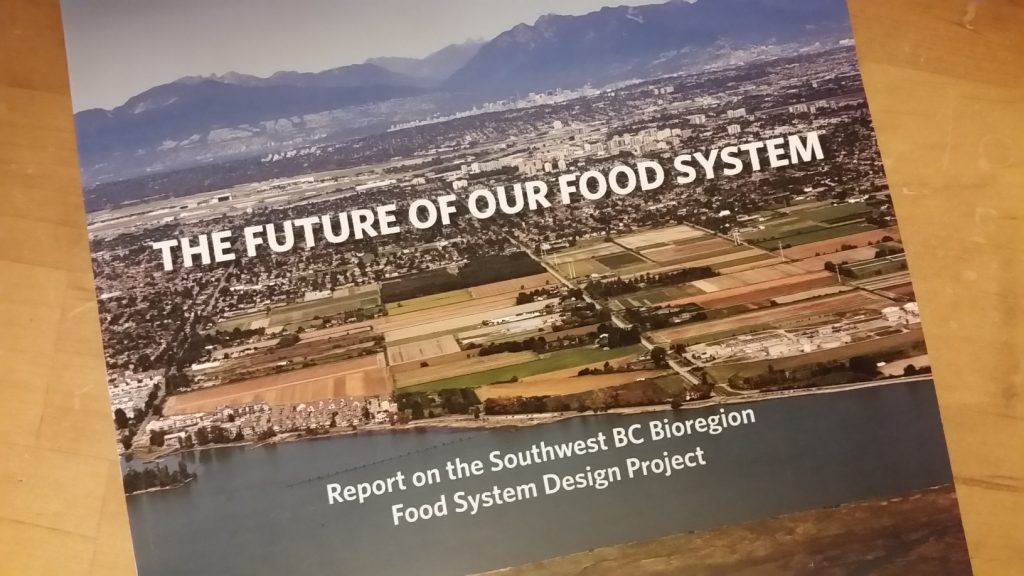
I attended a meeting this morning where the lead researchers of the Southwest BC Bioregion Food System Design Project reported out results of the first phases of their ongoing study. There is a lot to digest (pun!) here, and the actual reports are going to be made publicly available in a couple of weeks, so I will wait until then to have a longer discussion about what this research project means, to the region and to a City like New Westminster (we were one of 8 Local Governments that provided a little funding to help bring this research to life).

20170125_204921

Long version short – we are challenged to supply all of our food locally in this rapidly growing region, and without significant change in how and what we eat, the region will never be self-sustaining no matter how much ALR we protect. However, there are some significant economic and other advantages to encouraging increased use of ALR land for local food crops, and less reliance on food imports. There are also (somewhat paradoxically) some potential environmental/ecological disadvantages to this approach. It is a complex problem, as might be expected from an analysis of so many interweaving complex systems.

After this meeting, I took my first ever trip on the Evergreen Line to Coquitlam City Hall to meet with members of Coquitlam Council and staff to continue our discussion of the Brunette Overpass project. Nothing exciting to announce yet here, except for continued progress in finding common ground on the principles and challenges of the project. I remain positive about this file.

20170125_144144

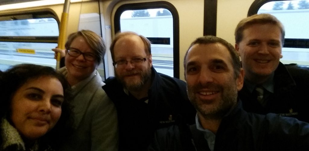
It may be telling about our biases that the New Westminster contingent (Council members and Staff) rode the Evergreen together to and from the meeting, reducing at least by one or two the number of vehicles trying to get through the constricted interchange that connects our City. Its almost as if there are alternatives to more lanes…

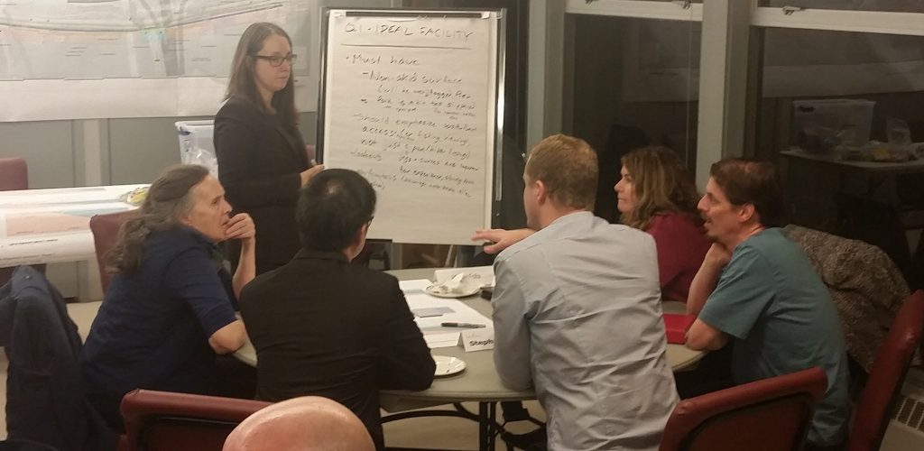
Finally, this evening members of the New Westminster Advisory Committee on Transit, Bicycles and Pedestrians, and the Parks and Recreation Committee had a joint meeting to talk about potential design and functional elements of a waterfront connection between the Pier Park and Sapperton Landing.

20170125_192616

We are *really early* in this process, and although making a connection here is a Council priority, we have a lot of jurisdictional, engineering, and budget issues to work through. However, some high-level understanding of what people would want or expect from the connection is useful in setting some terms and developing concepts.

These are all projects I hope to be able to write more about soon. I’d love to hear your opinions about any of them.

NW Station glass

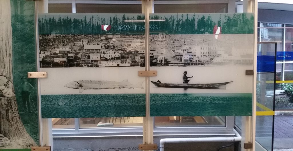
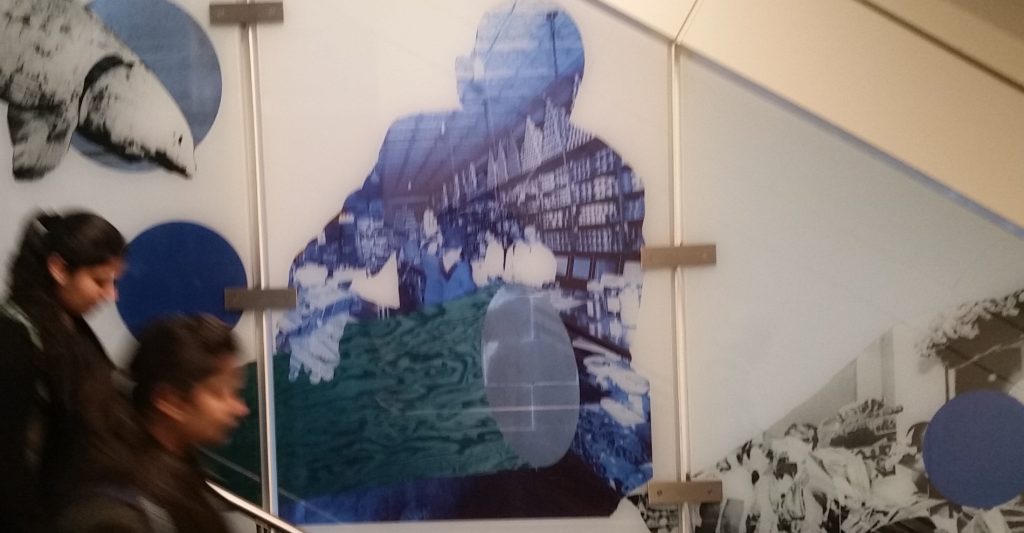
After several months of disruption, it is with little fanfare that the New Westminster Skytrain station was fully re-opened after renovation. Immediately noticeable in the new station is the mural stretching up the staircase to the eastbound platform.

20170118_122220

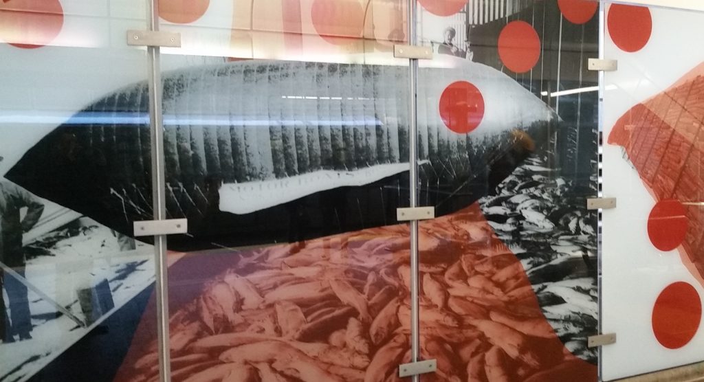
In a nice understated nod to local history, the glass mural is an amalgam of images from New Westminster history, some familiar, some not. The photos were drawn form New West Archives and the Vancouver Public Library collection, and collaged with colour effects by artist Sean Alward.

20170118_122237

The overall effect down the staircase is to mimic the flow of the Fraser River itself, with various pictures of “nature” juxtaposed with “resources” that we have created from nature through a 150+ year history of New Westminster’s development. And the people are more shadows, impressions imposed on the background. A really nice piece. And what’s with the blimp?

20170118_122321

Meeting with Coquitlam

Members of New Westminster and Coquitlam Councils, with staff support on both sides, had a great meeting yesterday to discuss the Brunette Interchange project.

The meeting included a tour of important locations on both sides of Highway 1. Both Councils took the opportunity to share ideas and issues, and have a better understanding of the many concerns with the current traffic through this corridor and with the potential solutions offered by the Ministry of Transportation.

I still have serious concerns with this project, but was really pleased with yesterday’s discussions between the two Councils. The meeting was positive, respectful, and informing, and I am looking forward to the discussions ahead.

Plans and Promises

I have had interesting interactions on social and traditional media this week, and it got me thinking about plans the City makes, and where those interact with promises made by politicians. I am new to making the latter, have made the former for a long time, but haven’t really thought about the differences. let me see if I can tie this together into a cogent discussion.

It started with this Facebook post:

Hey Patrick, Earlier this year you spoke of the pedestrian and cycle improvements that were soon to be built along Braid. What does soon mean? You spoke of right away, seems you’ve become just another politician, promises promises…….

I have a slightly vague memory of having this conversation, as it was around the time some public consultation was being planned around this project. I knew the project was coming along because we talked about it at ACTBiPed, and because I attended an event as Acting Mayor just before the last Federal election where an MP from and adjacent riding announced some federal funding to help fund the project.

So I replied to the Facebook post with a link to the project page (above), and slightly cheekily followed with “no promises, though”, because it seemed to me the poke about “promises” by my inquisitor was slightly tongue-in-cheek. Or maybe not, as another person took slight offence to my flippant attitude, requiring yet another response by me that provided more detail, proving once again that Social Media is a terrible place to infer nuance.

The longer version of my response is that the project is coming along, but this isn’t really something I would think of as a “political promise”. I don’t think anyone ran for Council supporting or opposing a plan to put green separated lanes on the north side of Braid Street to connect to the United Boulevard bikeway. However, some of us were more supportive than others of the Master Transportation Plan for the City adopted just before the election (I don’t think anyone NOT supportive of it was elected). I am not only still supportive of it, but am supportive of rapidly implementing the active transportation measures included in that plan, including filling some of the important gaps in our bicycling network.

When it comes to building certain connections, though, that is really a complicated discussion between Council, staff, our Advisory Committees and other stakeholders, and is influenced by the capital budget and various priorities. This particular project was seen as a good chance for some senior government grants (applied for and won), represented an important gap, and was generally seen as ready to go. Drawings were created, some cost estimates done along with some public and stakeholder consultation. Capital budget was set aside in the 2017 year to do the works. My “supporting” this plan was a very minor part of the plan coming together for 2017, even as one of the members of a seven person Council.

That said, I can see a couple of potential issues that may prevent this from happening on the existing timeline. If you look at the poster boards from the Public Consultation, you will note that the map has red lines on it. Those are property lines, and a large part of the project is within rail property. I understand that we have agreements for these properties, but as we are learning with whistle cessation measures elsewhere in the City, the way rules and agreements work on rail lines is not always straight-forward, and it is best not to be too hasty predicting how those agreements will work out when it comes time to roll out the excavator. The second issue is, of course, the upcoming Brunette Interchange project by the Ministry of Transportation. I can’t tell you too much about it because MoT has not yet released their project drawings, but if there are changes in how Braid Street works through this area, we may need to go back to the drawing board. I don’t know the answers to the questions, nor are they completely in Council’s control.

I have every reason to expect this project will proceed in 2017 as planned, but all plans are subject to change, based on the rule of best laid plans. This doesn’t mean we won’t build a safe cycling and pedestrian route between Braid and the Bailey Bridge, it just means that the connection may not arrive exactly as we envision it today, or on that timeline. We’ll stick to the goals, we may need to change the plan. Stay tuned.

As for “promises”, I remember promising to support the Master Transportation Plan, to support and work towards implementation of the transit, pedestrian, and bike infrastructure improvements in that plan, I promised that stakeholders like HUB and the members of ACTBiPed would be involved more in planning these types of projects. I also promised I would do everything I can to be the most open Councillor about talking about how decisions around the Council table are made – mostly through this blog and other Social Media, hoping that openness would build more trust in the work City Hall is doing. If we make a decision you don’t agree with, I hope you will at least understand my motivation for making that decision, and hopefully you will be angry at me for the right reasons.

Which brings us to this week’s editorial in the Record, where they are critical of Council’s approach to the Q2Q bridge. They are right that the current situation is a let-down, and that, ultimately, Council has to own that disappointment. I may (cheekily) offer surprise that they claim to have known all along it was impossible to build the bridge, and didn’t bother to point that out to anyone, even when previous engineering reports suggested it was well within scale of our budget, but that is not the part of the editorial that made me retort. Instead, I was pretty much with their argument until this:

It doesn’t take a political scientist to figure out that Queensborough’s project would be low on the priority list. In fact, you just have to drive down Ewen Avenue to know that Queensborough often gets the short end of the stick.

I have to respectfully disagree with the suggestion that this Council ignores Queensborough as some sort of political calculation. That the Editor used Ewen Avenue as an example suggests to me they have not been to Queensborough in some time. Ewen Avenue is undergoing the single largest road improvement project in New Westminster in the last decade. Two years into a three-year $29 Million upgrade, the entire length of Ewen Avenue is going to be a brand new transportation spine for all modes. It has been a big, disruptive construction project, but the end result is becoming visible now, and will change how Ewen Avenue connects the community in a pretty great way.

If the issue is priorities, the Editor may be reminded that the Q2Q plan was part of a series of DAC-funded projects that started with $6.2 Million towards the $7.7 Million renovation of the Queensborough Community Centre, including the opening of the City’s first remote library. It included another $5 Million in Park and greenway improvements for Queensborough (including the South Dyke Road Walkway, Boundary Road Greenway, Sukh Sagar and Queensborough Neighbourhood Parks, and a pretty kick-ass all-wheel park). These were the first thing done with DAC funds, not a low priority.

Just two weeks ago at Council, we turned down capital funding support for a Child Care facility in Uptown because we placed the need in Queensborough as higher priority, and dedicated our limited child care funds toward filling that need. That isn’t “the short end of the stick”, that is including Queensborough’s needs along with the other neighbourhoods of the City when directing limited resources towards where the need is greatest. This council has a record of fighting (and winning!) to keep Queensborough in the same federal riding as the mainland, and a record of fighting (and losing) to keep it in the same provincial riding. Queensborough has never been an afterthought at the Council table during my time there, but a neighbourhood we continue to invest in and be proud of.

The situation for Q2Q sucks, there is no way to dress that up or say it more elegantly. A set of projects was conceived a decade ago, and of them, this project does not appear workable in the current form. The work is ongoing right now to determine how the remaining DAC funds can best be used connecting Queensborough to the mainland, and I am hoping a new and viable plan will come along soon. Call the current set-back a broken promise if you must, but the decision to not move ahead with a $40 Million option right now is not proof of a City disregarding one neighbourhood, it is a matter of understanding our fiscal limits as a City of 70,000 people with dreams perhaps bigger than our reality.

The Q2Q quandary

No doubt the biggest let-down last Council meeting, indeed the biggest disappointment of my time on Council, was the releasing of the updated projected cost numbers for the Q2Q bridge preferred concept.

A short version of this project is that the City will receive “DAC” funding from casino revenues to spend on a fixed pedestrian link between the Quayside and Queensborough, based on a 2007 agreement between the City and the Province. Based on some very preliminary cost estimating, the project was put in the $10 Million range, so Council placed that amount in the budget to support the project. The idea has seen several rounds of public consultation, with several design concepts sketched out and debated. Ultimately, a design that would be acceptable to the regulatory authority that controls river crossings (i.e. a design that allows safe and unfettered barge traffic) and still allows reliable pedestrian use was developed to the point of doing detailed cost estimating. That cost came back at a little over $39 Million. The City doesn’t have $39 Million, and it is hard, with so many competing capital priorities, to see how we can get $39 Million to make this project work. I’m frustrated and disappointed.

However, regular readers (Hi Mom!) know I rarely stick with the short version, so I thought I would go into a bit more detail about how we got here, and where we may go from here, because I want to slay some of the social-media-derived myths about the project.

This project was not killed by NIMBYs. Over the last 10 years or so, the Q2Q project has gone through several iterations. The DAC agreement was in 2007, but it was always anticipated that the Queensborough Community Centre update, other park improvements in Q’Boro, and the MUCF (now called Anvil Centre) would be the completed before the Q2Q project began. The DAC funding did not arrive as one big cheque in 2007, but is allocated as projects come along, and as casino revenues come in. Q2Q was a little further down the timeline.

During those 10 years, preliminary planning work was done on a few concepts for a “fixed link”. At several times, early concepts with very preliminary sketches were bounced off of Quayside and Queensborough residents. For lack of a better term, these concepts were “focus grouped” to test public reaction and determine what potential concerns residents on either side and other important stakeholders may have. They were also run past pedestrians and cycling advocates (like me) to see if their needs were being met.

Three different “high level” crossings were evaluated about 8 years ago. These would completely span the navigable channel at a height that met regulatory requirements (and therefore be about the same height as the Queensborough Bridge). There were some concerned neighbours about the mass of the structure, and some were concerned about the fate of the “Submarine Park”, but there were also some functional and cost concerns with this early concept.
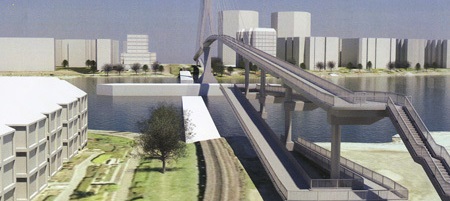
Cable stayed bridge Option 1, estimated cost $19 million.

At the advice of the Council of the time, staff stepped back a bit to take a look at options that didn’t go so high as to span the navigation channel, and would require a lift, swing, or bascule section to open and allow boat passage. This opened up a large number of potential options, including new alignments. For a variety of technical reasons, a bascule was determined to be the best option for a lightweight span with a limited footprint. This evolved, through a type of value engineering, into a couple of models of twin bascules – one at a moderate height (but requiring elevators to be accessible) and one at a low enough height that grades were accessible (but requiring more opening/closing cycles, due to reduced boat clearance).

These also saw some limited public consultation, and some neighbours expressed some concerns about the location of one of the “elevator” options. However, Council felt we had enough information to do a more detailed cost analysis of the most practical alternative. That alternative is the one that came back to Council with the $39 Million price tag. The concerns of neighbours were part of the considerations, but the $39 Million was the deciding factor.

Cost estimates are necessarily iterative.
Someone asked me how this project ballooned from $6 million to $39 Million? The simple answer is it didn’t.

The original DAC funding formula envisioned a ~$10.5 Million crossing. I can’t speak to how that number was arrived at (I wasn’t even a local blogger in 2007!) but I can guess it was a simple bit of math: pedestrian bridge, 200m span, look at a couple of recent examples around the country, don’t worry too much about details (the City can always make up a shortfall if needed from their capital budget), and since we aren’t building it for another decade, any estimate we make now is likely to be off anyway. The point wasn’t to plan a bridge at that time, but to earmark parts of this one-time funding source towards worthy projects.

The City then went to work on some of the other DAC projects: the Anvil Centre, the Queensborough Community Centre, and other waterfront improvements in Queensborough. To better make the financing work without having to enter too much long-term debt, they re-allocated some funding between DAC project areas. Consequently, the DAC funds for the Q2Q are now only a little over $6 Million, but another $5 Million in capital reserve funds was earmarked to cover the difference, meaning we still have the ~$11 Million originally earmarked.

As far back as 2009, order-of-magnitude cost estimates for the high-level crossing were in the $15 – $22 Million range. This is when the City went back to the drawing board to see if there were more affordable options, and also started to look around for sponsorship and senior government grant opportunities to see how much of a funding gap could be filled. By 2013, preliminary estimates for the first bascule concept were given as cost of $10.4 Million.

Fast forward to 2016, after Council asked staff to spend a little money on getting some detailed cost estimates on the more refined design, where $11 to $15 Million was still the general thinking, as we became aware of some of the significant engineering challenges. These included the need to install pillars in the river (not just on shore), the barge collision at Queensborough back in 2011 which definitely triggered a closer look at the safety factor for large vessels through the north arm, and the mechanical and operator costs for a bascule bridge. It seemed likely these would offset cost savings that might be realized by not going 22m high and building 1km of ramps. Add a few shifting project priorities as the public consultation and interest in the project increase (Strong enough to carry an ambulance? Wider than 2m for greater pedestrian comfort? Offset to reduce impact on vulnerable riparian habitat on the Q’Boro side?) and things start to add up.

That said, cost estimating for engineering projects is a complicated business, and like most engineering, you get what you pay for. Early estimates were preliminary, in that a lot of the project definition we not yet completed. After working to refine a project enough that we could confidently define important parts of it, Council recently directed staff to get a Class ‘C’ cost estimate, which is considered to be accurate to about 30% variance (i.e., costs are unlikely to be 30% higher or lower than the estimate). We could spend a lot more money to get that estimate down to Class A level, but when the estimate we have is well outside of our affordability range, we need to decide whether the extra design work required would represent money well spent.

I can’t speak too much about the decisions and work done before I was elected, but this webpage has links  to the reports that have come to Council since 2013, where you can (if you care) walk through the public process planning for the Q2Q has been.
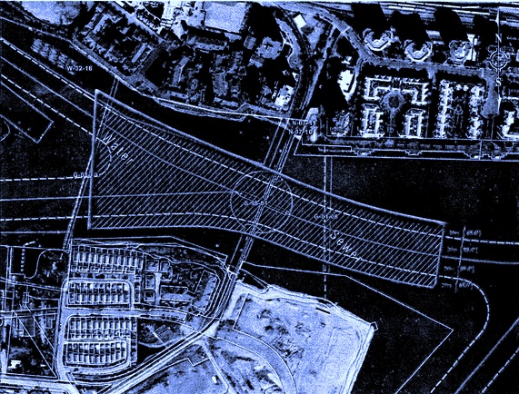
q2q5

This project only appears simple
I wrote a blog post a little while ago that talked about some of the complications and compromises required to make this project work, then followed up to answer a few questions, so I don’t want to go through all of that again. This is not a simple project to build, for a variety of reasons, and it is very different than a simple pedestrian overpass. Strapping a sidewalk onto the side of the existing train bridge raised other issues that seemed insurmountable. Many other proposals I have heard (a bridge to Poplar Island then a second to Queensborough, for example – why build one expensive bridge when you can build two at twice the cost?) have also been similarly evaluated, and either didn’t make sense at the time, or had significant issues that seemed to prevent it happening. If it was easy, we would have done it already.

Q2Q is still a good idea!
This is a serious setback, but I want to make it clear that I am still a big supporter of this project concept. A fixed pedestrian link between Quayside and Queensborough makes so much sense at so many levels. It has a certain tourist appeal (especially if you can build something aesthetically pleasing), but it isn’t for tourists. It is to connect people and businesses on both sides of the North Arm better, it is to connect the great pedestrian and bike routes on both sides of the North Arm, it is a vital piece of transportation infrastructure for the people of New Westminster, and for the region.

Is a passenger ferry a good substitute?
No. I do not think a passenger ferry service is a substitute for a fixed link. As a vital piece of transportation infrastructure, a fixed link provides certainty and reliability that a ferry service can’t. I think of it like a bus route (which can always be cut at the whim of a government) compared to a light rail line (which is a fixed asset difficult to remove). There is reason the bus lines running down Hastings have not resulted in the kind of development that the Skytrain running down Lougheed has – the latter is something people can count on still being there and reliable 20 or 30 years down the road – certainty is an incentive to investment. There is also the strange psychology of having to schedule/wait for a ride, vs. just being able to hop on a bike and spin across at the drop of a hat. The former “feels” like a tourist attraction, the latter more like a transportation link.

However, in the meantime, I think it is worth trialing a ferry service to determine the interest, and perhaps to argue the need for a more permanent link. Or maybe (I sincerely hope) the trial will prove my skepticism wrong. These cannot be the little aquabuses that run to Granville Island – currents and logs and heavy industrial traffic mean the Fraser needs a somewhat more robust design. We will need to invest in some dock upgrades and look for a partner to run the show. It is highly unlikely that a ferry can be made accessible for people with mobility issues. However, with luck we can have something running in the late spring.

What now?
To me, the fixed link dream is not dead, but it is definitely suffering a bit. I am hoping for a miracle some really creative thinking to come along that makes the transportation link more accessible and permanent. I am interested in looking at a more stable and reliable ferry option (like a fixed cable ferry), and wouldn’t turn my nose up at urban tramway ideas (could we connect to New West station?), or a pedestrian tunnel as is common in England, and would get us out of our 22m clearance issue. There may even be more efficient and elegant bridge designs that haven’t seen complete costing analysis but may thread the needle between what is acceptable to the river users and what works as urban transportation infrastructure.

It breaks my heart that we don’t have an immediate path forward on a bridge. I think it is a really important idea for the City, I just wish I could responsibly say the cost as presented made sense for the City.