Us & Them

This is a terrible story.

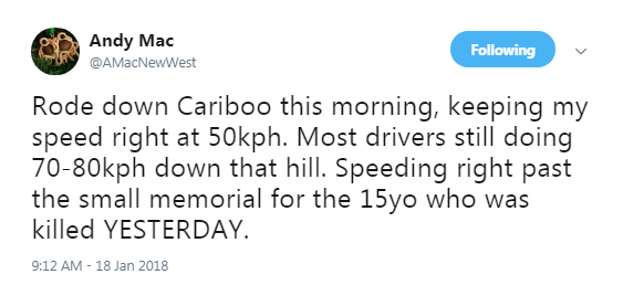
Over a period of four days, two pedestrians and a cyclist were struck by drivers of vehicles on the same section of Cariboo Road. The first pedestrian, a 15 year old, died at the scene. It’s heartbreaking.

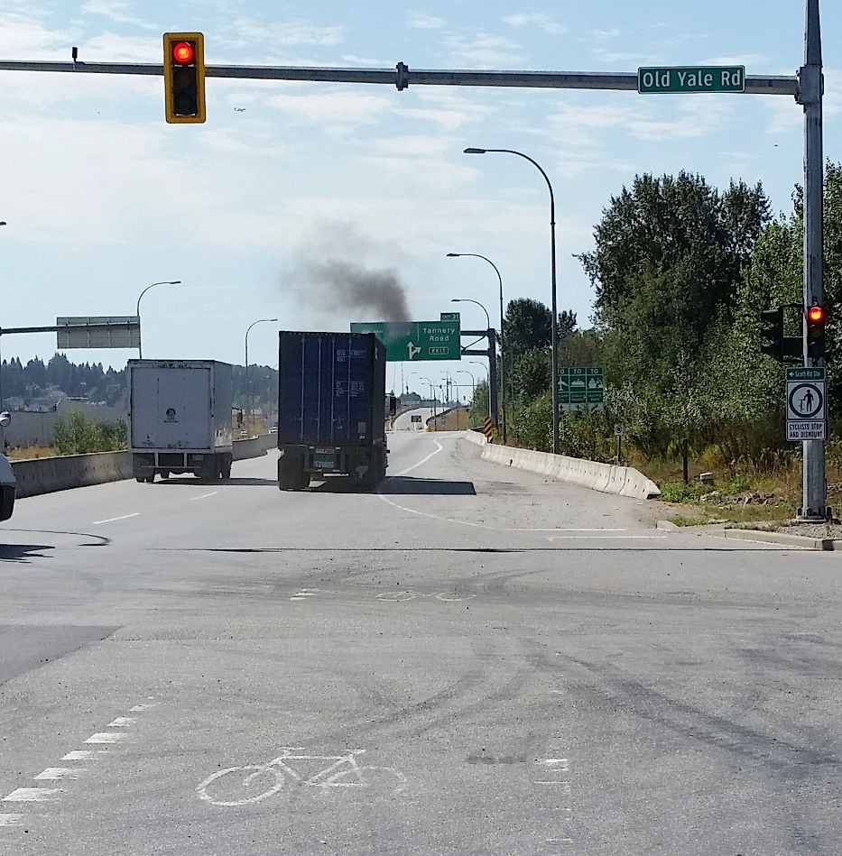
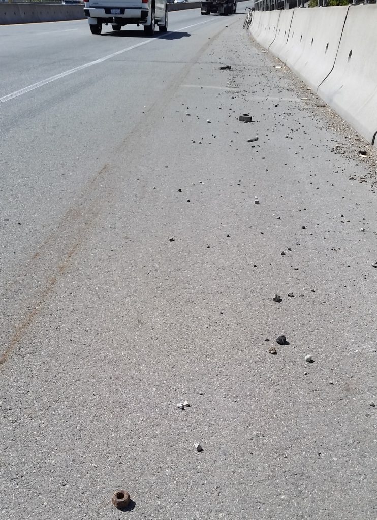
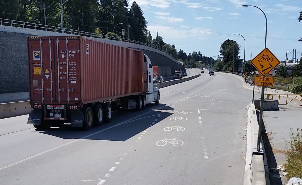
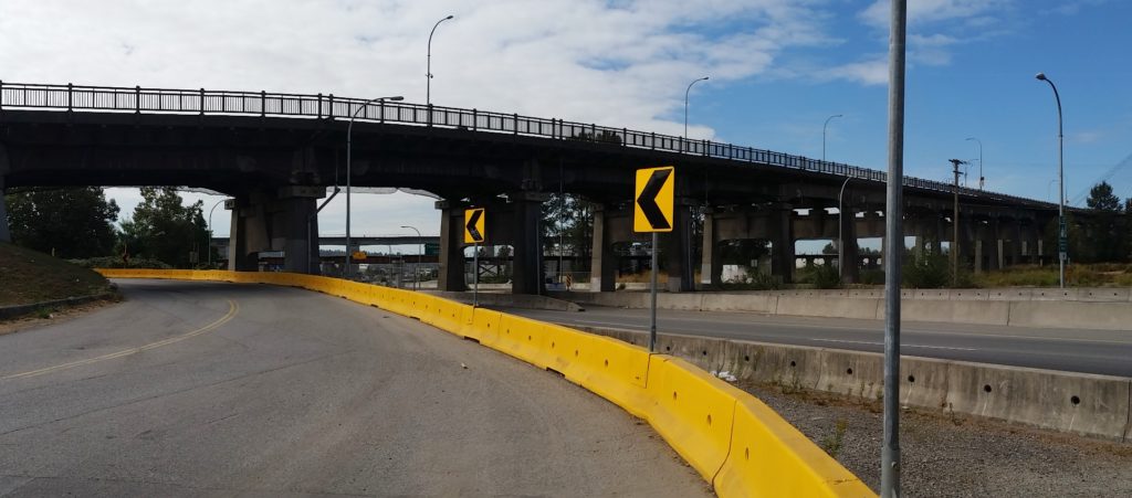
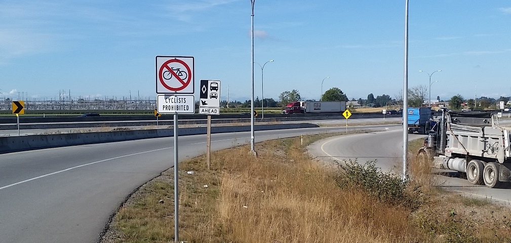
This is a piece of road I am familiar with. It used to be on my daily commute when I worked in Burnaby, and is still part of my regular cycling routine. So am quick to add my “anecdata” along with the list of people commenting that the crosswalk in question is a terrible design. It is a crosswalk that provides access to a well-used bus stop across the street from a residential area, but it is around a corner at the base of a big hill where the speed limit is ostensibly 50km/h, but every piece of the road’s design (separated centre, wide shoulder, 5m lane widths, sidewalk buffer) tells the driver to go much faster. And drivers do go much faster.

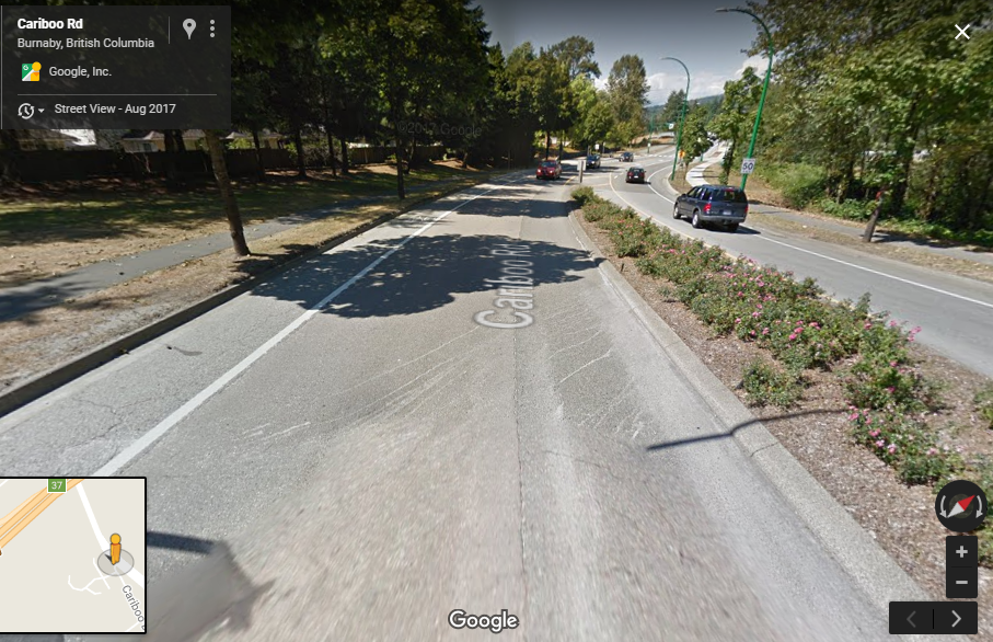
So there will be wringing of hands, and pressure for the City to fix this situation. Likely, some sort of pedestrian-activated light will be installed at the cost of a couple of hundred thousand dollars that will marginally increase pedestrian safety, but will add one more step a pedestrian must take (hit a button, wait for a light cycle) to beg for the right to safety while moving through public space. Meanwhile, a little bit of targeted enforcement by the police will increase the perception of something being done until their attention is drawn elsewhere and driver’s behaviors revert to what the road design is telling them to do. The 85th percentile will again sneak up to its design point.

I would be hopeful for, but not expecting, a more sustainable long-term solution, one that would meaningfully increase safety for all users. Reduce the lane width to something like 3.5m (which would provide opportunity for a separated protected cycling path on this well-used route). Complement the pedestrian light with a raised crosswalk, paint and texture treatment to send appropriate speed signals to the drivers. Increase the number of protected crosswalks along Cariboo Hill so people can access the Cariboo Heights residential Co-op and Briar Road, and to again signal drivers that this is a residential area where they should be driving 50km/h and expect pedestrians, not an 80km/h freeway on-ramp. This would, of course, be expensive, but the Google Earth air photo still shows the millions of dollars recently spent here to allow drivers on Cariboo Road to drive faster through here as part of a regional motordom expansion project…

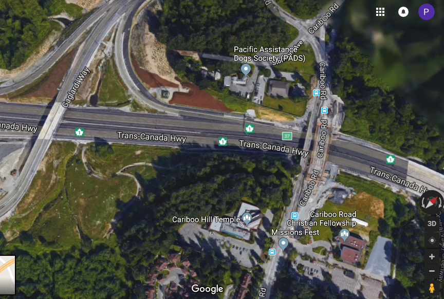
Uncharacteristically, I am not going to hate on Burnaby here. That would be too easy and unfair. This situation is not unique to Cariboo Road, and it is not unique to Burnaby. It in no way undermines the seriousness of this situation to say these three incidents in such close proximity are an unfortunate coincidence. Realistically, I can name a dozen other areas where similarly hazardous conditions exist, and municipalities like Burnaby, Richmond, and (yes) New Westminster are slow to react to them.

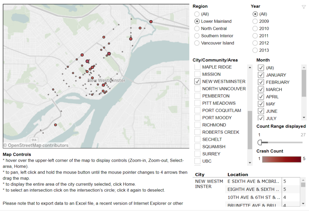
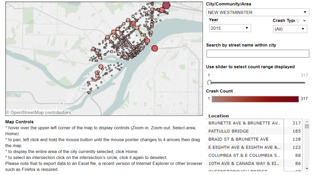
That these safety issues are so common is part of the reason we are so slow to react; there’s a lot of infrastructure to fix and a limited infrastructure improvement budget. Still, too much of it is spent on “getting traffic moving” in places like this, were public safety would suggest the opposite. I could go off on a long tangent about “warrant analysis” here, but instead I’ll just reiterate that even if the best intentions exist, priorities need to be set. There simply isn’t enough money to make every pedestrian crossing as safe as we would like, because there are too many unsafe intersections and crossings. 70-odd pedestrians are killed every year in BC, the vast majority at a marked crossing or intersection, demonstrating that we have a lot of work to do when it comes it engineering the protection of pedestrians.

However, engineering can only get us closer to the safety we desire (and please spare me the long digression into autonomous vehicles, the fantastical promises of which seem to commonly fail when pressed against some simple inquiries into their remaining challenges). I’ve recently-enough ranted about how the vehicles pedestrians are forced to share space with are increasingly dangerous to those pedestrians, but haven’t really called out another trend supported mostly by personal anecdote: an increasingly callous disregard for the safety of other demonstrated by people driving cars in British Columbia, and the apparent reluctance of Police and Crown Counsel to meaningfully address this public health emergency.

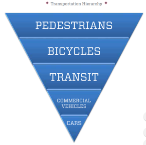
We have work to do as municipalities (working with and supported by TransLink and the Ministry of Transportation, I hope), and I am proud that New Westminster’s draft 2018 capital budget is showing a serious commitment to meeting the goals set out in our Master Transportation Plan – we are now spending as much on pedestrian and cycling improvements as we do on road repair and asphalt to “keep traffic flowing”. But at some point, we are going to need to convince drivers to meet us half way. We need to change people’s minds about their cars, their entitlement, and how that threatens the safety of our communities.

Motordumb

This is terrifying.

I mean, that is what it’s supposed to be. Part of the macho-truck-tough-guy/gal image it is meant to project. Sports cars were sometimes jokingly referred to as phallic symbols, projecting compensatory manhood and virility. This is a more of a rolling sawed-off shotgun, projecting violence, instability, and wide destructive swath to compensate for an inability to aim.

Big Trucks are nothing new in Canada, but look at the language the puff piece in the “Drive” section of our national newspaper (ugh) uses to describe it:

“Insane”, “ridiculous”, “’roid rage”, “invincible”, “out of scale”.

This truck is too wide (“A single lane suddenly feels too narrow… a foot wider than an already-huge F-250”), too tall (“the bottom of the seat is at eye-level”), and both creates a visual barrier for others (“Once inside you can see clearly over the tops of all SUVs”), yet has terrible visbility itself (“Nothing directly in front of it is visible, thanks to the huge, wide hood”). This lack of visibility is enhanced by mating a 450 horsepower engine with a design that features “bad steering, bad ride and bad handling.” But don’t worry, “You’re so high off the ground, there’s little sense of speed. It’s like looking out the window of a 747 during takeoff.”

Yes, this vehicle is an exaggeration of a point, and not many are sold (although the Globe & Mail will no doubt help with that little problem). But it is symptomatic of a situation where the use of automobiles is,  for the first time in history, getting less safe. And it is increasingly innocent bystanders being killed by them, not drivers.

There are many factors leading to these trends, distracted driving being a bit part of the equation (which raises an entire new rant about big LCD screens in cars). However, we live in a situation were you can roll a Honda Civic off the lot that is faster on the racetrack than a Lamborghini Gallardo. Dodge is selling, over the counter and with no special training mind you, an 840hp drag racer that does a sub-10 second quarter mile. It is so fast, that it is actually illegal to use at a regulated drag strip without doing safety modifications, but you can drive through your local school zone with no such regulatory concerns.

Cars are getting bigger, they are getting more powerful, and things like outward visibility are being compromised for design reasons. Trucks, especially, are seemingly exempt from any regulations around bumper height and fender coverage. After-market modification of lights, suspension, and other critical safety equipment is essentially unregulated.

This is all coming from the position of someone who walks and cycles in a dense urban community, but also someone who sees it as part of his job to make it be safer for 8-year-olds to walk to school and 80-year-olds to cross the street. We already give so much of our urban space to automobiles, because they serve a utility that people value. Recognizing that, we can build wide, comfortable sidewalks. We can design better crosswalks, and paint green paint at conflict zones. We can impose speed limits, improve lighting, create walkable neighbourhoods and dynamic retail districts. But our public spaces will never feel safe – will never be safe – if some agro asshole can charge through it waving a sawed-off shotgun at everyone.

We need to have a discussion about how far is too far for automobiles that want to share our urban space. We need enforceable standards of power, speed, bumper height, and other design elements that emphasize the safety of not just the operator and the passenger, but of other who unwillingly share space with these machines.

Some will suggest this is an intrusion – the end of freedom as we know it. Of course, we already have an actual law telling people to wear a Styrofoam helmet when sharing road space with this monstrosity. And when you get run over by it, rest assured the driver will say “I didn’t even see him!” like that is a defense, and not an admission of guilt. And Crown Counsel will agree.

There is no “War on Cars”, but if that’s what it takes to get these tanks off of our city streets, sign me up.

Bikes on the SFPR

Bike lanes are in the news a bit again, here in New West, and out in one of our higher-profile western suburbs. It got me thinking about good and bad cycling infrastructure, and I haven’t gone off on a rant on this blog for a while, so make a cup of tea, because I am going to launch off on the Worst Piece of Cycling Infrastructure Ever®, known around these parts as the South Fraser Perimeter Road (“SFPR” or Highway 17). As this will most surely be tl;dr, you can skip down to the important part here.

When some previous Minister of Transportation (Falcon? Lekstrom? meh, it doesn’t matter) was hyping the region’s biggest-at-the-time motordom project, loosely defined as “the Gateway”, they were quick to point out the benefits to cyclists. The SFPR was announced as part of the largest MoT investment in cycling infrastructure of all time. This hyperbole was supported by the entire ~40km length of this glorious new road having cycling lanes affixed.

At the time, a few skeptics suggested that the shoulders of a high-speed truck route through farms and industrial areas may not be the ideal place to ride a bike, and by the time the new highway was opened, the previously-promised cyclist benefits were being seriously downplayed (hence all the dead links in that 4-year-old post above). But a Bike Route it is, to this day. There is a sign every 500m telling you so:

One of these green signs is found every 500 m for 40 km of great cycling infrastructure like this.

A couple of years on, the disaster of this poorly-placed, terribly-designed, and wholly-disingenuous cycling investment is pretty clear to anyone brave enough to venture onto this designated cycling route. No point dancing around the point: for cyclists of all skill levels, the SFPR is so unfriendly and dangerous that those “Bike Route” signs represent a reckless disregard for public safety.

That is a strong statement, so before I committed to it, I headed out to the SFPR with my bike to experience the length of the route in its harrowing glory, just to build up the temper necessary to commit that charge to hypertext. I went into it nervous, spent the ride terrified, and left enraged. Mission accomplished.

Funny I never ran into any other cyclists on this sunny fall day.

For the majority of the SFPR, the “Bike Route” is a 2.5 metre wide paved shoulder adjacent to industrial traffic moving at highway speeds. Nowhere is there a barrier protecting the shoulder from intrusions by trucks, not even rumble strips to warn drivers who may vary from their lane. The traffic is mixed, but the route was ostensibly built for and dominated by large trucks. The speed limit is allegedly 80 km/h, but speeds vary incredibly, from closer to 60 km/h around intersections (trucks accelerate slowly, after all, creating great rage moments for commuters!) to well over 100 km/h in the more open stretches.

Seriously?

In places where there is a soft shoulder or a low jersey barrier, having 80 km/h truck traffic blow by 2 metres from your left shoulder is unsettling. Where you are between those trucks and a 4 metre-high sound barrier wall (marked by the occasional gouge from vehicle swipes) or a 10-m concrete buttress, it is nerve-rattling.

shudder…

The knowledge that a momentary lack of attention by one of those drivers, or an impromptu swerve or technical problem with your bike means certain death provides a certain… clarity of thought. That thought is not “sure am glad I wore my helmet!”

The rational move (other than to avoid the SFPR altogether, which I will get to later) is to squeeze as far over to the right and put as much space between your body and the trucks. The problem with this strategy is that the SFPR “Bike Routes” are dotted with particularly deep and treacherous rainwater catch basins, and the further you get from the traffic-swept white line, the thicker and more challenging the road shoulder debris becomes:

Rocks and a hard place.

The road debris on this route is not surprising for an industrial truck route, unless you are surprised by the raw number of rusty and broken bolts and other important-looking parts that are ejected from trucks. Debris encountered on my ride included rocks large and small, glass, plastic vehicle parts, kitty-littered oil slicks, random lumber, nails, tire carcasses, tie-downs and bungie cords, and the occasional dead animal. These only serve to heighten the chances of one of those life-limiting impromptu swerves or technical failures. Once you realize the “swept clear” parts of the bike lanes are only done so by vehicles crossing the line at speed that you start to wonder if the route is designed specifically to kill you.

I hope that speeding truck didn’t need those parts…

Or just designed to confuse you…

Seriously, what are they trying to do to us here?

To add another layer of frustration to this alleged “bike route” is its isolation. Choose the SFPR and you are stuck with the SFPR, because it largely fails to connect to an established regional network and actively prevents you from getting on or off the SFPR where these types of connections may be obvious.

There are two locations on either side of the Alex Fraser Bridge, where a perfectly safe, low-traffic road is separated from the SFPR (one by a tall sound barrier wall) in such a way that getting out of danger’s way is impossible. For lack of a connection here, crossing this 5 foot barrier requires a multi-kilometre detour.

That over there on the left is NOT a designated bike route.

This lack of connection to regional cycling infrastructure is most obvious at the three regionally-important bridges under which the SFPR passes. The quality of the cycling paths on those three bridges is (east-to-west) really good, terrible, and not too bad, but they are all nonetheless important links. Again, either no connection has been contemplated for the bike route, or actual multi-layer physical barriers have been installed to prevent an SFPR cyclist from getting to the bridge where connections would be natural.

You can’t get there from here.

To get on the Alex Fraser Bridge from the SFPR requires a 3-km detour through two hairy multi-lane intersections. The Pattullo requires 1.5km and riding right past a pedestrian overpass, which would make for a great connection if it wasn’t barriered from access from the bike lane. The connection to the great bike infrastructure on the Port Mann is so far that is it actually a shorter distance just to ride to the terrible cycling infrastructure on the Pattullo.

Multi-layer protection – keeping cyclists from entering or leaving the SFPR at the Pattullo.

So the SFPR fails at every aspect of effective cycling infrastructure: it lacks the most basic safety and comfort considerations, it lacks connections, it lacks any form of appeal. It is not surprising that during my ride of the entire 40km length of the SFPR, both ways (done over two sunny mid-week days early in the fall), I never saw a single other person on a bicycle on the entire route. However, every 500m there is one of those little green signs. Or something like this:

Share the Road!

So it is time for the cycling community to wake up and recognize we got played. Of course, this is the Ministry of Transportation’s standard playbook, so we could have seen it coming: This “bike route” is a safety pull-off area for trucks.

One of these signs improves safety.

We were sold “cycling benefits” of a Billion-plus-dollar piece of transportation infrastructure, and got something else: bike signs placed on paved shoulder really intended to keep trucks in the other two lanes moving if the occasional vehicle needs to pull over, or of someone just needs to park a trailer for a few hours. Aside from that, it is a gutter for gravel and trash and carcasses and truck parts to prevent them from accumulating where they may impede truck travel. This “Bike Route” is just a part of the truck route, nothing else.

This is why this shoulder exists, signage be damned.

(I need to super-emphasize this) The SFPR it was never meant to be a Bike Route. 


So what to do? I’d like first to call upon the new Minister of Transportation to take down those “Bike Route” signs.

It isn’t her fault, she didn’t create this mess, but she adopted it by getting elected, so it is on her to do the right thing. The MoTI must stop threatening the lives of cyclists. Removing the signs and anything else that may incite otherwise-unaware bicycle users from mistakenly entering this cycling abattoir. Put an end to the ruse that this is any place for bicycles.

I could ask her for many more things – investment in cycling infrastructure for Surrey and Delta to make up for the funding-securing lies told by her predecessors, a commitment to policy changes to prevent her staff from ever doing this kind of bait-and-switch again – but those are opportunities for the future, and will require budget and policy decisions and such. She is a busy person with a huge mandate and new to the job; there will be time for those niceties later. First we must undo this mistake made intentionally by the previous government.

In the short term, someone in Minister Trevena’s office needs to call up the road maintenance contractor that bought the rights to not clean the shoulders here, and ask them to send a crew out to remove those signs. It shouldn’t take more than a day, it won’t cost any money, and it’s the right thing to do.

Where the SFPR meets another truck freeway, cooler heads prevail.

Ask Pat: Braids

Rudy asks—

Hey, Pat. Is the Braid section of the Brunette Fraser Greenway still planning on being constructed in then near future? I know the city webpage doesn’t seem to have been updated in over a year, and still states that it’s due to be completed by December of 2017. Has the uncertainty over the design of the Brunette Interchange project affecting this? To be honest, while I would appreciate this section being completed soon (as I bike from Sapperton through to United Blvd every weekday), it does sound like a bit of waste if the interchange ends up making all of this irrelevant in just a few years.

Short answer is yes, for the most part, though it should be done by now.

There has been a plan to improve the connection between Braid Station and the Bailey Bridge, Canfor Avenue, and the rest of the Braid industrial area for cyclists and pedestrians for a couple of years. It’s been a pretty well-developed plan for long enough that I went to one of those run-up-to-the-election funding announcements for the money we got from the Federal Government to pay for part of this. The federal election of 2015. Here is my understanding of what has happened since:

After a year of design and consultation, which led to some pretty significant re-design, the plan was to do the work this summer. However, the changed plans were changed again when a significant sewer line under the road was found to be in unexpectedly poor condition, and in need of replacement. In general, we try to avoid putting fresh asphalt and curbs on top of a pipe you are going to have to dig up very soon, so the pipe work needs to come before the road improvements. To add fun to the mix, the portion of pipe needing the extra work is near the existing rail lines, which significantly increases the complications related to doing the pipe work. So the project was delayed, but will be moving forward, and we should see some work done this winter and spring (the City page has been updated!), pending interesting findings during excavation*.

As far as I know, the work should not be influenced by the Brunette Interchange work. The greenway section where works are planned will be a greenway for the foreseeable future, and the related driveway improvements for the adjacent buildings will need to be there to provide access to those buildings regardless of Braid/Brunette upgrades. The eventual interchange project may influence the ends of the greenway, or even intersect it, but the majority of the pedestrian/bike improvements will still be needed. As far as I know, we are good to go.


Rick asks—

Whatever happened to the Coquitlam-New Westminster Brunette Interchange joint task force? The announcement press release states that reports back to council were due by February 27.

These folks?

I have no updates since the news release of March. At that time, the Task Force had established some common interests, and we issued a letter to the Ministry to let them know where we found agreement, and to provide some opinions on the proposed interchange options. Perhaps not surprisingly, the work came to a pause shortly after that as we went into an election. I’m not sure the lengthy period between that election and a new Minister of Transportation being given a mandate expedited the work in any way. As the new Minister has a pretty full plate, I expect a moderate-priority project like this will be addressed after a few more raging fires are stamped down.

If I was to guess (and this is nothing more than a guess), I suspect we will hear something in the spring about next steps on this project, and the Ministry’s goals in light of the suggestions set forth by Coquitlam and New Westminster.

*one of the charms of a 150 year old City is that most times you dig a hole, you are surprised by what you find down there. These surprises apparently delay a large number of City projects, which gets me thinking about how we do contingency budgeting in this City needs a bit of a re-vamp.

ASK PAT: the Missing Link

Tom asks—

Any news on the BC Parkway’s “missing link” between 5th Ave. and 14th St.? I understand that Southern Railways has given up its lease on the old Central Park Line, and so it’s reverted to BC Hydro and the tracks have been pulled up. Will TransLink be giving this stretch a proper surface any time soon? Can New West nudge them to do it? Or should we hold another “Worst Roads in BC” poll?

The answer to this one is short, but probably unsatisfying, so I’ll do that politics trick of shifting it to something I want to talk about and leave it with asking you another question that somehow makes you forget I didn’t answer your question. Hey, election time is coming up soon, I need practice!

But first, the answer is that it is a work in progress. The City has expressed its interest in making this connection better than it is, and the right of way on the other side of the SkyTrain pillars makes sense. However, complications arise in that the City doesn’t own that land, nor do we own the BC Parkway Trail. I’m not completely up on the details here, so don’t hold me to all of these interactions, but my understanding is that the land belongs to Southern Railway (or BC Hydro), and there are rights of way for TransLink and either Southern Railway or BC Hydro (whichever isn’t the owner). The BC Parkway is a TransLink asset, supported by surface Rights-of-Way, so I think their right-of-way is only for the SkyTrain guideway through that portion, which is why the BC Parkway was not completed through here more than as a sidewalk in the first case back in the 1980’s.

So as far as the rights to build things, including a paved cycling or multi-use path, there is some legal work to do on the part of the City and TransLink. It is in the City’s work plan, but I don’t know when all of the stars will align. I am pretty certain it won’t be this year, possibly next, but I’m not promising yet.

There is another work-in-progress in the same area also in the having-conversations-between-TransLink-and-the-City stage. When Stewardson Ave was re-aligned to build the Queensborough Bridge interchange, a link in the BC Parkway across Stewardson below Grimston Park was lost. There is a route across involving the ramps to the Queensborough Bridge, but it is quite a lengthy detour for West End residents interested in walking down to the Riverfront or Quayside. At one point, a pedestrian overpass below Grimston was proposed, but I’m not sure we should build one, which is where I turn this around and ask you a question.

When is a pedestrian overpass a pedestrian amenity, and when is it an automobile amenity?

This is not an academic question. Our City’s Master Transportation Plan puts a priority on pedestrians, with other active transportation forms and transit next, with automobiles at the bottom of the priority for new infrastructure investment. We still spend an order of magnitude more on maintaining automobile infrastructure than other forms, but when investing in new stuff, our budgets are shifting towards supporting MTP priorities.

So when asked to partner with TransLink to build a new overpass, we need to ask the question: are we building this to serve pedestrians, or are we building this to move car traffic?

The easiest and least expensive way to move pedestrians across a street is a stoplight and crosswalk. This is especially true if we want to assure the infrastructure is as accessible as possible, as any grade separation inevitably results in a compromise between slope and distance, making a simple walk across a road either impossible for those with mobility challenges or unnecessary long and complicated for everyone else. The engineering required to put active transportation users 5m in the air so cars have unfettered free passage below is always counted in the millions.

However, if we build a level crosswalk with lights and buttons and paint, that means cars need to, occasionally, stop and let pedestrians by. It also means that we need to design a crossing to reduce the chances that a driver will fail to stop and kill a pedestrian, which may mean improving sight lines and reducing vehicle speeds in general. When we consider building a pedestrian crossing on this part of Stewardson, will it be the couple-of-hundred-thousand dollar signalized crossing, or the couple-of-million-dollar overpass? If the latter, should we pay for it out of the pedestrian amenity budget, or out of the car amenity budget?

The question may be academic, because it is highly unlikely the City’s engineers or TransLink will sign off on a crosswalk on a City Street that is part of the Major Road Network (as this part of Stewardson is) where the traffic typically moves at 80km/h, despite the 50km/h speed limit. This speed issue is also part of the reason why the existing cycling connection you originally asked about feels unsafe for all users.

And this, multiplied by dozens of places throughout the City, is how we still, for all the best efforts and good intentions, lose our pedestrian spaces to motordom. It is frustratingly slow making this change, it represents a cultural shift in three levels of government and society in general, but that’s our goal.

on Data

This isn’t exactly an Ask Pat, but I was asked a question on Facebook comments thread discussing the new Crosstown Greenway changes along 7th Ave, and I needed more than a Facebook post to answer:

I read two questions here, tied up into one. Paraphrased, the first is “How many cyclist injuries or deaths are there in the City to justify all of this money spent on bike lanes?”, and the second, perhaps more nuanced, is “What data justifies spending money on all these new bike lanes”.

I didn’t answer the first question, because I think it is a terrible question, but never got around to explaining why I feel that way. If we have a spike in deaths or injuries, it may be an indication that we have a problem that needs immediate attention, but we don’t wait for those spike if we can anticipate and prevent incidents. A raw count of deaths or injuries as the sole driver of infrastructure investment is not responsible governance.

The actual data being asked for is hard to come by. Local governments do not (to the best of my knowledge) collect these stats in any kind of comprehensive way for public consumption. ICBC presumably still collects stats, but their reporting out has become pretty inconsistent, and their crash maps for New Westminster have not been updated since 2013 (for Pedestrians and cyclists) or 2015 (for cars) and cannot be filtered by injury/death/property damage: 

Anecdotally (and off the top of my head) I can think of two cyclist and three pedestrian deaths in New Westminster in the last few years (there have surely been more). One of them I am comfortable in calling an “accident”, a second was clearly an act of negligence on the part of a pedestrian. The rest were just as clearly acts of negligence on the part of the drivers of a vehicles, resulting in the death of 3 innocent road users. I have also spent the last year watching a good friend struggle through recovery from a near-fatal cycling crash where he was clearly a victim of a negligent driver. New West is not unique here, as across the region, there is news every day of cyclist endangered by the negligence of drivers.

Of course, I acknowledge the obvious point that cyclists and pedestrians also sometimes act negligently, and cause accidents. However studies have shown that accidents causing injury or death of pedestrians and cyclist are in the vast majority, caused by the actions of drivers, most notably not yielding right-of way while making turns.

That said, we are talking about infrastructure, and part of designing and investing in transportation infrastructure is in making it harder for people (drivers or vulnerable users) to be negligent, and to reduce the potential impacts of any negligence on vulnerable road users. We can do this through design that reduces conflict points, improves visibility, slows cars, or puts barriers between vulnerable users and the vehicles that endanger them. At some level, this should be the primary goal of all transportation engineering. But perhaps I am already digressing too far from the point, so let me answer more succinctly:

We don’t measure the need for a bridge by counting the number of people drowning in a river.

The second question seems to be more relevant to how governance works: What kind of data do we use to make transportation investment decisions?

The City passed a Master Transportation Plan back in early 2014, and it sets out priorities for the City’s transportation investments. It was developed in context of a bunch of other planning documents, including larger regional plans like the Metro Vancouver Regional Growth Strategy and the TransLink Transport 2040 regional transportation plan, both of which the City participated in. Internally, we have our own Official Community Plan (currently being updated), a relatively recent Sustainability Plan, and a variety of other strategies to make the City more equitable, safer, livable, and sustainable.

These plans all point to making active transportation modes (pedestrians, cycling, and transit) easier to access, safer, and more comfortable, as an important strategy towards the larger regional and local community development goals. This was reflected in our Master Transportation Plan with an established hierarchy for our transportation system:

In an ideal world, our transportation spending would reflect that hierarchy, but we are not there yet. This year, we will spend something like $4 Million* on asphalt, mostly to make roads smoother for drivers. At the same time, we will spend about $500,000* on sidewalk improvements and maintenance (which represents a pretty significant proportional increase over previous years), and the Crosstown Greenway improvements that started this entire conversation will cost us less than $125,000*. By any measure, the hierarchy in the MTP is aspirational, as travelling by car is still the preferred mode for a little more than 60% of residents.

(* all budget estimates, very close to reality, but not exact numbers) 

So the City has a well established and regionally-supported goal to encourage active modes, mostly by making them safer and more comfortable for all users. The only question left is what evidence do we have to suggest making active modes safer and more comfortable encourages their use, or provides the livability, sustainability, and inclusion goals the City is after?

I could start with Montreal, or Copenhagen, or Medellin, or even Vancouver. I can refer you to books by Jeanette Sadik-Khan or Charles Montgomery. We are not inventing a new wheel here (we are too small and too fiscally conservative a City to do that), but we are taking the best of what other jurisdictions have already demonstrated to work, and are warned by failures in other jurisdictions.

If you want to dig in to the academic underpinnings here, I can link you to resources about how protected bike lanes save lives and reduce injuries, and studies showing that communities where people are encouraged and supported in choosing active modes are happier, healthier, and more inclusive ones. Perhaps most importantly, I can show you the data that building proper infrastructure increases the number of cyclists, which actually correlates with cyclist safety much more than does helmet use (for example):

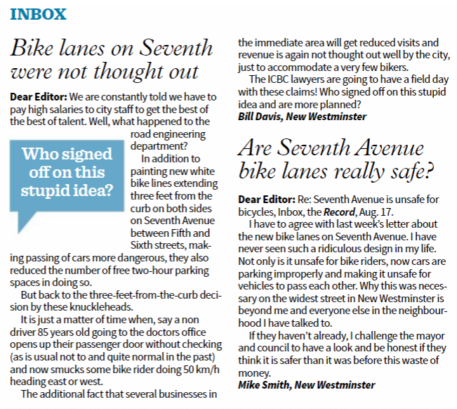
The Crosstown Greenway improvements are very small part of our transportation budget (less than 3% of this year’s budget for road improvements), and has numerous potential benefits to the community at large. As the City’s first foray into modern separated bikeway design, it may have a few kinks to work out, and it may take a bit of time for drivers to get their head around the new layout, but it is based on well-established design principles, and is a big step towards creating a safe, effective, and all-ages cycling network in the City.

That said, they were done as a bit of a trial, and I encourage everyone to let the City know what you like and don’t about the design – and provide suggestions about how the City could improve upon the design.

POST SCRIPT: I swear I did not read the New West Record that came out today before writing this post… 

Ask Pat: Q2Q Ferry

I am a little behind on my Ask Pats, I apologize. there are a few in the queue, but work, life, and an amazing array of community events have kept me away from the computer keyboard. I’ll try to catch up.

BoatRidesAreFun asks—

Hi Pat,

Any updates on the Q2Q ferry that was supposed to open July 1? I haven’t seen anything happening at either of the docks.

The ferry has been a challenge. This is one of those times I am glad I am an Elected Type setting unreasonable expectations for staff, and not City Staff trying to meet the unreasonable expectations of the elected types!

The good news is the the trial is ready to go, and will be starting this weekend. The Ferry will run on weekends and holiday Mondays in August and September from 9:00am to 7:00pm, and from 5:00pm to 9:00pm every Friday in August. It will run every 20 minutes, and will cost a Loonie or a Twoonie. The route will be from the Quay (near the Inn) to the public dock on the south side of Port Royal. The bad news is that the limitations of the project as a “pilot” will mean it falls short of some expectations, and that could benefit from some background explanation, so I am glad you asked.

Running a passenger ferry turns out to be a much more complicated process than you may think. You need a boat and operator, you need (at least) two places for it to dock, and you need permission from several different agencies responsible for keeping people from drowning as a result of poor planning.

The first issue was surprisingly hard to solve. The Fraser River is a dynamic, working waterway. There are tides reaching 9 feet in range, and tidal and river currents that flow in different directions up to 10 knots. These currents shift lots of hazardous debris like large logs. There are also tugs, barges, and large ships moving around the river. The little tubs used to shuffle tourists around the relatively safe tidewater of False Creek were not going to work on the Fraser. Something more skookum (to use the nautical term) was required. The more requirements the City put on a boat (number of passengers, weather protection, accessibility, room for bicycles, operating cost), the more limited the number of available boats just sitting round BC waiting for hire.

Then we need two places to dock the boat. Installing a new dock facility in tidewater in Canada is not a simple process, as it activates everyone from the local Port Authority to the Marine Carriers and environmental agencies including the Department of Fisheries and Oceans. For a short-term trial, the City really needed to find already-existing docks.

Ferry_Map(1)

The public dock at Port Royal was there and available, but designed for small pleasure craft, not to accommodate a passenger ferry. Significant changes would intrude into water lots owned by Port Metro Vancouver, who were helpful and accommodating, but had their own safety and operational concerns that had to be addressed. On the Quay side, the only functional docks are operated by the Inn at the Quay (where the paddlewheeler tours launch from) and the industrial dock operated my Smit. Again, both had challenges with accommodating their established operations with a new every-20-minutes group of passengers, many of whom are not that accustomed to walking around industrial marine operations, and who will create no end of hassles if they fall into the drink and get dragged downstream. Again, a deal was worked out and operational concerns managed.

At this point, City Staff need to be acknowledged for managing a significant number of potential game-stoppers here, but in the compromises required to make this work are the inherent flaws in the final plan. During this summer, we are going to have the trial ferry service that was possible, not necessarily the one we want.

When I think about connecting the Quay to Queensborough, I am not thinking of it as a tourist draw or a piece of recreation programming, I am thinking of it as a vital transportation link. To be such a link, it need to be reliable, available for daily users, and fully accessible. The trial ferry is going to fall short of this. The high tide range and reliance on existing dock infrastructure means it will not be fully accessible to those with some mobility challenges at all tide stages. Running the ferry only on weekends with limited hours means it will not be useful for work commuters wanting to get from Port Royal to Downtown or Skytrain. The limited hours will further cause people crossing the river for diner and a drink to look closely at their watches while waiting for the bill to arrive. The City recognizes these limitations, but also recognizes the value of getting this project running to see how the public reacts.

In the end, I hope people will appreciate this is a test-of-concept trial, and not the ultimate solution to connecting Queensborough to the Quay. Its successes may be limited, but there has already been a lot learned by the City just in setting up the service, and there will be much learned during its limited run, both in it’s success and where it falls short of expectations. I hope that people on both sides of the North Arm will come out to support this pilot, and provide your constructive feedback to the City, so that we have useful info to inform planning for a more permanent solution.

Pattullo EA

With all of the excitement around elections, renewed commitments to transit funding somewhat confounded by unclear priorities around the application of road tolling, it is easy to forget the Pattullo Bridge is falling down and scheduled to be replaced very soon. At this point, it is unclear how the replacement will be funded, but it is clear right now that the existing structure is unlikely to be carrying traffic in 2023, so unless they get busy planning the replacement, we will be entering uncharted territory.

Translink is continuing to get busy with that planning, and is currently involved in the Environmental Assessment (“EA”) process. I write about this now, because you have until the middle of next week to provide your first round of input to that process.

The need for an EA is mandated by the province, and the EA itself is run by the Environmental Assessment Office, not by Translink. It is a fairly tightly regulated process, with a structure and firm timelines, so if you at all care about the Pattullo (and I think most people in New West fall under this category), you might want to take your chance to comment while they are open. I thought I might outline the process a bit here, not to tell you what to comment on, but to help you understand the process so your comments have the best chance of being heard.

The first stage of any EA is the pre-application stage when the terms of the EA are determined. The primary purpose of this stage is to evaluate what impacts (positive or negative) will be created by the project, and what are the potential targets of these impacts – so “sediment in the river” is a potential impact of construction work, and “fisheries habitat” is a potential recipient of that impact. The second stage is the actual “Assessment”, where these potential impacts are assessed to determine if they are real, and then to make adequate mitigation of these impacts a condition on moving forward with the project. To have a project (any project, be it a bridge, a mine, or a pipeline) refused an EA certificate would be very unusual. The more likely process for an EA to kill a project would be to create conditions that make the cost or hassle of mitigating an impact so high that the proponent will decide not to proceed. I don’t think that will be the case here.

By necessity, an EA has to have a project to review. So the proponent has to provide a project description to hang the assessment on. It appears, from the preliminary documentation provided by TransLink to the EAO, that project is “a new four-lane bridge funded primarily by user pricing” and “located north and upstream of the existing bridge, its approaches will connect to McBride Boulevard in New Westminster and the King George Boulevard in Surrey” , which is consistent with the public consultation work TransLink has done to date and with the MOU between TransLink, Surrey, and New Westminster. This is important to recognize, because comments like “they need to build 8 lanes for future capacity” or “they should build the bridge in a different location” are not relevant to the EA. Those arguments were made, and discussions had, over the last 5 years while the project was being developed, they are not the current plan, and the EA is not the process through which a radical change of plan will come about. In essence, the question in the EA is not “how best to connect Surrey to New West by roads”, it is “what impact will this 4-lane bridge proximal to the existing one have”. Comments addressing the first question are interesting, but not relevant to this process.

So the comments the EA needs right now are pretty limited, but foundational to the EA to come. Have TransLink and the EAO appropriately identified potential impacts? How do you think the proposed project will impact your life, the livability of your neighbourhood? What concerns you about the project as proposed? If you want TransLink (or other parties, such as the Ministry of Environment) to address something as part of this project, now is the time to ask, so it can get into the EA early, and the proponent has an opportunity to properly address it.

Picking a random example, I have talked in the past about how the Pattullo is an iconic structure. It has significant heritage value for the City of New Westminster. It is hard to finds a picture or photo of the City over the last 75 years that doesn’t feature the large orange arch defining the skyline. There is a value to that for our community. I don’t know how the EAO or TransLink can address that value, or what kind of mitigation can happen, but if we don’t raise that as an issue important to our community now, it will not get into the EA review, and an opportunity to discuss that aspect of the design of the bridge will be lost.

There is another issue that I hope will become clearer as the project EA proceeds, and this might be a bit wonkish. How valid are the traffic modelling assumptions baked into the assessment?

Transportation Planners and City Planners understand that traffic is impacted by induced demand. If we build a 4-lane bridge to replace an existing 4-lane bridge, there will be no more than a marginal increase in traffic counts (perhaps induced by a wider, safer, bridge configuration). That small increase in traffic is fundamental to a bunch of other impacts that will be measured – air quality impacts, noise and vibration, economic impacts, etc. However, if the traffic numbers coming out of this model are based on false assumptions about traffic, then all of the resultant data will be similarly flawed, and mitigation will not be appropriate. With all due respect to our regional transportation planners, the last two major bridges built in this region have completely failed to reach modelled traffic volumes – let’s not three-peat that mistake here.

So if this bridge is being built to accommodate future expansion to 6 lanes, how does that increase in traffic capacity (and concomitant induced demand) change those impacts, and (more importantly at this stage) is that being assessed as part of this project?

Then we have to raise the uncomfortable subject of tolls. The MOU and Project Definition both call for a tolled bridge, and the recent election seemed to indicate the province is now cold on the idea of bridge tolls. There is some time (this bridge will not be built until 2022 at the most ambitious rate) for the region’s Mayors to work up a regional road pricing scheme as envisioned in the 10-year plan, but that is something different than specific tolls on this bridge. As we have learned from recent experience, tolls significantly decrease demand for bridge infrastructure, so if this EA is based on traffic models based on toll aversion behavior of drivers, is that base assumption still valid? This is the type of thing we need clarity on right now.

Finally, there is an area of the EA where the cumulative impacts of multiple concurrent projects can enter into the assessment. The idea here is that one project may have a small, but acceptable impact on a valued part of the environment, but 10 similar projects on the same river will have a bigger impact. However, this is a transportation project, so cumulative impacts may be thought of in a different light. What impact will the (potential) cancelling of the Massey Bridge have on regional transportation (and the resultant traffic modelling?). Perhaps more important, what impact will SkyTrain/Light Rail in Surrey have on regional transportation patterns, and the assumptions feeding the transportation plan?

So that is long way of saying, if you care about the Pattullo Bridge and the impact its replacement will have on New Westminster, do a bit of reading here, and take the time to provide some comments to the EAO before the end of business on July 26. Then hold tight and wait until early 2018 when the full EA process starts.

paint

Free Rides

You may have heard TransLink is doing a Fare Review process. I wrote a bit about this a few months ago after attending a stakeholders meeting. The next phase of the process is meant to begin in the Fall according to the TransLink webpage, but I recently read a story that brought to mind one of my pet peeves about the transit fare system, and an idea that I think we need to adopt.

It is time we stop charging youth for using Transit.

I don’t have kids, so this isn’t about me saving money, but I have a couple of close friends in New Westminster who changed their travel pattern once their kids got to paying-for-transit age. At some point, paying for yourself and two others makes transit less desirable when a family can travel together in other modes (car, taxi, rideshare, etc.) at the cost of one person.

I would rather that young families be encouraged to ride transit together, for a couple of reasons. First off, it promotes the more sustainable mode, allowing more people to access transit and reduces traffic congestion, travel cost, environmental impact, all of the good things a well-used Public Transit system delivers to a community. The larger benefit, however, may be found in normalizing the use of transit for youth at the time of their life when life-long patterns are established.

It sends a message to 6-year-olds when we tell them that being driven by mom or dad to every event is the normal way to travel longer than a walking distance. By making it easy for them to accompany their parent on a bus and the SkyTrain, kids are not only demonstrated that public transit works for many trips, but are also taught how to navigate the City using transit, and to be comfortable in transit situations. This means they will more easily transition to being independent transit users, and will more likely see transit as an alternative when they grow older.

Of all the incentive programs that TransLink could put in place to drive ridership, this could potentially have the greatest long-term benefits since the U-Pass program was introduced. It would also, arguably, increase revenue, as more parents would be encouraged to pay a fare that they are now skipping because they have kids in tow, and the kids who are now riding for free are likely to become regular customers when they reach working age.

I’m not sure how this would work with our Faregate system (ugh…), nor am I sure if following the example of Toronto and London by making 12 the cut-off age is the right balance. I get the feeling that extending free rides to the age of 18 (essentially, the age students finish High School, and have first access to the U-Pass system) will better meet the public policy goal of “normalizing” transit use. These policy details probably require a better economic analysis than this blog post, and I trust the planners in TransLink to do that work. However, the larger policy idea will have to come from the community asking this of TransLink.

For the future of the region, kids and teens should ride for free.

Disgusting (updated)

At some point, a pander to one group of electors goes beyond cynical, and becomes an abdication of responsibility and an offence to the idea of governance.

The BC Liberals platform apparently includes a promise to create a “cap” on bridge tolls – where no driver pays more than $500 per year, regardless of how often they avail themselves of extremely expensive and not-yet-paid-for infrastructure. A great election promise to “put more money in the pockets of hard working British Columbians”, or some such bullshit, but I have to go bullet point to condense my anger about how bad an idea this really is.

  • It completely undermines the Mayor’s Council and the regional transportation plan that they developed. The province has put roadblock after roadblock in place of that plan, while shoveling money to vanity road projects that won’t solve the problem. Just last week they wrapped themselves in benevolent support for the plan with some commitment of financial support of a couple of it’s components. However, it has been clear all along that road pricing and Transportation Demand Management will be major components of the next phases. This cap is a pre-emptive strike against the Mayors, delivered with no warning.
  • This isn’t saving anyone any money. The tolls on the Golden Ears Bridge still need to be paid, because Golden Crossing General Partnership still needs to get paid. Similarly, the tolls on the Port Mann are still owed to TREO, and are already not bringing in anywhere near enough revenue to meet the business objectives of that White Elephant. The Province is going to have to top up these agreements from general revenue – potentially costing taxpayers hundreds of millions of dollars, because use of the bridge above the cap – the tolls taxpayers will have to cover – are actually encouraged by this scheme.
  • This undermines the business plan for the Massey Bridge. We don’t know much about the business plan for the Massey replacement, because the province redacted it to the point that none of the business risk was disclosed. However, the Ministry has been clear through the planning and the Environmental Assessment documents that the 10-lane bridge will be tolled. Tolling was not just a major component of the finances, but was fundamental to the traffic forecasts and environmental impacts for the project. This tosses all of those best-laid plans out the window.
  • It undermines the terms of the MOU for the Pattullo replacement. The stakeholders for the Pattullo have an agreement in place that underlies the ongoing project: a 4-lane tolled structure. Tolls are not just there to pay for the bridge, but to balance the traffic demand between crossings and reduce the impact on residential neighbourhoods of Surrey and New Westminster. A commuter cap on tolls shifts this balance, and sets back a decade worth of progress and partnership on this project, just as we were crossing the goal line.
  • It is counter to basic economics. We are taking a scarce and valuable resource, road capacity, and encouraging its increased use to save money. Simply put – the more you use the bridges, the less you pay. It is insane, and contrary to all Transportation Demand Management best practice across the industrialized world. It is separated from reality. It is deranged. Do I need to get out a thesaurus to make my point here?
  • It is not being offered for any alternatives. It will now, once again, be cheaper to drive a car across the Port Mann Bridge than to take transit across it. Just as the province has been dragged reluctantly into bringing expanded light rail to South of Fraser , they are creating a quick incentive to discourage its use, and undermine the entire model, shifting growth patterns in Surrey for a generation, at the most critical point of its growth.

Now, I am writing this about an hour after this information leaked out, so there may be devil-in-details I am not aware of here that will arrive with the official announcement, but that speaks to the point that there has been no consultation with the Mayors of communities affected, no public engagement over a plan that will re-shape the region and undermine so much of what the region is trying to achieve in livability, sustainable development, greenhouse gas reduction, and transportation. How do you recognize electioneering replacing governance? It is a surprise announcement completely disconnected from any other policy, program, long-term planning, or previous action by the government.

This is a flip of the bird to the regional plan (to the very idea of regional planning!) and to every resident of the Burrard Peninsula. It is a cynical pandering to a few ridings South of Fraser, and low-information voters across the province who likely won’t realize they are going to have to now pay through their taxes for infrastructure built on the promise that users would finance it. Not surprisingly, Jordan Bateman is taking a pass on criticizing this specific tax increase, being the original champion for the Port Mann fiasco.

And people will fall for it, of course. Congratulations, BC Liberals. You have raised the art of disgusting panders to a new level.

UPDATE: I was in the room when John Horgan announced out of nowhere that he would end all tolls on the Golden Ears and Port Mann bridges if elected. The closest thing I have to a response was what James Gemmill made succinct on Twitter:  holdmybeer