Moving backwards through traffic

You know, I hate to dig at TransLink. They are getting beaten up enough by the likes of Jordan Bateman and John Winter and Todd Stone that they don’t need actual public transit advocates like me running them down.

I recognize that most of their problems are the result of a near-impossible mandate from a Provincial government not interested in providing the secure funding to support that mandate, accentuated by the occasional random Minister of Transportation decision that take a another big chunk out of their budget for no reason but to give the Minister a speaking point or a ribbon to cut. Examples? The Golden Ears Bridge; Universal U-Pass; Faregates.

It may ultimately be this untenable funding situation that is causing all of this euphemistically-named “Service Optimization” that I am currently going to complain about. At least TransLink should have the guts to call it what it is: Service cuts. These creeping reductions of service impact already-poorly-serviced areas, and further erode the ability to earn fare revenue by making the choice of using Transit less viable for more and more users. TransLink must know this is a terrible course to be on, why are they sugar-coating it?

We in New West are fortunate to have exceptional Public Transit accessibility relative to many parts of the Lower Mainland. We have more Skytrain stations per capita than anyone else, and the majority of our populace lives only a few minutes from a transit stop of relatively high reliability. For this reason, New Westminster residents lead the region in transit use per capita. Build it, and they will come.

But what do they do when you take it away again?

A previous round of service cuts severely limited transit access in New Westminster’s fastest growing neighbourhoods in Queensborough, and the important community centres in the neighbourhood are starting to speak out. This round, we see the C9 service reduce to once per hour in “off-peak times”. With not a sniff of local public consultation. There is essentially no mention of New Westminster in the document I just linked to, which is a report on the public feedback to the reduction in service. Near as I can tell, they didn’t even come to New Westminster to talk to us about it – and their office is here! Their entire feedback on the cutting of service in New Westminster? “Some concern in selected communities”.

For people in our City – people I know personally – the C9 is their only reasonable transit access. They do not live out in the distant suburbs of Langley or South Delta that TransLink can hardly , they live in a dense (formerly) transit friendly neighbourhood in the centre of a bustling urban centre, in a City with huge transit use. Their only access to Transit becomes a once-per-hour service, which by any measure no longer makes it a reliable, useful, or accessible service.

For reasons that should be obvious to everyone, I’m talking to a lot of people in New Westminster these days about the “big issues” they have around local governance. Traffic is #1. Few people on the doorstep admit they understand the problem, and what the solutions are. I know I don’t have an easy solution, and can’t promise one. But this – cutting bus service in the middle of a busy transit-friendly dense urban area to the point where it is no longer a useful service – is clearly NOT the solution to our traffic problems, and may well increase them.

I hate, Hate, HATE this idea of a referendum to decide if we are going to securely fund out transit system, but if that is the only pathway towards ending these cuts and building the service to support our growing population, then we need to line up to vote Yes and get this system building again.

How much road is enough?

For reasons that should be obvious to everyone by now, I have been talking to a bunch of people about “the transportation issues” in New Westminster. It has been fun, informative, sometimes perplexing, often frustrating. For every person suggesting simplistic short-term solutions, there is another calling for bloody revolution. Unfortunately, the suggestion of gradual improvement though better planning, application of the best practices from other jurisdictions, and working with our neighbours to solve the regional transportation puzzle sounds unsatisfying compared to those extremes.

A local twitter follower I respect greatly raised an interesting point a couple of weeks ago, asking a seemingly simple question out of the blue: “does anyone know percentage of metro Van covered in asphalt?” I was (almost) embarrassed to admit I had written the answer down less than 24 hours before he asked, but his question led me to do a little more digging, and I found the data interesting.

First, the reason I wrote the information down was my job. I was attending a meeting at Metro Vancouver where a version of this question was answered. The meeting was of municipal engineering and environmental staff from around the region, and the subject was stormwater management. As part of the regional Liquid Waste Management Strategy, Metro is helping the municipalities of the region set some planning priorities around how the manage their stormwater.

Efficiently moving rainwater from your street, roof, and back yard to the river or ocean so that is doesn’t flood your community is one of those big, expensive tasks that is almost invisible to most people, except the way it eats up your tax money. The amount of pavement covering the ground is important to stormwater management because rain that hits pavement doesn’t get absorbed and stored in the soil like it does if it falls in a park, the forest, or your back yard. Instead, it needs to be immediately dealt with by the storm sewer system. Also, rainwater that runs off of streets tends to get dirty, and is a major cause of pollution for sensitive estuarine and marine ecosystems near urban areas. Reducing this run-off, or encouraging natural filtration of parking lot run-off (for example) through bioswales or the such is one of those strategies that requires some investment in the short term, but can save Cities a lot of money in the long-term while improving the environment.

But I was talking about roads, so back to roads.

During this meeting, a pie chart went up on screen that showed how land use was divided up over the region, for the purposes of thinking about road run-off. The quick stat I wrote down was 17% of “developable” land was roads. After the fact, the Twitter question was raised, so I found the source data, and drew up my closest approximation of the pie charts we were shown. Note this is 2006 data I am using here, and I think the data I was shown at the meeting was 2011, so there will be a little change at the edges, but the major divisions are pretty clear.

Of all land in Metro Vancouver, here are the major land uses, of which “roads” (in red) equals about 7%:

Land use in Metro Vancouver, 2006, by area. Click to Enlarge.

If you remove from consideration all of the land that is protected from development: Active ALR land, Watersheds, Parks and Protected Natural areas, you end up with 17% of the “developable” lands being roads:

Land use for “developable” land in Metro Vancouver, 2006, by area. Click to Enlarge.

The reason I am using 2006 data is because Metro Vancouver very kindly broke it up into Municipalities, so you can play compare and contrast. Turns out the City with the highest proportion of roads? If you guessed New Westminster, you know where I am going here:

Land use for “developable” land in New Westminster, 2006, by area. Click to Enlarge.

Of the “developable” land in New Westminster, 29% is covered with asphalt so people can drive on it. If you include the City’s undevelopable Parks and Protected areas, that number only drops to 26.6% Both of these numbers are the highest in the region. Comparing our immediate neighbours: Burnaby is 17% road, Coquitlam 9%, and Surrey 11%.

OK, enough with the numbers, you say- what does it all mean?

Roads don’t pay taxes. Dedicating a large portion of your land space to roads means that land is not earning revenue for the City, so the taxes on the adjacent (commercial, industrial and residential) lands have to be proportionally higher to provide the same level of services to the residents and businesses of our community. However, it is worse than this, because roads are a huge financial burden on Municipalities. Pavement is expensive to install and maintain, as are the associated drainage works, curbs, road markings, signs, lights, overpasses, and other fixed assets that keep the road system operating. Add to this the less tangible policing, fire, and ambulance costs related to enforcement of traffic laws and dealing with accidents and injuries on the roads.

I’m not arguing against roads, they are a service the City provides, through your taxes, for the general good (dare I say, they are an example of a benefit of socialism). I am arguing that the City with the highest proportion of roads in the British Columbia should continue to resist the calls from neighbouring communities to solve their traffic problems by turning more of New Westminster into road space.

It isn’t just a matter of livability, it is also because we simply cannot afford to give more of our land away to support their poor planning.

Bonus Graphing Excellence: Here is a plot of the Area of every Municipality in Metro Vancouver with the % of that area dedicated to roads. Note poor correlation between two data sets. You might need to click to make readable.

Truck Routes – Disappointing, not surprising.

I suppose the refusal by TransLink to remove various New Westminster streets from the designated truck route network is not surprising, but the wholesale dismissal of the concerns with a paucity of supporting arguments is definitely a disappointment. I hope this is not the end of this discussion, but the beginning of a conversation about the specific routes, and just a small setback to eventual progress*.

I don’t think anyone really thought Royal Ave would be removed from the designated routes at this time, not at least until there is a significant change in how the Pattullo Bridge connects on the north side of the River. However, there is no reason for keeping East Columbia through the Sapperton business area as a truck route, and a re-evaluation of the East 8th Ave connections are definitely in order.

Part of the frustration is the TransLink news release itself. Apparently released to a few news outlets, there is nothing on the TransLink media page, and the reasoning behind the decision is not made clear. The City of New Westminster provided rationale, alternate routing proposals, and justifications, and TransLink essentially said “no” without addressing the specific points.

Of course, they “took feedback from… Port Metro Vancouver, BC Trucking Association, and the Greater Vancouver Gateway Council” – that last agency essentially being the marriage of Port Metro Vancouver and the BC Trucking Association. It is unclear of they consulted with any of the residents being impacted by these trucks, by the PACs of the impacted schools, or by the businesses in Sapperton or elsewhere in the City that are meant to be serviced by these trucks. Nor are they reporting out on the feedback they received.

They basically asked kids if they want ice cream or Brussels sprouts, and got the predictable answer.

On the positive side, there is language in the news story about working with the impacted neighbourhoods to find solutions, so let’s hope this dismissing the proposed solution out of hand doesn’t set the City back too far, and we can start an expanded conversation about accommodating goods movement while protecting the livability of our City.

“No” isn’t an answer I want from any level of Government. I would rather hear: “That solution doesn’t work, but lets find one that does”.

There is an ongoing Facebook conversation about this topic in the Group “Rattled About Traffic In New West” with a variety of voices piping in, some more rational than others. The voice I find most interesting is that of Dave Tate, who is both a trucker, and cognizant of the impacts truckers have on neighbourhoods. He has been promoting the idea that a weight restriction on the Pattullo would increase safety, prolong the life of the bridge, and would remove much of the heaviest cohort of the truck traffic from Royal- those triple-axle container trucks that are typically the ones that rattle and bang down Royal, have the biggest impact on road wear and traffic, are typically the worst performers in the random roadside safety inspections, and are most likely to be using the Pattullo as the “toll free alternative” between two points that could easily be connected by an alternate route.

It is good to hear from a balanced group of people on this issue, as it is refreshing compared to the comments one might hear on the AM radio call-in shows. Yes, I’m looking at you Simi Sara.

If you listen to CKNW and (I cannot believe I am suggesting this) listen to the comments, you hear little but ill-informed people complaining that New Westminster is a progress-hating problem child, and has always been. There are a few major themes that are constantly repeated, so I thought I would touch on them as a point of retort:

“If New West keeps putting up barriers, I will avoid it, and will not shop there!”
If a significant proportion of the several hundred thousand cars that pass through New Westminster every day actually stopped to shop here, this would indeed be a strong argument to use, but unfortunately, this is just not the case. In actuality, it is the massive number of through-commuters and heavy truck traffic that makes it harder for people from around the region (and our own residents!) to access our business storefronts. It also makes our retail areas less attractive to spend time wandering around in. Removing trucks from East Columbia would improve, not worsen, conditions for businesses in Sapperton.

“Without all these trucks, your store shelves will be empty!”
Admittedly, New West does have a resounding number of Save-on-Foods outlets, but I doubt they require the 3,500 trucks a day crossing the Pattullo, with similar numbers coming in from Brunette and across the Queensborough to keep the lettuce shelves stocked. Besides, these truck route changes would not impact at all local delivery or pick-up of goods, because trucks are permitted on non-truck-route roads when actually having business on that road.These closures would only effect through-traffic trucks with no business in New Westminster, the ones that we just spent $5 Billion on new bridges and highways to accommodate.

“New Westminster needs to get with the program and build roads around the perimeter!”
Problem is, there is no perimeter, unless you define perimeter as “where someone else lives”. The roads at the perimeter of our City run right through the heart (and other vital organs) of our community, and right past people’s homes. 10th Ave is residential west of Kingsway, and residential and way too steep for trucks east of McBride. 8th Ave is residential most of it’s length. Columbia is both residential and home to a lot of ground-based retail, and is the heart of two of our most historic neighbourhoods. One can argue Brunette is a perimeter, but it only connects to non-perimeter roads to the west. Front Street cuts through our resurgent waterfront area – downtown will only succeed if Front Street succeeds as human space that connects downtown to the River. McBride, Royal, 12th Street, 8th Street – these are urban streets in the middle of bustling neighbourhoods surrounded with parks, residences, and commercial districts. Where is this mythical “perimeter” where you want to put all the trucks?

“How many of those New West people commute through surrounding Cities – they’re just being selfish!”
The short answer to the rhetorical question: fewer than any neighbouring community. New Westminstergenerates fewer car trips per capita than any Municipality in Metro Vancouver excepting Vancouverproper. Our “alternative mode share” (people who use their feet or transit for their daily commute instead of their car) is the second highest in the region. If the Northeast Sector (~82% of trips in a car) and South of Fraser region (~82% of trips by car) [data available here] had New Westminster’s mode share (~65% of trips by car) or took steps towards reaching the goal New Westminster is reaching for in the new Master Transportation Plan (~50% of trips by car), that would be a huge step towards addressing the traffic problems in New West, and a huge step forward for the region and the Province.


This all brings me to the real point here: New Westminster is not the selfish, parochial, progress-impeding “speed bump” in the regional transportation system and we need desperately to get past that narrative. New Westminster is a leader in moving towards meeting its regional commitments to a more sustainable transportation network. It has lead by building a more compact City, investing in mixed-use developments near transit hubs, but taking a SkyTrain station that Coquitlam refused, and by holding the line on mega-freeway development while suggesting increased transit investment might be preferable if the region hopes to meet its Sustainable Region goals. New Westminster has been demonstrating transportation leadership, both in words and in action, and we should not be shy talking about it.

*Since someone asked:  Progress, by my definition, is moving towards an efficient transportation system that serves the community, not a community that serves the least efficient transportation systems. “Building more lanes” has not represented progress in traffic management circles since the late 1970s; where providing affordable, efficient alternatives is how the 21st Century sees progress in Transportation planning.

On the Bailey Bridge

At least we can stop fighting about this and move onto more important issues, right?

I’m not sure it is a “disaster”, but the results of the arbitration on the Bailey Bridge dispute are disappointing, and a little frustrating.

The disappointment comes from the fact that this result will do absolutely nothing to solve anyone’s “traffic problems”, as a century of traffic research and Braess Paradox tell us that adding capacity has never reduced congestion when there is a near-infinite supply of vehicles. Instead, it will likely increase induced demand and create more congestion in the Braid Industrial area, making it harder for New Westminster businesses to access Brunette or United Boulevard.

As was already made clear, the “Ambulance Argument” was either bluster or bullshit, as a critical care ambulance is unlikely to risk getting stuck behind a train when an alternative is available, and an alternative is available from Coquitlam. An ambulance at the south foot of the new King Edward overpass can get to the Emergency room at RCH via the Bailey Bridge (2.8km) or via Lougheed and Brunette (3.4km), a difference of 600m. To save that 30 seconds, they would run the risk of getting stuck behind one of the 60-odd trains a day that cross Braid, and now will run the risk of getting stuck behind a line of cars in one of the few places where cars would not be able to pull over to get out of the way – a two-lane Bailey Bridge. I suspect the 4-and 6-lane alternative route provides higher response speeds, more room for people to get out of the way of lights and sirens, and more reliable transport times. But hey, one thing have in common with Richard Stewart is that I’m not an ambulance driver.

The frustrating part is how little information we have about why the decision was made the way it was. If you read the actual arbitrator’s decision, it clearly states that under Section 287 (e) of the Community Charter, the arbitrator is not to provide written reasons for their decision. We (the voters, the citizens, even our elected representatives) are specifically forbidden from knowing why the decision was made, or what evidence was used to inform that decision. Essentially, your parents just answered “why?” with “Because I said so!” For someone who gets engaged in local politics, and expects accountability and reasoning behind policy, this is a frustrating way to resolve a 20-year conflict.

To understand why this is the case, you need to go back through the Community Charter , which is the Provincial Legislation that governs, amongst other things, boundary disputes between municipalities. Under Part 9 of the Charter (Division 3- Dispute Resolution), there are two types of arbitration available to the disputing Municipalities in this type of case. Section 287 describes the “Final Proposal Arbitration” process, where the two parties provide their proposals and supporting justifications to the arbitrator, and the arbitrator chooses one of the two, based on whatever criteria (s)he deems appropriate, with no room for compromising middle ground or requirement to justify that choice. Section 288 describes the “Full Arbitration” process, where the Arbitrator can conduct whatever proceedings they deem appropriate (including hearings, negotiations, etc.), the arbitrator can provide an alternate solution to the ones proposed by the two parties, and the decision comes with a written explanation of the decision and justification. Clearly the second is the more open, transparent, and accountable process.

This more open and accountable process was the one argued for by New Westminster. Coquitlam wanted the closed process in the interests of expedience (because, you know, after 20 years, this needs to be settled right away). As there was no agreement on this first point of arbitration, the Province stepped in and made the decision that the closed process would be used. Which is why the New Westminster Council is now scratching their heads about how the decision was made. They are not allowed to know. Take your complaints to… uh… no-one.

Regardless, now that the arbitration result has been released, it is all (wait for it) water under the bridge, and we need to move on. Hopefully, the City will find a way to reconfigure the traffic patterns on the New Westminster side so that the businesses down there on Canfor Ave are not completely choked out when the inevitable commuting rush arrives on Braid. Also hopefully, Coquitlam won’t use this as an excuse to uselessly blow United Boulevard just east of the bridge out to 4 lanes, and take away the cyclist and pedestrian-friendly layout they have recently created between the bridge and the King Edward overpass.

Clearly ,we will find out which prediction comes true: Mayor Stewart’s assertion that his City’s (sarcasm) biggest traffic issue will finally be resolved (end sarcasm); or New Westminster’s prediction that the 5 rail tracks and already-problematic Braid and Brunette intersection are just going to mean the traffic pinch point has been moved 400m to the west, making the rail crossings less safe for everyone, and hurting New Westminster businesses for no gain whatsoever. But we likely won’t know the answer to that question until after the election, so Mayor Stewart can enjoy his gloating in the meantime.

The Mayors have a Plan

The Mayors of the region have done what no-one (and I include the Minister of Transportation in this group) thought they could: they came to a consensus around a 10+ year transportation plan. For a moment in time Thursday morning, people around the region started to dream about a rational transportation future… then the Minister reminded us that he wasn’t interested in solving the transportation problem, he wanted to perpetuate the contrived impasse. Alas…

First the good news: the plan looks good. The major components show a significant amount of compromise by many of the Mayors, as a few big dreams have been scaled back somewhat. However the route charted is clear: Rapid transit in the form of underground Skytrain on the Broadway corridor and two light rail lines in Surrey. A whole swack of B-line routes for everyone else. Investment in the SeaBus, a few shekels tossed to pedestrian and cycling infrastructure, and yes- a tolled 4-lane Pattullo Bridge.

Surrey LRT: Three lines total, 104 Ave and King George Boulevard running within 7 years, and the Fraser Highway line in service by year 12.

Broadway Corridor: Continuation of the Millennium Line to Arbutus within 10 years.

Skytrain: improvements to the system to increase frequency of Skytrain by 2016.

Burnaby Mountain Gondola: They are calling it a “connection” to avoid discussing technology, but the business case for the gondola is solid: it can move many more people for much less money with much more reliability than buses. There is no timeline provided for this investment.

SeaBus: An increase in SeaBus service by 50% will bring it close to a “Frequent Transit Service” standard, meaning waits for the next SeaBus will be reduced to the point where “Over Town” commuters don’t have the schedule your life around catching the next boat.

Pattullo Replacement: A tolled, 4-lane Pattullo is now the plan – although no date is provided for completion. The bridge will be “expandable” to 6 lanes, so the devil will clearly be in the details (for those who remember the Alex Fraser was built with two “spare” lanes that were opened about a year after opening). The language sounds to me like they are NOT trying to sneak in a 6-lane bridge:

“This possible expansion may be considered if need arises, if demand increases beyond forecasts and/or the surrounding network changes. Future consideration of expansion would require all-party agreement and Mayors’ Council approval.”

I read from that that New Westminster, being one of the parties, would need to agree, and with the toll in place, the odds of demand requiring more lanes any time soon are pretty small. I call this a win for the “Reasonable Approach” work that New Westminster Council has been doing for the last year. This was the part of the Mayor’s Plan I was most concerned about before it was unveiled, and I’m glad to see it is something I can vote for as part of the greater plan.

Roads: “…having benefited from many decades of high and consistent investment… no major road capacity increases are needed” -BOOM!

Pedestrians and Cycling: The Mayors support and call upon TransLink to strengthen the regional cycling network, and to invest in making the pedestrian connections to transit stronger. There are few specifics here, but the next time you hear about the great Bicycle Conspiracy/Agenda, note that only 3% of TransLink’s current budget will go to all of the cycling, pedestrian , road and bridge maintenance (yes, even truck and car roads), and the plan will bring that proportion up to… 3% (which is an increase, as it will be the same percentage of a slightly larger budget).

B-lines: 11 New B-line bus routes. These almost-express buses bridge the gap between light rail and old-style buses, by being frequent enough with limited stops to get a lot of people across medium-distances fairly efficiently. The advantages are that 200km of these lines can be installed with very little capital investment on the part of TransLink, but their effectiveness is tied to their being as fast as, or faster than, a car on the same route, which requires the individual Cities investing in supporting infrastructure (priority lanes, queue-jumper lights, etc.). More devil-in-detail stuff here.

Buses: More and newer buses will mean a better quality of service, and lower operating costs. The plan includes more than half a million more service hours per year, between the B-lines, peak load service, and off-peak service. This would support getting more people to the “core services” of rapid transit which will increase revenue. The plan proposes that by 2030, more than 60% of front doors in Greater Vancouver will be within walking distance of the Frequent Transit Network (the service that is frequent and reliable enough that you don’t need a schedule to depend on it, you can just walk to the stop and a bus will arrive within a few minutes). That gives pretty much the entire region a level of service approaching Burnaby levels, if not quite New Westminster levels. This is good, and will provide huge revenue increases through tickets.

There is a bunch of other stuff in there about transportation demand management, better integrated information and payment systems, upgrading the Goods Movement system, etc. This is a 45-page document full of good details; a well-referenced and integrated Regional Transportation Plan. It is simply amazing that TransLink and the Mayors were able to put it together so quickly, and find enough consensus on it to get it (almost) unanimously passed.

Reading it through, you can see how this happened. Overall, there are signs of compromise – a little of everything, not too much of any one thing – note the SkyTrain to UBC is not included, and the LRT access for Surrey is coming online slower than ideal. Make no mistake: this is actually a very modest plan compared to what our region should build if we want to be “world class”… but at least we are, for the first time in almost a decade, moving forward instead of backwards.

Well, we were, until Minister Stone killed it shortly after birth. This, once again, confuses exactly what his goal is. The Minister told the mayors to make a plan, they did it. He told them to set up a payment plan, and that (this is the important part) the populace would be able to vote on whether that plan was acceptable. No money unless the people agree. That was the deal.

Of course, he didn’t really want the people to vote, he wanted the Mayors to be forced to supplicate themselves in front of the public asking for more money…ideally during local elections. The tax plan the Mayor’s have proposed has suggested a re-jig of the Carbon Tax, which puts a load on general revenue , which the people are apparently not allowed to vote on.

This type of cynical politicking is why we can’t have nice things.

The hanging question, after a year of this discussion, is this: What is the BC Liberal Plan? So far they have offered nothing- no vision, no funding, no ideas, not even any creative criticism – they just say “No”. Leadership is not asking other people to come to you with proposals, then responding by saying “I think not, try again”. It is instead about finding the way to say “yes” to a better future – something the herd-of-cats Mayors’ Council have been able to do, but Todd Stone simply cannot abide.

Put this lack of leadership in contrast with Kathleen Wynne’s bold leadership on sustainable transportation in Ontario. Both of these unexpectedly-re-elected premiers call themselves “Liberals”, but they clearly have very different visions of what liberalism is, and different views of leadership.

Reflective Clothing and Infrastructure

Twitter is a pretty cool communications tool. One person can link many others to common information, ideas can be debated 140 characters at a time, and you can immediately link to a larger “community” based not on your geographic location, but your common interests.

The format also allows you to take quick jabs at cultural norms – some of them that need constant jabbing.

One example is the ongoing discussion about how the RCMP and other Law Enforcement message active transportation in the world of motordom. I could list endless examples, from “crackdowns” on helmetless cyclists on protected bike paths, the use of euphemisms like “accident involving a pedestrian”, or the constant messaging that everyone needs to be vigilant around traffic, because one of these cars (never “drivers”) could kill you. Somehow, surrounding pedestrians and cyclists are held more responsible for the operation of the 3,000-lb steel box than the person inside the steel box. The pervasive message is that the safest place to be is inside a car (despite a huge body of evidence that inside a car is the most dangerous place most people in North America ever spend time!)

There have been a couple of “incidents involving cyclists” in Burnaby of late, including one that did not involve a car, but rather infrastructure installed to reduce car traffic. Clearly, this is a sad, unfortunate event, and we don’t really know all the causative factors. This did not prevent the Burnaby RCMP from repeating the “helmet and reflective clothing” meme. We don’t know if a helmet would have helped this person (likely it would have, depending on whether the presumed head injury was to the area typically covered by foam), but there is no doubt reflective clothing would have done nothing to help this person.

What the RCMP did not suggest was that the City should assure infrastructure is safe for cyclists, be they helmet-wearing and lit up like a Christmas tree or not. One thing we know for certain is that the quality of cycling infrastructure is the best correlate to cyclist safety (much better than helmet use does).

Upon reading this story, I immediately went to Google Street View and saw the intersection where the accident took place. It is pretty ugly:

Google Street View – Click to zoom in.

A tattered old set of curb-standard concrete barriers, yellow paint faded and tattered, a single sign in the middle of the lane (the main part of which is offset 90 degrees from the direction of travel on Esmond Ave). The barriers go right to the curb, where the offset sidewalk ramps are incomplete. Simply put, there is no safe route through this intersection for a cyclist. Could this crappy piece of infrastructure be at least part of the problem?

So I took a screen capture from Google, and tweeted away that perhaps bad infrastructure was more a part of this than a lack of reflective clothing. And as sometimes happens with Twitter: the message got out. (note, the first hint I got that the reporter wrote a story around my tweet was when I read it in my twitter feed – full circle!)

For a better, and safer, solution to the intersection in question, you don’t have to look any farther than south Burnaby where we have barriers like this…

…which serve the same purpose, but with better visibility, better sightlines, logical through-paths, and are also more attractive in the streetscape.

The City of Burnaby response in the story above is familiar for anyone involved in transportation planning (allow me to paraphrase): it’s been like this for a long time; we think it is probably OK; we don’t think anyone has had an accident here before; we will look at it again.” That last part is satisfying, but the rest sounds like the excuses often heard when a bad piece of infrastructure is pointed out. To many active transportation advocates, tragedy too often sounds like something used to elicit change, instead of something we should be actively trying to prevent through change.

This is why active transportation advocates have to keep beating the drum whenever we see a potentially-unsafe piece of infrastructure.

BLOC – The Bike to Work Week edition!

My place of employment had a remarkably successful Bike To Work Week – lots of people rode their bikes in, some every day, some just one day. That is the point of BTWW- for people to take a chance and see of riding a bike works for them. In the end, our organization more than tripled the number of kilometers ridden in BTWW over last year, by creating some fun inside challenges, and a significant beer-based bet between co-workers. It was fun for all, but mostly for those of us who ride in on a regular basis.

As I have written before, my ride to work is really, really good. The bike route is, for the most part, really well designed, safe, and easy to use. However, there is one ongoing issue that I keep complaining about (and I am not alone): the lack of respect for bike routes. With the vanishingly small amount of our regional transportation investment going to bike infrastructure, can we please just acknowledge that bike lanes are for bikes- the one piece of our region’s vast expanses of pavement that are not dedicated to cars and trucks?

Here is what I am talking about, in images. And yes, every single one of these photos was taken this week during my regular bike route to or from work. I wish this was not typical, but this is my daily commute, folks. Actually, this is an abridged sample of my week.

Monday:

I’m not the only one avoiding this guy.
in his defense, how could he possibly have seen the bike lane of no parking sign? 

Tuesday:

At least it is a pictogram of a bike under him, not an actual one.
Nice picture of my commuting bike, and a no stopping sign on the bike lane.

Wednesday:

This guy put a cone up, which is nice, in a way.
Note the only construction stuff blocking this bike lane is the warning sign.

Thursday:

Note both of these pics for Thursday are from the way home, as the morning ride was too rainy to photograph.
And note this guy is a jerk… 
…but not as big a jerk as this guy who honked at me (?) as I passed him.

Friday:

Yes, he was parked. Yes, a completely separated lane. 
Note no stopping sign. 

I’m not sure  what my point here is, except that I don’t think any of these people were in any kind of risk of receiving a ticket for their illegal vehicle use, while the City of Vancouver police were using BTWW to crack down on people riding bicycles on bike lanes without helmets and Bruce Allen was ranting on the radio about scofflaw bike riders and the out of control bike lane lobby. You would figure people like Bruce would love bike lanes – if only for the free parking.

A short note from the complaints department

Let’s skip the obligatory apologies for infrequent updates here; I’m busy.

On a not-unrelated note, I was on my way to the very successful RCFM fundraiser on Wednesday night when I noted that we are soon to get our sidewalk back, as the Anvil Centre nears completion.

This is great news, as the deplorable condition around the east entrance of New Westminster station and lack of connection with the rest of Columbia Street has been disruptive for a couple of years. I look forward to the opening of the Anvil, the re-activation of that important piece of real estate as a new, expanded public space. I also look forward to a return to the debate about the need for a mid-block crosswalk at the foot of 8th Street between Carnarvon and Columbia.

We have been through this debate at least twice before, once when the crosswalk was installed, and once again when it was removed a few years later. The removal was put off until the start of Anvil construction, when the sidewalk on the east side of 8th essentially ceased to exist. Now that there will be a major destination on the other side of 8th, the obvious, direct, and dry route for pedestrians connecting between Anvil and Plaza 88 will once again be up for discussion.

Much like the recent discussion about a mid-block crosswalk on Eighth Avenue by the Massey Theatre, to make safer the preferred pedestrian route between major destinations, the idea of a mid-block crossing at the foot of 8th Ave is a measure of how serious the City is about its Pedestrian Charter.

Then on Thursday night I was on my way to the NWEP meeting in Uptown, and I notice this sparkling new piece of bicycle infrastructure on Seventh Avenue, built concurrent with the redevelopment of the new drugstore at the corner with of 6th Street:

Bike lanes are important here, because Seventh is part of the Rotary Crosstown Greenway, one of the City’s primary bike routes, connecting the West End to Uptown to Glenbrook and upper Sapperton. As far as east-west travel across the upper part of the City, it is the premier bike route, as important as the Central Valley Greenway (the connections of which I was recently lamenting).

With that context, just look at this ridiculous piece of infrastructure:

A cyclist is meant to clear the signal-controlled intersection at 6th, take a sharp right turn into the dip at the curb then up onto a sidewalk, clear the pedestrians, then take another hard left before hitting the light standard to dump themselves back into traffic immediately in front of a parked car just before two (2!) driveways where the opulent 30m of bike lane abruptly stops.

Allow me to count the many ways this installation fails. The entry point creates confusion for three modes (cyclist, turning car, pedestrians), all of whom are forced to cross each other at the single crosswalk point. The cyclist is forced to share the crosswalk with pedestrians, who are unlikely to be expecting them there when they get out of the passenger side of their car, when they go to the parking meter, or when they are simply walking on the sidewalk as pictured below. The exit back onto the street is again confusing for the cyclist and the drivers who may be either passing a line of parked cars when a bike appears, or even turning right into the driveways (see picture below) when a cyclist appears “out of nowhere” from the behind the parked cars, and hops off the sidewalk. I honestly have no idea who has right of way in that collision!

For drivers pulling out of the driveways, the pole is located perfectly to block the driver’s vision, requiring them to pull a little forward, and making it more likely they will pull right in front of a cyclist who is checking his left shoulder as he is about to hop back into traffic (note this picture has no-one in the parking spots – so this is optimum visibility).

Now I can sort of see what the thinking is – it is a Greenway, we need to accommodate bikes. The developer will pay for sidewalk improvements, so let’s get it done by him. Businesses need parking, so let’s protect the 3 precious spots. With all these best intentions, the result is actually significantly worse than if they had done nothing at all. By trying to build a “bike path” where it doesn’t work, and not connecting it meaningfully to anything, they have made the situation considerably less safe for pedestrians and cyclists.

I’m not sure if I am more angry about the danger created, or the money wasted doing it!

I look at this fiasco and I wonder why? How? What was everyone thinking? Surely at some point someone – the person creating the drawing, the person approving the drawing, the person laying the concrete, the person painting the white lines – looked and said: what are we doing here? Does this make any sense at all?

We can do better. We need to do better.

Banging my head against a (heritage) wall

I’m having a hard time finding time to write blog posts these days. There is much happening on many fronts, pretty much all good stuff, so no worries.However, this story got my gander up, so I am staying up to midnight on a work night to vent, or I’ll sleep the sleep of the angry – and that’s never good.

The crosswalk situation at McBride and Columbia sucks, and it needs to be fixed. Asking staff to do “more review” at this point (as New Westminster Council did) is a dodge, and I hope to hell no-one gets hurt on that corner before something is done. The topic of this crossing even came up during last weekend’s Jane’s Walk that passed nearby, and it was happily reported that Council was finally going to address this issue on Monday. I cannot believe the ball was dropped so resoundingly. I am astonished.

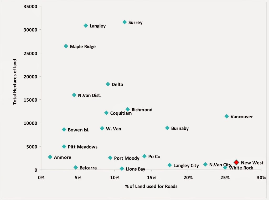
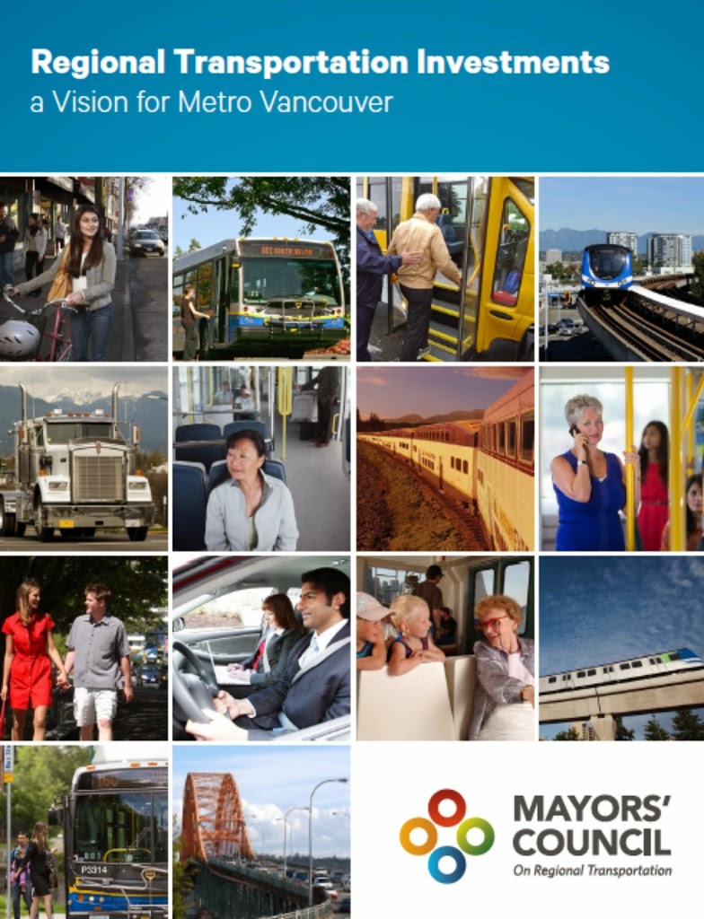
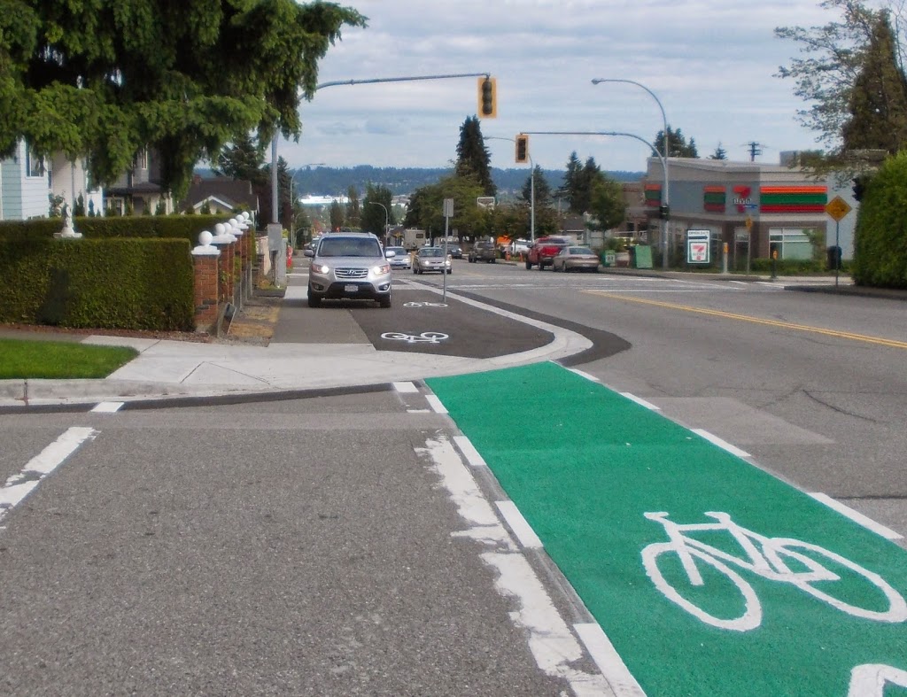
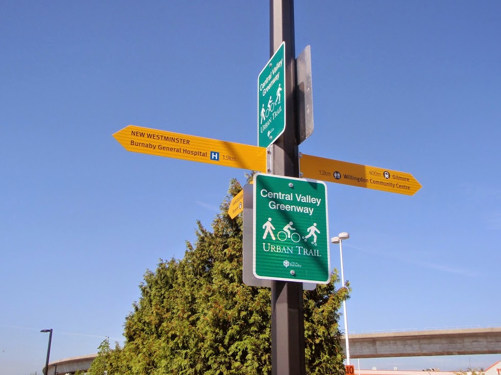
To understand my disappointment, we need to step back a bit. The crosswalk at McBride and Columbia is part of the Central Valley Greenway. This is (arguably) the premier inter-regional Greenway in the Greater Vancouver region, opened with some fanfare in 2009, as a partnership between New Westminster, Burnaby, Vancouver and Translink, with significant funding provided by both the Provincial and Federal governments. It is a 24-km low-grade route that connects Downtown New Westminster to False Creek, via the Brunette River and the Grandview Cut. This route works as the new central corridor for Greenways through three Cities. It represents the single largest one-piece investment in Greenway infrastructure in the region’s history. The CVG is a Big Deal for sustainable and active transportation types. It’s not prefect, but it is well used, and a real success story.

(Image from Let’s go Biking, where there is a good description of the route).

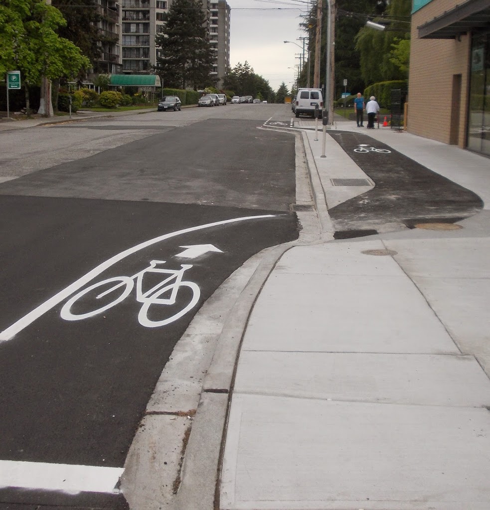
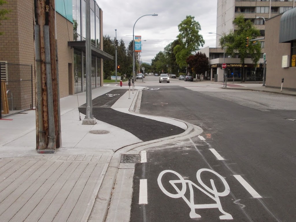
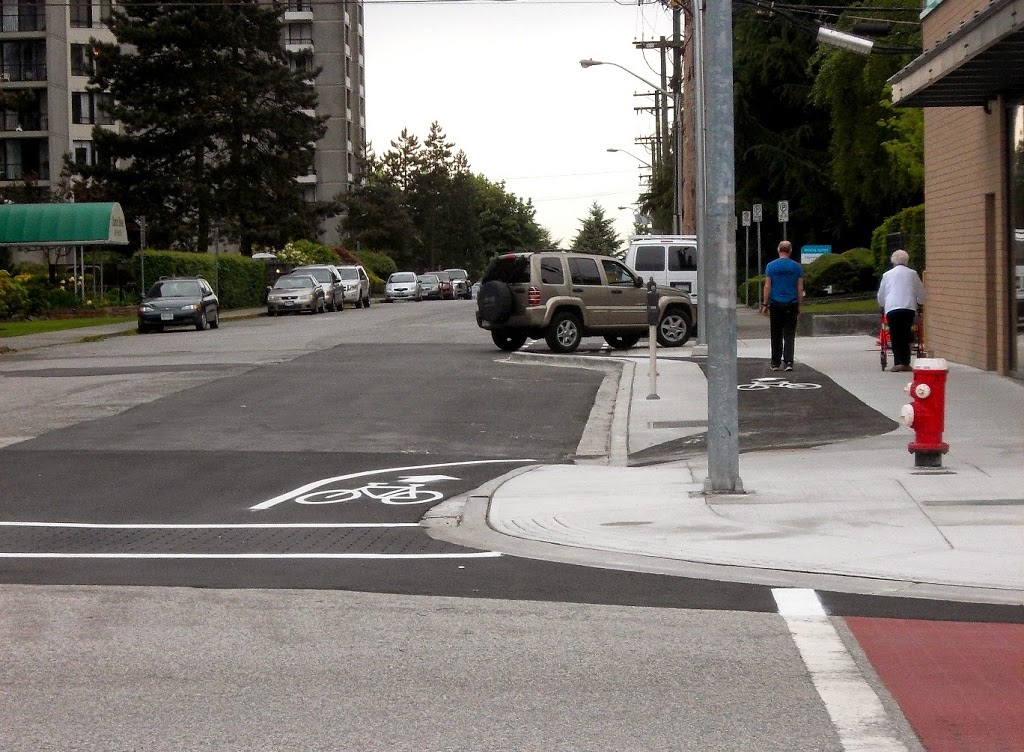
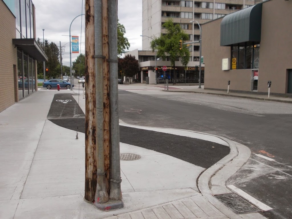
The CVG also happens to be the lowest-grade active link between Sapperton and Downtown – a point emphasized because of the constant lament about New Westminster’s hills making it a tough town for walking and cycling. The CVG along Columbia is low-grade, easy and safe to use (for the most part), and should be celebrated more. This is probably the most important active transportation link in the City – and will be until the not-yet-built pedestrian link to Queensborough is completed, but I run the risk of serious digression there, so let’s stay on topic.

The point of this background? Of all the intersections in the City where there may be a push-pull between accommodating pedestrian/cyclist/disabled safety and managing other factors such as throughput and heritage treatments, this is one where the emphasis must be on the active transportation users. If not here, then where?

As a transportation design issue, no-one is arguing the intersection isn’t problematic. The grades are bad, the sight-lines are terrible, the traffic is thick, and includes a constant flow of large trucks that require much larger turning radii than other vehicles. To put a poorly-operating pedestrian crossing in the middle of this mess is to invite disaster. This is why we need to throw the minimum needs in the standards book out the window, and go above and beyond to make this vitally important intersection safe for all users.

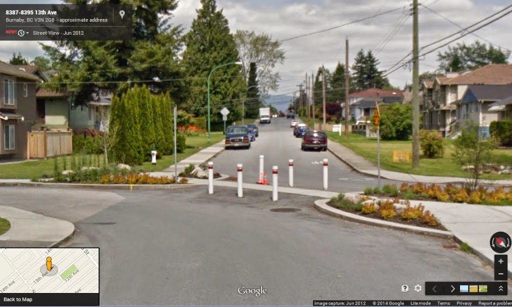
First of several Google images you can click to make bigger.

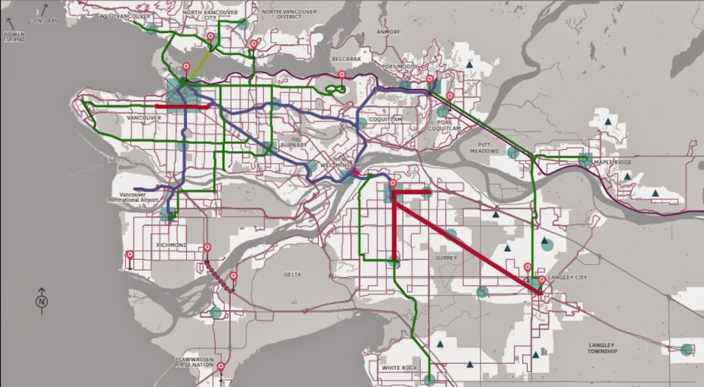
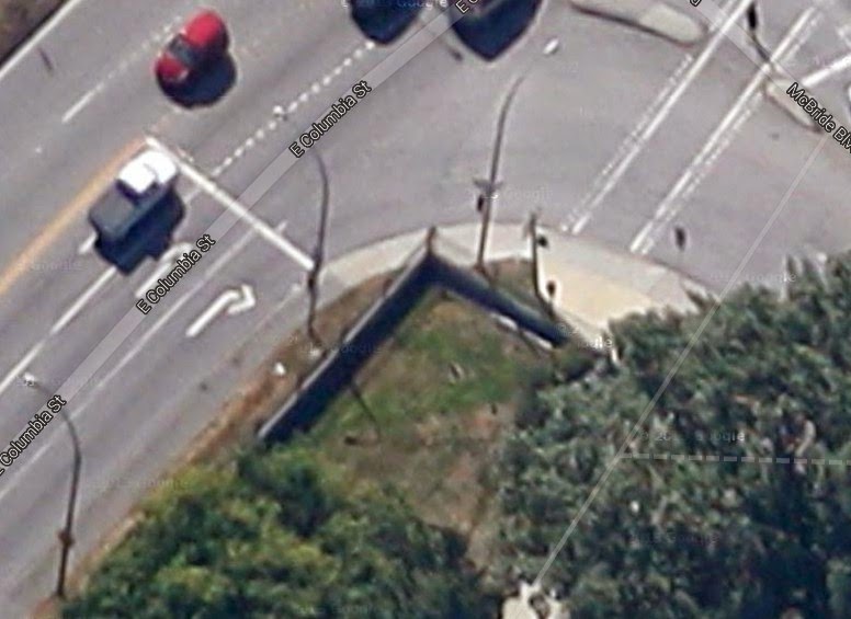
Here is the problem, and fortunately, Google provides enough different views of the intersection, we can see how it has evolved in attempts over the last several years to solve the problem.

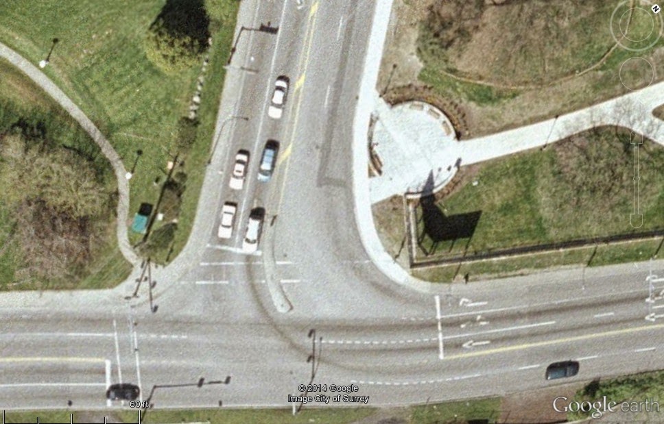
This image shows the original design (this looks like around 2006, best I can tell, prior to the construction of the CVG), with the crosswalk (paint almost worn away) going corner-to-corner as in any typical intersection. The crosswalk was at the foot of McBride, where the road is exceptionally wide due to the need to accommodate the aforementioned Big’ol Semi turning radius. The crosswalk was 26 m long (when compared to a typical urban lane width of 3.5m, the crossing was equivalent to crossing more than 7 lanes of traffic), and not particularly well marked. There was a right-turn-only lane from Columbia to McBride which operated in synch with the usual light signals.

The primary problem with this configuration was the extreme length of the crossing, which challenged some pedestrians to make the crossing on a single signal. Another issue was that the east crossing point is 10m from where the CVG proposed to dump cyclists and pedestrians onto the sidewalk. The grade on this piece of sidewalk is almost 15%, providing cyclists, people with mobility issues, and those in wheelchairs an almost insurmountable slope upwards, and a frankly dangerous one downhill, when failing to stop would launch you into heavy traffic.

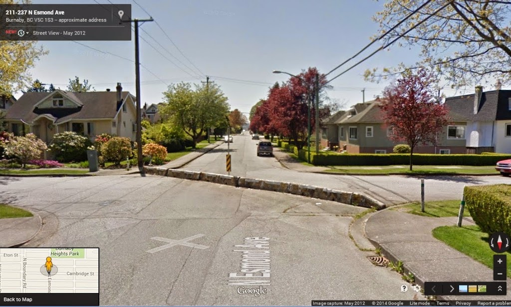
The fix that was implemented a couple of years ago was to move the crosswalk half-way up the hill and mark it more clearly (note, “zebra striping” is one of those things that no longer meets the “standards”, but would no doubt assist here). This reduced the crossing length marginally, and cut the steep slope length to make the east sidewalk more useable. The right turn light was also changed to make it turn red – no right turn when a pedestrian pushed the crossing button. They also cut a slot through the mid-road island, making the crosswalk accessible.

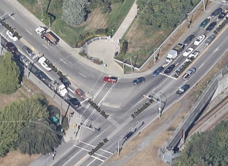
Problem is, moving the sidewalk up the hill makes the sidewalk essentially invisible to the people making the right turn until they are well into hill-climb acceleration mode. The variety of slope and direction factors are exacerbated by the presence of the Heritage Wall. This view in Google Earth rally shows the issue with visibility of the crosswalk and the stop line:

Potentially worsening the situation, the right-turn-only light was no longer synched with the through-traffic lights, but was pedestrian-activated, creating confusion for the half-attentive driver, especially when they can’t see the crosswalk. No surprise, the half-solution to deal with the initial crosswalk design found the problem only half solved, yet spawned other issues altogether.

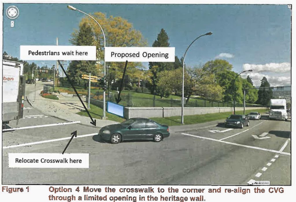
A once-considered proposal to remove the corner of the wall would be another half-solution. It would indeed improve the visibility, but not fully address the slope issue, or the non-compliance issue with the right-turn only light. Staff suggested it would also require a metal railing be installed to stop corner-cutting by pedestrians. All that, and more loss of the heritage structure – not a great compromise.

The long-sought solution was to create a new opening in the wall, 3m wide or so, closer to the bottom of the hill. This would allow the crosswalk to return to the corner where visibility is optimum, but would also allow a connection to the CVG via a new paved walkway with a gentle 3.5% slope that is accessible for cyclists of multiple fitness levels, people with mobility issues, and wheelchairs. For the cost of one 3 – 5m opening in a 300m-long “Heritage Wall”, we can make this important link work for all users, and markedly increase the safety of people using this regionally-important route. Combined with a more progressive approach to pavement marking (yes, this would be an appropriate place for a greenway crossing marked with green or blue paint, similar to what you see in other jurisdictions), this has a potential to be a real success story.

I need to emphasize, this is the solution suggested by the engineering staff, working on their own best data, bolstered by analysis from their external consultants and the committee that advises on pedestrian and bicycle safety issues. This issue has been ongoing since the CVG opened in 2009, and several attempts to address it have happened over the last 3 years, as outlined in the Report to Council. Even in the Google Earth images you can see the history of these attempts that are described in the report: adjusted geometry, changes in signal operation and placement, signage changes, even directed enforcement and monitoring. The best solution from a pedestrian safety standpoint is not an issue of debate at this point, every option has been explored.

So I was especially exasperated listening to a few Councilors speculating how staff should maybe think about changing pavement markings, or adding flashing lights, or report back on other approaches, as if these are novel ideas never considered by the people who have been banging their head against the problem for 5 years. With all due respect, does the Councilor seriously think that through three years of engineering staff time, committee meetings by at least three City committees (two who are dedicated to discussing accessible transportation issues), and the hours spent by the team of professional traffic consultants hired to develop and assess the best alternatives – IT NEVER OCCURRED TO THEM TO SEE IF ADDING A FREAKING FLASHING LIGHT WOULD WORK!?!

(…deep breath… count to 10….)

Ultimately, Council made a non-decision that is actually a bad decision. To be generous, some fault for this may lie in the inability of staff to transmit the information in a way that prompted action, or even on me and my fellow advocates for safe transportation for not showing up to delegate and explain the urgency of this situation to Council. I cannot believe that Council, if considering this as primarily a safety issue (it is), would not decide to take the advice of Staff, Consultants and Committees, and fix the damn thing when they have the chance.

In my mind, the only question here is how to we make this vital crossing as safe as possible for all users, recognizing limited financial resources (which precludes things like overpasses or 24-7 enforcement of the right turn light). This is one of those situations where something has to give: we cannot maintain 100% of the heritage wall, have a safe accessible pedestrian crossing, and have a road designed to accommodate Big’ol Semis turning up the hill.

I would choose safety first.

Jane’s Walk time again!

Last year, New Westminster resident, pedestrian, and rabble-rouser Mary Wilson brought Jane’s Walks to New Westminster, to great success.

This year, despite her continued reluctance to do all that Social Media stuff, she once again drew together a team of people to put on a variety of interesting walks.

As a summary, I will quote myself from last year plagiarizing the press release:

“Jane’s Walks are becoming a global event, held in hundreds of cities around the world on the first weekend in May. Around the world, neighbourhood groups organize free community walks to honour the memory of Jane Jacobs. 

Jane Jacobs is considered by many to be the Mother of modern Urbanism, in that she brought it to life, loved and supported it, and worked tirelessly to give it all the tools it needed to prosper. She rose to prominence for her activism to protect Greenwich Village from the Lower Manhattan Expressway proposal, and her ground-breaking book The Death and Life of Great American Cities. She moved to Toronto during the Vietnam War, and brought her Urban Activism with her, such that she received first Citizenship, then the Order of Canada. To put a local angle on her story, Jacobs is sometimes referred to a founder of Vancouverism for the influence her writings and research had on the development of the urban character of post-freeway Vancouver, built on the belief that density can be done without compromising liveability. 

Jane’s Walks are meant to honour Jane, but also to honour her desire: that cities and urban areas become safe, diverse, and interesting places for people to live, work, and play. We honour this by drawing urban neighbours together to take a walk through their own city, not to get from A to B, but to have a ‘walking conversation’, meet neighbours, learn something new about their own backyard, and ultimately increase citizens’ connection to their urban home.”

I hope to attend a few walks this weekend, but I want to highlight two:

On Saturday evening, I will be joining many of the NEXT New West crowd for a bit of fun, combining Jane’s Walk with the SkyTrain with a good old fashioned Pub Crawl. We will start in Sapperton and use our feet and the SkyTrain to make several stops in local food and drink establishments, at Sapperton, at both ends of Downtown, and then (in an interesting twist!) taking the Starlight Shuttle from 22nd Street Station to the Casino, where there will be live music, dancing, and general merriment.

Sunday will have a different feel, as I am walking with members of the New Westminster Environmental Partners, Get On Board BC, and a few noted local historians, tracing the route of the old BC Electric streetcar line through Queens Park and Downtown. It seem unlikely to us now, but yes, electric trains used to travel along Third Avenue and such places, through the residential heart of our City. It was part of a system that connected Downtown Vancouver to Chilliwack and Steveston (proof exists in the few spots where the old rails still emerge from the asphalt). Along the way, we will talk about what was, what was lost, and what might be possible in the future, with our regional transportation system.

Should be fun! Rain or shine! Come and meet some neighbours and learn a bit about your City! Make Jane proud!

Oh, and if trains and pubs aren’t your thing, there are at least 10 other walks going on Friday, Saturday, and Sunday – you really should get the family out for at least to one! They are free, run by volunteers, and you never know what you might learn.

All the info is here: Jane’s Walk New Westminster)