The MTP Begins

Thursday night is the first open house for New Westminster’s Master Transportation Plan. The first meeting will mostly talk about the process to come over the next 12-18 months, and there will be more public consultation, so don’t go in expecting to hear a lot of answers… but do expect to hear lots of questions, and be prepared to ask them!

The part I am looking forward to is the first bits of data coming from the City’s traffic measuring and public surveys. it will be interesting if the problems we perceive are the same as the problems shown by traffic counts and other data collected by the City and their consultants.

As for the path ahead, the new President of the NWEP, Reena Meijer-Drees does a great job getting Grant Granger at the NewsLeader updated on what the vision that group has for the future of transportation in the City. This is a great start. 

 There was also a great short article in the March Walrus Magazine (I suspect you non-subscribers will have to wait a month or so until you can read it on-line, or pick it up at the Library) talking about Luc Ferrandez, the Mayor of the Montreal’s Plateau borough. Being both a cyclist and and a believer in contemporary urbanism, he has been turning one of the most storied and historic neighbourhoods into a pedestrian-friendly paradise of wide sidewalks and green spaces.

Limited in his powers by a Metropolitan Government that oversees all major transportation infrastructure, and facing opposition from neighboring communities whose denizens want to commute through the Plateau unfettered by his neighbourhood traffic calming, Ferrandez is unapologetic. How unapologetic?

“I accept that some people think I’m the Devil. For them, the Plateau doesn’t exist. It is just a place to be driven through. I don’t give a shit about those people. They’ve abandoned the idea that humans can live together”.

Oh, to have the candor of Québécois politicians. However, when speaking about his vision for his neighbourhood, he sounds inspired:

“The Plateau is an Italian cathedral. It’s a forest. It’s something to protect, something sacred. I don’t want it to become a place where people come to live in a condo behind triple-glazed windows for a couple of years. This has to be a place where people can be comfortable walking to the bakery, walking to school, walking of the park – where they want to stay and raise a family”.

Will anyone stand up and say they want anything less for British Columbia’s most historic City?

Master Transportation Plan and Complete Streets.

I posted this picture last week as a bit of a joke, but it really isn’t that funny to people who try to use bikes to get about. The Internet is full of ridiculous images of bicycle infrastructure build in such a way that it completely fails as bicycle infrastructure. The blog Bike Snob NYC always has great photos of these types of things, but they can be found anywhere transportation engineers try to fit a bike lane on the side of a road built for cars. 

It isn’t just the engineers. Bike lanes are used as bus stops, as right turn lanes, as defacto parking spots, as loading zones, as trash dumps, as construction staging areas, and as walkways. It is no wonder cyclists often feel safer on the sidewalk.
I was in a Public meeting where a Transportation Engineer for a major City in the Lower Mainland opined that cyclists got no respect from drivers because they were always hopping on and off of the sidewalks and no-one knew if they were pedestrians or cars. My only response to this is that cyclists do what they can with the infrastructure they are given. Hopping on and off is a sidewalk is actually quite the hassle for a cyclist when they really just want to be where they feel safest, and at times that is the sidewalk, at times that is the street. If the transition between the two is erratic, that is a damnation of the transportation engineer, not the cyclist. 
The problem is usually found in how old-school transportation engineers see bicycles and pedestrians: as things to accommodate as best as you can while building a road for cars and trucks. A “transportation” project is building a road, a bridge, or an overpass. After the road is designed to accommodate the traffic as best as possible. Then is the time to have the baubles attached: sidewalks and bike paths (if the budget allows).
There is a better way. There is a movement in the Excited States to encourage local governments to adopt a “Complete Streets Policy“. In essence, Complete Streets are those:

“…designed and operated to enable safe access for all users. Pedestrians, bicyclists, motorists and transit riders of all ages and abilities must be able to safely move along and across a complete street.

The idea is that pedestrian and cycling infrastructure, along with infrastructure to allow people with mobility challenges to get around, are integrated in to the design at the top level, not added on a baubles afterwards. 
New Westminster is actually not too bad at this, really. Compared to other jurisdictions, we have a pretty pedestrian-friendly City. Those sidewalk bumps installed on Royal Ave that were the source of much mirth this previous election season are a relatively successful product of adding pedestrian-friendly elements to an infrastructure designed to move cars. Part of this might be a result of the “Pedestrian Charter” that the City established a few years ago. 
This doesn’t mean that all is well. The ongoing saga of 5th and 5th, where changes of the intersection to accommodate grocery trucks resulted in completely untenable compromises for pedestrians and cyclists, is an example of one user’s needs being met without consideration of the other users. 
So I am suggesting that the City’s Master Transportation Plan include a reccommendation to adopt a home-grown Complete Streets Policy. This will expand the idea of the Pedestrians Charter to include all users: pedestrians, cyclists, transit users, the mobility challenged, and those who, but choice or by neccessity, are stuck behind windshields. There are lots of examples available on-line of Complete Street Policies created by other jurisdictions, and one could easily be adapted to the New Westminster situation. 
Instead of figuring out ways to accommodate “alternative” users, we can design our roads and sidewalks and bike paths and green ways to work together to move all users through as efficiently as possible. Who can argue with that?

The Master Transportation Plan and Models.

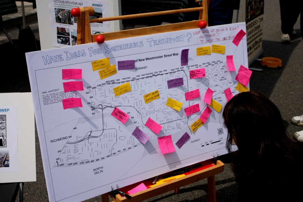
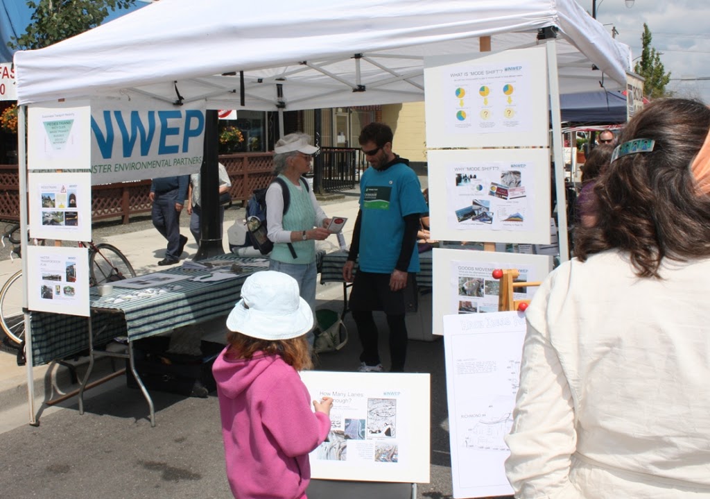
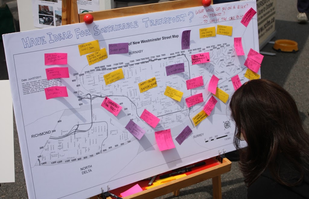
A second report to Council that came down last week was an outline on the Master Transportation Plan process. I have railed on about this in the past, and have spent much of the summer letting people know about the MTP during NWEP booth events. All along, we have been telling people it is coming, asking them questions about their transportation issues, and suggesting they get involved in the consultation process if they care about the future of the City.

The report to council outlines how the Master Transportation Plan will come about, and now that we have some details. It seems the first opportunity for public consultation will be during Stage2, and we can expect a lot of initial “community visioning” events like took place during the UBE process.

However, I want to talk about Stage 3, and about transportation models. First, the caveat part: I am not Transportation Engineer, so my opinion here is worth exactly what you paid for it. My expertise is in other areas, so I will be the first to stand corrected by those with more expertise or different facts. That said, during the UBE controversy, in discussions around the NWEP’s transportation forum last year, and by following along in transportation discussions with people like Stephen Rees, Voony, and Eric Doherty (who have a much higher level of expertise than I), I have learned a bit about Transportation Models, their strengths and weaknesses.

My concern about Transportation Models is that they generally fail to accommodate things like induced demand and the traffic demand elasticity – things that are vitally important for planning a transportation system in a built-out city like New Westminster, where the economic and social costs of building expanded road infrastructure are massive.

The basic transportation forecasting model works like this: You draw out a virtual transportation network to match your existing one. You then enter landuse parameters within and outside your study area, which tell you a bit about what is generating the trips (i.e, 30,000 residents here, industrial area there, commercial district over here, etc.). These create a model framework. Then you count your actual traffic, and calibrate your model so the traffic load generated in your model matches the traffic you measure in the real world. Then you take the Regional Growth Strategy off the shelf and apply the projected growth to your model: 10% more residents here, 15% more businesses there, etc. and count what that does to the traffic. If there are trouble spots that pop up, you mess around with your transportation network to make it work as efficiently as possible.

To demonstrate this, I can draw a ridiculously simple model. Let’s say you have a village with 10 houses, one factory and one shopping centre, and they are connected in a triangle (see below). We measure 20 trips between the factory and the house every day, and 6 between the houses and shopping centre, and 2 between the shopping centre and the factory. That is our model set up.

Now let’s say the Growth Strategy indicates we will double population in 10 years. In this case we double the number of houses (and for the sake of model simplicity, keep the factory and shopping centers in the same place, just assume they both double in size). We enter that in our model and presto: we get a doubling of all trips.

But what if the road between the factory and the houses can only handle 30 trips until it becomes hopelessly congested? In that case, the citizens have two options: sit in the congestion and accept their fate, or go around the “long way” which might take less time if the congestion gets bad enough. Some will choose to go-around until the time is equal on both routes, and the model might look something like this:

Since citizens hate congestion, they lobby City Hall to fix the problem. City Hall has two options to fix the problem: it can expand the road to accommodate the traffic, so things look like our second drawing up there. Or it can build another route to relieve congestion. (Now we enter into the world of the Braess Paradox, but let’s not go down that rabbit hole just now).

We can do all sorts of messing around with the road configuration to best accommodate the traffic generated by the growth, and this is how we can apply the model to make the most logical choices about how we invest our transportation money. However, (and this is the nut of the matter) it is assumed in these models that traffic (=trips) will grow to match the population increase. Whether you build a road to accommodate it or not is irrelevant to the model.

Let’s say you don’t do anything to expand road capacity. Do we really get 32 trips on the one road and 20 on the other? If 32 trips cause congestion enough to shift people’s behaviour and make them change road choices, perhaps it also induces some to not drive. Carpooling, transit, bicycling, or telecommuting become better options. Maybe building a bus route instead of building a road is better investment – we can move more people with less money (if a bus is cheaper than two more lanes).

With 8 of the trips from home to factory going via the Shopping Centre, won’t this cause people to shop in the way home, and reduce the number of specific trips between the houses and shopping centre? If we don’t build more road capacity to accommodate growth, will the number of trips actually be reduced?

One thing we noticed in the UBE process is that models are really good at predicting increased levels of congestion, but do not accommodate the idea that congestion has an upper limit before people stop fighting it, and find alternatives.

The result? People discussing the NFPR say that traffic on Front Street is at a dead stop, is constantly congested, is completely at a breaking point, then produce models that suggest the problem will only get worse until we fix it. Of course, if the roads are already at capacity, the problem cannot get worse, unless we add lanes in an attempt to fix it.

Transit is a real alternative when it is faster and more efficient that driving (Canada Line anyone?), cycling is an alternative if the distance is short enough, the trip is on safe infrastructure, an there are end of trip facilities available. Moving closer to your work, or working closer to home, is an alternative, when land-use planning makes this possible. Shopping locally is an alternative to driving across town to your favourite Megamart. Moving containers by rail and barge is an alternative. And yes, building more roads an option, but is it the best use of our resources?

Back the Master Transportation Plan, and I’ll be uncharacteristically brief here. Because the vast majority of traffic in New Westminster is through-traffic (something like 400,000 vehicles a day in a City with a population of less than 70,000) most of the factors that control traffic in our City – like landuse planning, growth in the rest of Metro Vancouver, the building of mega-freeways – are beyond our control. Therefore, it is possible that the only control we have is how we allocate our road space. In a sense, the only way we can control out own traffic fate is to manage the implied demand part of the equation. Will the model be the tool to do this?

Poplar Island, and a bridge to elsewhere.

It is the biggest stand of trees in New Westminster, and you have probably never been there.

Poplar Island has a rich history, which you can read about in some detail here. For those with stunted attention spans, it has been a rancherie, an Indian Reserve, a smallpox hospital (prison?), a shipbuilding centre, a home, and for most of the last 50 years, little more than a convenient place to boom logs. The history of ownership is about as chequered, and perhaps even a bit uncertain now…

I raise this issue now because some people have suggested that a bridge to Poplar may be a good idea, as part of the project to connect Queensborough’s perimeter trail system to the Boardwalk and Quayside, and finally provide a real community connection to Queensborough residents.

The problem is, attaching Poplar to this idea is a recipe for all kinds of troubles.

First off, that legacy of Poplar creates all sorts of legal issues around connecting to it. With a 100-year history of industrial activity, there is a clear history of Schedule 2 activities, so re-zoning it for Park would be somewhat complicated, even if there is not contamination present (actually, the logistics involved in doing the sampling required to determine if it is contaminated would be a real hassle for an island with no roads, no landing docks, and no services). Then if somehow the City got the rights to use the Island, and negotiated fair use with the appropriate First Nations, and got the contamination situation figured out, how do we go about controlling access to the park, preventing fires, stopping squatters, etc. I suspect there is a reason the island is being preserved in a relatively natural (if second- or third-growth) state…

I hate to be a Debbie downer. I think that a well-designed park, accessible and safe, with a proper emphasis on displaying the important heritage of Poplar, would be great benefit to the City, but it will take a long time and a fair pile of money to develop. Maybe in my second term as Mayor. So the risk here is a measured response to reclaiming Poplar Island will slow down the bridge project, potentially for decades.

Worse actually, is that Poplar Island does not represent a good place to put a bridge, if your goal is to connect the burgeoning communities of eastern Queensborough and their integrated greenways with the Boardwalk, the Quay, Skytrain, and the rest of downtown.
If we want to build a pleasant park trail to be used occasionally for dog walks, then let’s wait until we can get Poplar worked out and build the bridge then. If we want a piece of sustainable transportation infrastructure to connect Port Royal and the rest of Queensborough to the rest of the City, let’s at least put the bridge in a useful spot. That means ignoring Poplar for now.

(Click to make big enough to be readable. Hey Google Earth, your share of my profits are in the mail)

As you can see in the above diagram, connecting just west of the train bridge to the trail just east of the little beach on Queensborough would require a bridge about 200m long (measuring between imaginary pillars set on opposite banks). The controversial “Submarine Park” location, more like 225m. Access via Poplar will require two bridges, totalling 325m at the closest points, of 475m to connect to the Third Ave overpass as was suggested by come commentors.

I recognize there is more to a bridge’s cost than a simple length calculation, but as a first approximation, isn’t it safe to suggest a shorter bridge is likely to be cheaper?

The second half of bridge location is that it connects to. As attractive as hooking into the Third Ave overpass may be aesthetically, I don’t think pedestrians from Queensborough are not all that interested in better access to Key West Ford (although I am sure their vehicle deals are second to none). They want to get to the Quay, to the Skytrain, and to Downtown New West and the new MUCF. So why take them so far away from their destination?

I think the Submarine Park is a minor issue, compared to building a bridge that acceptable to the local community from an aesthetics viewpoint, is accessible by more people, and serves its purpose as an important peice of sustainable transportation infrastructure.

The Submarine doesn’t have to move, and in the slim chance it has to, there are other locations it can go. At the Quayside Sale/Festival, I overheard Councillor Harper talking about the bridge with a concerned citizen, and addressing concerns that the “Submarine Park” was going to be removed. He said: “do you really think this Council is going to vote to remove a park?” The question may have been rhetorical, but it seemed to stump the questioner…

Community -updated!

I had such a fun weekend. One that reminded me how much I love my community.

I just want to add the note that back in December, I did an interview with the News Leader, and made my predictions for the 2011 Stanley Cup Playoffs. OK, I said Canucks-Habs, but Boston are an original six team that needed 7 games to knock Montreal out, so I’ll call that predition 75% accurate.

Friday evening was spent in Downtown Vancouver with some great friends, performing an unusual ritual for a life-long Canuck fan: drinking beer and watching hockey in the month of June. The sounds of the crowds downtown when the goal was scored, and when the final buzzer sounded, were amazing. I was lucky enough to be downtown during the Olympic Gold Metal Game as well, and the feeling was much the same. To be in amongst a crowd of tens of thousands, everyone throwing high-fives as they walk the street, the feeling was electric. Lots of cops in the crowd, but much like the olympics, they were present to make us feel secure, not to “keep order”, and they shared as many high-fives as anyone else. It was a great time.

It wasn’t the camera – it was actually this blurry out.

It is silly to try to explain it. Generally and really large crowd of like-minded individuals is inherently a dangerous thing, but the feeling was so positive. Why? Because, as XKCD so eloquently put it, a weighted random number generator just produced a new batch of numbers. Why care if the Professional Sports Franchise in my hometown is superior to the Professional Sports Franchise in another town? Is the only benefit to all the time and energy we put into ultimately meaningless entertainment just about feeling good, collectively, once in a while? Is this a better way to spend out time an energy than curing cancer or writing piano concertos?  Is this community building?

It occurred to me on the SkyTrain home; it might have been the beer.

Saturday was mostly a garden day. Putting out a lot of the plants that I started indoors: the peppers, the tomatoes and the cucumbers, along with a few squash plants I was gifted from a friend. The radishes, lettuce and spinach are already out of the ground and into my salads, but with the cool spring we had, everything is starting late, and I have to fight the slugs, aphids and cutworms for every leaf. More bloggin on this to come, an ongoing summer project.

Finally, Sunday was spent at Sapperton Day, and it went off great. The event itself was incredibly well attended, the bands were great, the food was great (mmm…pulled Pork sandwich from the Crave/Ranch), and it was great to connect with many people I only see during summer events.

The NWEP booth was well attended, and there was lots of great discussion about the future of transportation in New West, post-UBE. We had a “blank map” to allow people to attach post-it notes with ideas about transportation in the City – What works, what doesn’t, pet peeves and points to ponder. Hopefully ,we can use this blank slate to collect ideas at all the summer events we are attending this year. It was great at facilitating conversation, and lots of great ideas were placed on the board. Notably, not all were NWEP member ideas, or even ideas the NWEP would endorse! The point was to start people thinking about transportation, as the City is getting into its Master Transportation Plan process. We hope that by starting the conversation, people will be informed and curious when the public consultations start.

But mostly Sapperton days is about getting together in the community to meet neighbours, catch up with friends, make new friends, get a little sunburned and have fun. Again, it is all about people coming together to community build.

…and have a little fun along the way.

NWEP’s cycling wildman and Ryan Kesler look-alike Pete taking a few turns on his new bike?

Sapperton Day this Sunday

The Summer Festival season is upon us. We don’t have “Car Free Days” per se in New Westminster, but there are a few days when we close roads and let people gather on the streets. It is always a great way to meet your neighbours, re-connect with people you haven’t seen in a while, and remind yourself how we are a small community within a large City.

I guess the season started last month with the Hyack festival, and I had a great time sitting in the beer garden at Queens Park listening to Jim Byrnes play the blues while the Octopus and the Tilt-a-Whirl made faces green a few metres away.


However, for the NWEP, festival season starts with Sapperton Days , as we are setting up our booth and doing some outreach to the community.

Last year, our outreach concentrated on solid waste issues, as the City was rolling out it’s clean green program, we had two neighbourhood Zero Waste Challenges in the City, and Metro was consulting on an Integrated Solid Waste Resource Management Plan (still sitting on the Minister of Environment’s desk, by the way).

This year, we are talking transportation. The reasons should be obvious to anyone who has been reading this blog (hi mom!). With the UBE dead, with the future of the NFPR in doubt, with questions about the future of the Pattullo Bridge, and with the City starting its Master Transportation Plan process, now is the time to talk about transportation issues in the City.

So the NWEP will be there sharing our perspective. Our Transportation Group has established a set of ideas and principles that the group can support, based on our vision for the City and our research and consultation with regional transportation experts.

However, these community events aren’t about us preaching to an audience, they are about exchanging ideas. The main point of our booth is to listen to what the community thinks, and where the community is going on this issue. We hope that our ideas will be the starting point of conversations and will raise the topic so that more people get engaged in the public consultation around the Master Transportation Plan.

As such, we will be asking lots of questions about what you want to see in the City’s Master Transportation Plan. These are the “big ideas”: do we want to build more roads to move more traffic? Do we want to make the streets safer for bicycles and pedestrians? Can we take better advantage of our Transit opportunities? Can kids safely walk to school in New West? Can people with disabilities safely cross a street?

We will also be going smaller-scale. We hope to have a map where you can attach your ideas, where you can point out the “good, bad, and ugly” of New Wesmtinster’s transportation system. That intersection that just doesn’t seem safe, the area under-serviced by transit, the traffic light that doesn’t make sense or the crosswalk no-one seems to stop at.

So I hope to see you there Sunday. Make sure you show up in time for the Pennyfarthing Races, it is a highlight of Sapperton Day for me.

Just for fun, and to start a discussion, here is a collection of Myths about transportation I prepared for our booth (these are my opinions, and not neccessarily the NWEP position on these points). These are common conversation points that come up when we start talking about sustainable transportation to an audience that sees the world through a windshield. Don’t agree? Come down on Sunday and give me a hard time. I’m the guy with the 4th Round playoff beard.

Myth: The best way to fix traffic problems is to build more or better roads.
Evidence clearly indicates the opposite is true. No-where in the world has road building acted as anything more than a temporary solution to traffic congestion. Many large cities around the world (New York, London, San Francisco, Seoul, etc. etc.) have solved intractable traffic problems by reducing road space and investing in more rational alternatives. Others (Los Angeles, Seattle, Shanghai, Tokyo) have continued to build and expand roads, only to find them soon swollen with cars.

Myth: “Sustainable Transportation” means we will all be forced to ride around on bikes! You can’t move products to stores on bikes!
Sustainable transportation needs to include multiple choices for transportation of people and goods, and the most carbon-and space-efficient should be made the most cost-efficient. By moving people towards mass transit or “active transportation” like walking or cycling, and long- and medium-haul freight movement towards rails and ships, we make better use of existing roads to move goods to the stores more efficiently!

Myth: The traffic is going to come whether we build for it or not!
Traffic expands to fill space available. This is incontrovertible, and has been demonstrated around the world. “Rush Hour” traffic is caused by landuse planning built around the automobile. We need to start building to encourage more efficient transportation. The only demonstrably effective way to reduce the noise, pollution, and loss of liveability related to traffic is to reduce the space that traffic can take up. If you build it, they will come.

Myth: Trucks caught in traffic are limiting our economic growth!
No-one has clearly demonstrated how our economic growth is slowed by traffic. Clearly, the movement of bulk and container goods by truck is still competitive compared to the alternatives (such as rails or short-sea shipping) or companies would not rely so heavily on them. However, the trucking industry (much like the private automobile) is heavily subsidized by all levels of government, while rails and ship operators are mostly on their own for all their infrastructure costs. Economic growth comes from a level playing field and robust competition between competitors, not by favouring the least carbon-and energy-efficient mode of transportation by externalizing many of the infrastructure costs to the taxpayer.

Myth: Roads are cheap, building alternative transportation is expensive!
This should be an easy one in a Province where we are spending $3 billion in road bridge and highway expansion, and cannot find $400 Million to “fill the gap” on the Evergreen line. But when you add up the amount of your taxes the government spends on roads, on traffic lights, on traffic cops, and factor in the “externalized” costs related to healthcare, oil company subsidies, air pollution and greenhouse gas emissions, environmental degradation resulting from road runoff into our rivers and loss of developable land to parking lots and road lanes, the amount you pay for insurance, car repair, and gas seems miniscule. Once transit systems are built, once urban development encourages active transportation, their maintenance and operation costs become very small fractions of the costs of roads. One reason transit so great in most European cities is that they didn’t waste their money on roads!

Myth: Cyclists don’t pay taxes for the roads they use, drivers do!
No tax exists in BC that specifically charges drivers for road use. Gas taxes and carbon taxes go into general revenue to pay for roads, hospitals, fighter jets, Stephen Harper’s Stanley Cup roadtrips, and gazebos in Tony Clement’s riding, not specifically towards road building (although a portion of the TransLink gas levy does go to road building). Your roads are built mostly by the municipality and the province, using a combination of property taxes, income taxes, and sales taxes. People who ride bicycles pay the same taxes as people who drive cars, yet use 5% of the road space. Pedestrians and transit users also pay all these taxes, and use less than 5% of the road space that drivers do. People using alternative transportation are in fact subsidizing the private automobile user, and most would strongly support a road tax that fairly charged drivers for their road use

What next?

Now that the UBE has been killed, and TransLink has decided that the NFPR is no longer a priority, the natural question is “What next”?

First off, we now have the luxury of a bit of time. Part of the original concern with the UBE was that there was a pressing deadline: shovels had to go into dirt real soon or Federal matching funds were going to disappear. That meant we didn’t have time to come up with comprehensive solutions for the Brunette-Columbia-Front-Stewardson corridor (the BCFS as I am going to start calling it for brevity). Although there I still a pressing need to address many of the traffic, access, and safety issues along the BCFS, we at least can now approach them with adequate planning and discussion. Stories of a 2015 Pattullo replacement now seem a little premature, with TransLink suggesting 2020 as a more likely time frame, yet a slide at the TransLink presentation on Thursday that suggested 2017-2018… let’s agree to call TransLink “non-committal” on the Pattullo timing, but at least we know we are likely a couple of years from the consultation process. That would indicate we have a couple of years to plan for that.

I would like to have a community conversation about the Brunette Creek industrial area, and how we can provide adequate access to the important businesses there without burdening those same businesses with commuter through-flow (the inevitable result of the UBE proposals). I think keeping the Bailey Bridge as one-lane alternating is a good control on through-flow. I also think that closing the level crossing at Braid would provide safety benefits and simplify the traffic situation at Braid and Brunette. (Note I don’t think it will reduce congestion, because I am strong believer that induced demand is the major control on traffic congestion; the smoother we make the flow, the more cars that will enter the flow, until the congestion reaches a point of equilibrium). This leaves us with only one other way out of Brunette Creek: Spruce Street.

Currently, one can enter Spruce Street from northbound Brunette, and can exit northbound on Brunette from Spruce Street. To connect Spruce Street to southbound Brunette, I would suggest an underpass beneath Brunette, with entrance/exit ramps on the west side of Brunette that essentially mirror the ones on the east side. A single light-controlled intersection at the underpass. This moves trucks down where the noise will have reduced impacts on the surrounding neighbourhoods, and makes the biggest ingress-egress point from the industrial lands nearer the center of the industrial lands, but a long way from the Bailey bridge, to reduce the attraction of commuters to the industrial area. Clearly, this approach will need to take into account the current development plans at the Brewery district, but there is nothing in the ground there yet. By using this to close the Brain level crossing, the Federal Gateway Money should still be available, as this meets the same rail safety improvements as the UBE (which, notably, also included maintaining the Spruce Street level crossing).

Click to enlarge – and please excuse ham-fisted CorelDraw use

I don’t want to spend too much time on the details, because that is what these things are: details. Before we start fleshing out details, we need to make the big decisions: How will our City address its traffic problems? How will our City adapt to regional and internal growth as projected by MetroVancouver’s Regional Growth Strategy? How will we accommodate a new Pattullo Bridge? How will we address the pressure our City will see from the Highway 1 expansion? How will we support TransLink’s goals for mode shift as outlined in their Transport 2040 plan? How will we adapt our transportation infrastructure to deal with Climate Change, with Peak Oil, with an aging population? How will we protect the livability our City’s neighbourhoods, from Sapperton and Downtown to the West End and Queensborough?

The proper way to address these questions is through the City’s Master Transportation Plan. Fortunately, that planning process is starting right now. So the opportunity is in front of us.

I am hoping to take a lot of the blogging energy I have been putting into the UBE, and direct it towards addressing those questions. I don’t pretend to have the answers, and don’t expect to find them on this Blog. I think the answers have to come from the community, and it a pretty big order to fill. I only hope to open a dialogue and help find our way towards the answers. Make no mistake: this is important, even more important than the UBE. The Master Transportation Plan will shape our City for the coming decades.

Climb on board, folks, it should be a fun ride.

The Master Transportation Plan, Background

The City of New Westminster is currently working on a Master Transportation Plan. The process to update the City’s 10-year-old transportation planning document was initiated n 2010, and will hopefully be completed in 2011 (the plan has been delayed somewhat by “staffing changes” in City Hall). As I suggested at my year-end looking back/looking forward interview with the News Leader, the MTP should be the #1 environmental issue in New Westminster this year, as nothing will have more influence on the liveability of our City in the decades to come than this plan and its successful implementation. With the UBE Experience behind us (for now) and the NFPR breathing down our necks, the City needs to get it’s transportation priorities down, or decisions will be made without us.

So what is a Master Transportation Plan? It is the high-level guidance document that outlines what the goals, priorities, and needs of the City are in relation to its transportation infrastructure. Usually, it is a high-level document, which creates broad guidelines, as opposed to providing details, it is more likely to state that all sidewalks should be accessible to people with disabilities, instead of detailing the dimensions and slope of the perfect curb cut. It sets guidelines that the engineers and planners can use to do their work. Think about the MTP as the Constitution: it doesn’t create laws, but all laws must be compared to it to see if they comply.

Once the MTP is created and accepted, then every transportation project in the City can be assessed compared to that document. If the project meets the goals and priorities of the Plan, it is easy to approve. If it doesn’t, then the project has to be adapted. In theory, this assures that the complex integrated system that is the “transportation infrastructure” all works together, instead of being a slapped-together patchwork. The end result should be lower building and maintenance costs due to efficiencies, reduced overlap or competition between projects, and ultimately, a less expensive, better organized transportation network.

So perhaps you can see why it is so important to the City that the MTP is right, and how important it is to the liveability of the City.

The big issues are outlined on the City’s website on Transportation Planning: pedestrian safety, cycling infrastructure, transit access and service, the volume of regional traffic through the City, air quality, and noise. Further, the City states that the MTP “will focus on principles of sustainability, social liveability, environmental stewardship and economic prosperity”.

This is a promising start, as it seems to put the emphasis on sustainable transportation choices, increased safety for all road (and sidewalk) users, and increased liveability.

There are two other documents that are already available from the City that will provide guidance for the MTP. They are the (now slightly dated) “Official Community Plan”, and the “Livable City Strategy“. Both of these documents make many of the same points: sustainable transportation alternatives (walking, transit, bicycles) need to be encouraged, and building more roads to accommodate more traffic will only result in more noise, more pollution, and more congestion.

Over the next couple of months, I hope to Blog quite a bit on the MTP process. The NWEP Transportation Group is also watching to see how it develops. It is the documents above that are going to provide a framework for the discussions. If you are interested in the topic, you might want to read them. And you should be interested, both because it is important for the City, and because the City will be looking for public input into the plan, through consultations. We don’t know what those consultations will look like, but it would be great to be informed when the call comes.

There are also many examples of Transportation Plans available on line, most Cities have them. Here are links to a couple of interesting ones:
Vancouver (showing how “Gregor’s Bike Routes” were planned in 1997).
City of North Vancouver (A city with similar demographics and challenges as New Westminster)
Coquitlam (as cautionary example).
Burnaby (our closest neighbour)