Ask Pat: 1.5m

Liz asked—

What is the distance required from a residential driveway to a parked vehicle?

This is an easy one!

The City’s Street and Traffic Bylaw has an entire section about Parking – Section 4. There are 22 subsections and a couple of hundred clauses, but this is the part I think you are looking for:

So, I’m no lawyer, but I read from this that you cannot park within 1.5m of the edge of a driveway (Section 4.8.8). Even if you are more than 1.5m, though, you can’t park in a way that is “obstructing free movement” in and out of that driveway (see 4.8.5), or within 5m of a hydrant (4.8.2.) etc. etc. Oh, and there may also be a sign indicating a larger buffer for some reason (4.8.15), and you should be aware you can’t obstruct pedestrians (4.9.5). Actually, the Bylaw has a lot of bits saying where you can’t park. So this is not legal advice. Caveat Lector.

Ask Pat: Transport 2050 & New West

jectoons asks—

With the new Transport 2050 plan out and the goal of lowering speed limits in urban areas to 30km/h, what is the expected timeline for those changes to take effect in major New West arteries? (Royal, for example).
Also, regarding the 850 km of protected bike lanes, is there an estimation of how much of that will be devoted to our city? Is there a timeline and map in the works? The official plan for the city reimagines Columbia street beautifully, but I wonder when will we actually see those changes applied. (Not a complaint, I know it takes time for these things to be approved and worked on). Thanks for all you do, Pat.

Indeed TransLink has adopted a new long-range plan that creates inspiration for the region’s transportation in the decade ahead. And there is a lot in there:

The theme is “access for everyone”, and there are laudable goals:

And there are 350 pages of this. If I can get my minor complaints out of the way, it leans a bit too much into unproven tech solutions and benefits of unlikely automated vehicle adoption. My slightly bigger complaint is that it leans much more on other orders of government doing their bit to see the plan succeed, with not enough emphasis about what TransLink can do and should do with the power it holds. But I want to get those gripes out of the way, because it is overall a good and forward-looking plan that draws a positive vision for regional mobility. So I encourage you to thumb through it, because here I’m going to only talk about your questions.

The proposal for reducing urban speed limits is outlined under a section where the plan looks toward a Vision Zero approach to reducing fatalities and deaths in our transportation system. The plan calls for:There is a good defense for going in this direction in the plan, and to Active Transportation advocates, there is nothing surprising there. 30km/h saves lives, and makes shared spaces on our City streets much more comfortable for all users. It also allows us to start re-thinking how we design our streets. I talked a bit about that back here when it came up in Council, and New Westminster is one of a group of Municipalities advocating for the Provincial Government to make the change to 30km/h default speed for neighbourhood streets. We have also started to transition roads in select areas around town to 30km/h, and there are promising signs the Province is looking to make it easier for Municipalities to do this.

Which all raises the point that TransLink can advocate for this, but has no power to legislate speed limits. It will be up to the Provincial Government to loosen up the regulatory control on speed limits in the Motor Vehicle Act, and individual Local Governments to adopt these new relaxations.

That doesn’t mean that TransLink adopting this as a policy direction is meaningless, though, as one limit on Local Governments more widely adopting reduced limits is the Major Road Network. These are roads across the Lower Mainland that are shared jurisdiction between Local Governments and TransLink. In practice, that means TransLink gives local governments some maintenance money for them in exchange for some regulatory control over them. If we want to add a new intersection with traffic lights or add a left-turn bay or reduce lane widths or speed limits, we need approval from TransLink to make those changes. The Major Road Network includes the blue lines on this map:

So, if we want to make (your example, not mine) Royal Ave 30km/h, we would need permission from TransLink, and if 30km/h meets their strategy goals, that should make it easier to get that permission. But to be honest, I don’t think Royal will be a priority for that change. At this point, the push for 30km/h is concentrating on neighbourhood roads, collectors, greenways, and pedestrian-dense commercial streets – a work in progress that will advance greatly in the next year or two I hope. The regional arteries like this are not likely to see any change until we actually adopt a Vision Zero strategy, instead of just talking about as something we aspire towards. More on that later.

On the 850km of bike lanes, there is a map in the TransLink plan:

…and my back-of-envelope calculation of this puts it at about 24km of New Westminster, mostly the existing Central Valley Greenway, Crosstown Greenway, and BC Parkway, but with some notable “gaps” in the existing system patched. There is no timeline (except “2050”), and there is no established budget for any of it. But it is an aspirational target, and with senior governments getting into the funding-active-transportation game and municipalities ramping up their work, it is good to have a regional framework to hang our efforts on.

If you are looking at what New West is going to look like in coming years, I put forward a motion passed unanimously by Council in October to start the work on planning a AAA network in New West, which I wrote about here. Staff and the Sustainable Transportation Task Force are engaged in doing the preliminary work of designing what that local network should ideally look like – because the sketches in my blog are just sketches on a blog, and designing these routes requires more thorough analysis by actual experts. You should expect the City to be coming out to the public with some consultation on this in the months ahead. I would suggest the TransLink network will be a major part of our core network, but not all of it. Like speed limits, it’s good to know they are on side.

As for Columbia Street, There are some fresh ideas for the area around New West station and a few key traffic management and public realm improvements on paper, but I can’t tell you the timeline for those. There is some money in the 2022 Capital Plan for some works at the foot of Eighth to improve the pedestrian realm, but the rest will compete on the priority list with improvements in other area. Our capital plan is aggressive, because there is a lot going on.

Finally, I don’t want to get back to complaining, so I’ll try to frame this as an observation triggered by my re-reading the Transport 2050 Plan in preparing this post, because this isn’t a TransLink problem so much as a North America problem. We are much better at talking about Vision Zero than we are at actually understanding it. You can read more about it here, but I am afraid we are starting to use it as a slogan, when it needs to be a change in mindset.

As an example, the Translink plan is to reduce traffic-related fatalities by 5% a year and to zero by 2050. Currently, about 100 people die in traffic fatalities in the region every year, and 40 of those are vulnerable road users (pedestrians, cyclists, or people just standing in a bus stop when a car plows them down). The cynical part of me sees this as planning for 95 deaths next year, and planning for 60 deaths in 2030, etc. This looks particularly unambitious (and slightly macabre), and unambitious considering there are true Vision Zero jurisdictions about the size of Greater Vancouver that have *zero* Pedestrian deaths in the typical year. Yes, they exist.

This is not on TransLink to fix – it will take coordination between all levels of government, a pretty fundamental shift in the Motor Vehicle Act, a shift in how we enforce traffic safety, a new approach to managing investigation of traffic deaths to better understand the causes, and re-engineering parts of our transportation system based on those results. But it is that coordinated effort that defines a Vision Zero approach. The vision is for zero deaths right away, not 30 years from now. 30km/h is part of it. Safe AAA bike networks are part of it. But unless we lose the attitude that people dying from car “accidents” is an unavoidable part of our society, they are going to continue to die at increasing rates. I want us to do better, and I’m afraid the provincial government’s emphasis on reducing the cost of driving is working against this.

Getting to AAA

Last month I put forward a motion (passed unanimously by Council) asking that we commit to planning and building a AAA Active Transportation Network in New West. I thought I would take a bit of time to outline what that means (from my point of view, anyway, because I am always cautious not to speak on behalf of all of Council) and talk about why I think it is important for us to do it now.

As I am often using terms more familiar to transportation advocates than your average person, maybe I could start by talking about the italicized-in-blue term I just used. Because this is not just about bike lanes. Though it may include bike lanes.

AAA” stands for All Ages and Abilities, to differentiate it from infrastructure built specifically for me – the “avid cyclist” stereotype. I’m a healthy middle-class middle-aged sorta-fit guy who has been riding bikes pretty consistently for more than 45 years. I have raced bicycles (mostly mountain bikes; remarkably unsuccessfully), I have commuted by bicycle in big cities and small towns, ridden next to highway traffic over mountain passes sometimes more than 100km in a day. I even spent some time as a bicycle courier in downtown Vancouver, back when that was something people did. Because of this history, I have a high tolerance for danger and an inflated sense of invincibility. I don’t need bicycle lanes or special infrastructure to get me riding my bike. I’ll ride anyway (and probably irritate a few drivers on the way, but we’ll get back to that). AAA bike infrastructure isn’t for me.

Transportation advocacy used to be about people like me – wanting to make trips safer for a American Wheelmen (yes, that was the name of an early cycling advocacy group, and by early, I mean until the 1990s). But there has been a shift in North America since then, following after a couple of decades of progress in Western Europe, to shift towards making cycling infrastructure work for more people. Ideally, everyone who chooses or might choose to ride a bike (or trike, or quadcycle, or handcycle, etc.), but may not be avid about it. Like the way many people drive cars or ride buses, but aren’t avid drivers or avid passengers.

There is also advocacy around “880 Cities”, the idea that if you build a City that is safe enough to make an 8 year old and/or an 80 year old comfortable and independent in public spaces, it is making the space safe and accessible for everyone. You can read into that that people should be able to ride their bikes to school, even in elementary school (like I did as an 8-year-old). An 80-year-old should be able to ride as safely as they can walk, to expand their reach and options in a community and make them less reliant on cars (like my Mom does, with the help of her E-bike). To build for these users, we need to build AAA.

This corresponds with talking about Active Transportation Routes instead of the more restrictive “bike lane”. This means infrastructure should accommodate adult trikes or recumbents for people who may rely on the extra stability they offer. It should also be comfortable to share with people who rely on scooters, electric wheelchairs, or similar lightweight controlled-speed rolling devices. Multi Use Paths (MUPs), where pedestrians are mixed with rolling users should be built in a way that accommodates both user groups and their distinctive needs. Moving bicycles off of busy roads and onto sidewalk-style MUPs makes the bicycle riders feel safer from the larger, faster vehicles, but it may do so by making bicycles the larger, faster vehicles making some pedestrians feel less safe, unless a MUP is built what that in mind.

Finally, we need a network. Bike lanes are like roads, sidewalks, and pipes: they don’t do as much good until they are connected to something. Some people note they don’t see a lot of people using the Agnes Street bike lanes, or the bike lanes in front of the new high school, but both of them represent an important first piece of infrastructure that isn’t yet connected to a network. For users like me, it’s great to have those sections of increased safety; for less confident users, 100m of missing safety between two great bike lanes can be the barrier stopping them from riding on either. This is the issue being addressed by current region-wide “Ungap the Map” campaigns.


So, where is New West now? We are six years into the current Master Transportation Plan, and have made serious progress in pedestrian safety and accessibility. Though it lags behind a bit, we are starting to see some key parts of our planned cycling network come into place. However, the planned bike network envisioned in the MTP is no longer, I would argue, the vision for a AAA Active Transportation Network we would choose to develop if we were starting today. We can, and should, do better.

By way of sketching on the back of an envelope, our current network of infrastructure that meets AAA standards looks something like this:This is a map I sketched up using MSPaint just for discussion purposes. This is NOT an official City of New Westminster map, and possibly not even accurate.

There is some good stuff there, but it is disconnected and incomplete. Of the AAA we have, it leans heavily on the MUP-in-the-Park bikes-are-for-recreation model of the 1990s.

In my mind, a complete AAA network built off of our existing system would look something like this:

Once again, not a map created or endorsed by the City of New Westminster or anyone else. I just sketched this up to facilitate a discussion. Actual plans will probably look different than this.

Note that there are two kinds of future AAA Active Transportation routes shown in my sketch. Those shown in Yellow would comprise separated and protected bike lanes and/or MUPs (like the Agnes Greenway or the CVG past Victoria Hill), where people rolling or riding are not expected to share space with cars. The other type is shown in blue, where bikes might continue to share road space with cars but only if there are specific structures to significantly calm the traffic and force cars on that route to move at bicycle speed. No cars passing bikes, no person on a bike placed between a moving car and a parked car, and intersections designed to be safe by people using all modes. There are several routes like this in Vancouver (I think sections of the Ontario Street or 10th Ave bikeways in Mount Pleasant qualify), and maybe London Street through the West End is the closest example in New West (though there could be some improved calming and signage there). There is some work for us to do to establish the standards we want to apply to safety/comfort of these routes to call them AAA, including the level of traffic calming we can achieve vs. the need to separate.


Finally, I want to emphasize that the time is now to do this work, for a variety of reasons.

One result of the pandemic is that it resulted in a generational shift in how people around North America move about their cities. Bicycle take up has happened at an unprecedented rate, such that stores across North America ran out of bikes and parts to maintain them. Add to this the battery and technology revolutions that have brought reliable e-assist bikes and other personal mobility devices that open up active transportation to many people who did not see that as a viable option previously.

Some communities have seen more rapid pick-up in this shift than others. And surprisingly (unless you have ever been the Madison Wisconsin or Boulder, Colorado), it is not warmer climate or flatter topography that correlates with this take-up, it is the availability of safe infrastructure. Like roads – build it and they will come.

Examples abound, but I’ll limit myself to two: In Paris, Mayor Hidalgo introduced Plan Velo, and committed to 1,000km of cycle paths, a key part of the 15-minute City vision, transforming her city into one that is now seeing close to a million bike trips a day. Recently, emboldened by a landslide re-election, she doubled down with another $300M investment in expanding bike lanes. The City of Lights is becoming a City of bikes.

Closer to home, the work Victoria has done since adopting a 5-year plan for a AAA bike network in 2016 has been equally transformative. With most of the network now installed, it is seeing incredible take-up, and Victoria has established itself in a few short years as one of the most bike-friendly cities in Canada.

At the same time, senior governments in Victoria and Ottawa are funding Active Transportation projects as never before, so we don’t have to pay for this alone. But right here in New West, we have introduced an ambitious climate action plan, framed around 7 Bold Steps. These goals will not be achieved unless we start shifting how we move around, and how we allocate road space in the City, and only a complete AAA Active Transportation network will get us there. The time is now to commit to this work, and to ask staff to give us the data we need to integrate that commitment in to our 5 year capital plans.

ASK PAT: bikes, etc.

Alvin asked—

We were looking to get clarity on the bylaw for riding bikes on trails specifically glen brook Ravine. My 5 year old son (regular bike) and I were attempting to ride down as we have for years down Glenbrook Ravine and we were accosted by a woman who flipped out at my pedal assisted bike. It is an ebike but We are riding safely, going down hill and the power wasn’t even on. We were riding walking speed, literally 5km or slower. I understand the bylaw is riding max 20km or slower.

I was unable to find any info on the acceptability of riding bikes in general on trails. If not I will avoid this in the future but I always see people riding here that it never crossed my mind that it could be illegal. Just wanted guidance on the bylaw as I want to follow the proper rules.

Shane asks—

Bit of an odd question, but as the owner of sole Velomobile in NW. I’m always curious to what people think of it. When I first got it, I showed up to the Hyack Parade with Cap’s Sapperton to show it off. Even today I often over hear people arguing if its a bicycle or a car. Has there been lots of chatter in city hall about my different type of vehicle for commuting? I had heard horror stories from other Velo owners about cops stopping them, but so far ours have been great.

For those who haven’t chased me down, its a tricycle with a fiberglass body for aerodynamics and weather protection. Weighing about 90 lbs, my long-bike is much heavier.

These two questions both bounce around the same theme, which is bicycles as regulated vehicles. I’m seen as a bit of the “bike guy” on Council, though I’m not the only one who rides a bike regularly, and one even has one of them fancy new e-scooters (you won’t believe which one, but we’ll get to those later). I do feel the need to caveat everything below by saying: I’m not a lawyer or legal professional, I’m just a lowly geologist trying to understand these regulations as best I can You should NOT take this as any kind of definitive legal advice or get in to an argument with a police officer or, Gord forbid, a judge, based on what I wrote here. You’ve been warned.

I have several versions of the same rant in the archives in this blog that touch on how poorly governments at all levels are doing at adapting to the new reality of how people get around in urban areas, on the roads, trails and parks, so this looks like a good opportunity to unpack that a bit.

For the most part, bicycle use on roads is regulated by the provincial Motor Vehicle Act. The MVA applies on most roads in cities, and though local governments can create Bylaws regulating cycle use, we are generally able to add regulations to the MVA, not supersede or reduce the MVA regulations. Bylaws also tend to regulate things like trails and sidewalks more than roads. For example, the Motor Vehicle Act makes it mandatory to wear a helmet when riding a bicycle on a roadway, but if there is a pathway through a park in the City, it is up to the City to make a Bylaw to require helmets there.

“Cycles” are defined in Section 119 of the MVA as “a device having any number of wheels that is propelled by human power and on which a person may ride and includes a motor assisted cycle, but does not include a human-powered wheelchair, skate board, roller skates, in-line roller skates or regulated motorized personal mobility device.” Put all those qualifiers aside for a few paragraphs, and the simplest interpretation is that a human-powered pedal device that has a recumbent seat and a plastic shell that covers the rider like Shane’s Velomobile is clearly a “cycle”, and regulated as such.

You have probably heard some version of “bicycle riders have the same rights and responsibilities as cars” under the MVA, or “bicycles are vehicles under the law”. Both of these are wrong, perhaps already surmised by the fact that no-one in BC is required by law to wear a helmet while driving a car (though automobiles are the #1 cause of traumatic head injuries… ugh, I am trying to avoid digressions like that…). More precisely, Section 183 of the MVA starts with “In addition to the duties imposed by this section, a person operating a cycle on a highway has the same rights and duties as a driver of a vehicle” then lists in a few dozen clauses and sub-clauses the many duties people on cycles have above and beyond that of drivers, like requiring you keep a hand on the handlebars, have a light at night, etc.

The MVA also has regulations around what is defined as a “motor assisted cycle”, that being a device to which pedals or hand cranks are attached that will allow for the cycle to be propelled by human power, to which is attached a motor of a prescribed type that has an output not exceeding the prescribed output. The MVA basically says you need to be 16 years or older to use one on the road, but other than that, its a cycle. “Prescribed” in this definition mean there is somewhere else in regulation that puts limits on the device, so if you have a e-bike, you need to worry about the Motor Assisted Cycle Regulation.

That regulation says any e-bike in BC must be electric (not gas), is limited to 500watts power and 32km/h speed. It also requires that the electric motor not be active unless the person is also pedaling – it cannot be “engine only”. This is probably surprising to anyone who has watched the recent ubiquity of electric motorcycles on bike paths. They are illegal on the road, but not illegal on many bike paths unless the Municipality has a specific Bylaw preventing them, because of that whole part above about the overlap between MVA and City Bylaws.

This may leave you asking, what about electric kick-scooters, electric skateboards, or those one-wheel electric TRON-thingies you see whipping around town? There are some references in the MVA to “skates, skate boards, sleighs”, but only to say they aren’t cycles (so their users do not have the rights or responsibilities of cyclists), and that Local Governments can regulate them as they see fit, but there does not appear to be a strict prohibition of them either. However, there is another category of device called “regulated motorized personal mobility devices”, and this is where most rational people stop trying to understand the law, because section 210(3.2) of the MVA says “the Lieutenant Governor in Council may make regulations in respect of regulated motorized personal mobility devices,” then goes on to list the kinds of things the LG could regulate, if they so felt like doing so, but leaves you to hunt for said regulations. Aside from something called the “Electric Kick Scooter Pilot Project Regulation”, I cannot find any provincial regulation that exists to manage these devices. Please review the “I’m not a Lawyer” part above.

So this brings us to Municipal Bylaws. In New Westminster, we have the Street and Traffic Bylaw, which regulates our roads and trails and sidewalks above and beyond the Motor Vehicle Act. In it, cycles are defined pretty much like in the MVA:

As an aside, I love this restriction:

Anyhow, the City’s Bylaw regulates cycling about the same as the MVA, which in effect means on City streets regulated by the MVA, the MVA limits apply, and on bike paths and trails in the City, the Bylaw applies the same restrictions as the MVA. The Bylaw further restricts skateboards and skis and scooters and the lot:

The way I read this, you cannot do any of the above on a Street, but you can on trails, most sidewalks, and multi-use paths as long as you follow traffic rules and exercise appropriate care and attention. Nothing on here says anything about motorized devices, (which is probably a gap we should be concerned about). Here is the list of Sidewalks where you are NOT allowed to cycle or skate:

Notably, nowhere in this Bylaw are speed limits imposed. Our Parks Regulation limits the speed of all Motor Vehicles (as defined by the Motor Vehicle Act – so not cycles, not scooters, etc.) to 20km/h, but that is really directed to regulating the limited roads and parking lots in our parks, not trials like in Glenbrook Ravine, where there shouldn’t be any vehicles at all.

So to answer Alvin’s question, unless there is a sign that says “no cycling”, you and your son are good to go. Though there is no strict speed limit I can find, I think reasonable and safe operation on a multi-use path like in Glenbrook Ravine would be something in the 20km/h range, and closer to 10km/h when near pedestrians. However, everyone has their own comfort level when it comes to interacting between bikes and pedestrians, so the best rule to keep in mind is to give other people lots of room, go a little slower than you think you probably should, and don’t be a jerk, even if they are a jerk to you. But it is hard to write that into a Bylaw, like “No Stunting”.

Ask Pat: Micromobility

Peter asks—

Traffic is always a contentious topic, I always appreciate your views (agreed or not). Curious of your thoughts on the growing micromobility options (electric bike/scooters, etc) and how they may affect our current traffic situation as it grows (as projected)? My industry organization had a recent article about it with some concerns over insurance/registration and before that I hadn’t even thought about it. Here’s the link (page 20-21) 

This is a can of worms. I’ve written around the central issue here a few times, but thanks for framing it with the ARA article, because it shows that it isn’t just “bike guys” and pedestrian safety advocates like me who are thinking about it. Unfortunately, I have yet to see any proof that any government is really thinking about it with any seriousness. And that’s a problem.

There is a revolution happening in personal transportation, and I do not think that is hyperbole. Advancements in technology borrowed from smart phones (inertial sensors, compact computing power) and electric vehicles (battery and power management tech) are delivering what was probably initially envisioned by the inventors of the Segway as a re-thinking of personal transportation. They promised it 20 years ago, but it is here now faster than government appears to have expected.

There are powered skateboards, balancing mono-wheels, scooters, and bicycles of varying shape and utility. They are getting cheaper and easier to access every day, and in the rush to “disrupt” traditional market systems, they are being introduced not just as consumer products, but as shared mobility devices you can use by the minute or mile and leave behind. They are breaking down the barriers between automobiles, bicycles, and pedestrians.

That could be a really good thing.

E-bikes have opened up cycling to a whole cohort of people who may not have been able to use a bicycle for transportation, my Mom and my Mother-in-Law included. Both have reached a stage in life where cycling is still accessible until hills get in the way. Their e-bikes have kept them active and out of their cars for some trips, especially as both live where public transit simply does not exist.

There are other people for whom electric mobility aids have extended their neighbourhoods and independence, by extending the distance they can comfortably travel without Transit or a car COVID has only  made these personal mobility options more attractive. When you think of these devices from the lens of not replacing a car trip, but instead expanding your walkshed, you can envision how impactful these devices can be on our neighbourhoods and business districts. Taking a bunch of cars off the road and reducing the need for parking, traffic management, and other negative externalities of automobile reliance is really just the bonus.

The other side of the coin are the inherent problems that come from that old regulatory trichotomy of automobile–cycle –pedestrian. Those aren’t just social categories, they are codified in law. The Motor Vehicle Act and local Bylaws are structured to define transportation by these categories. Pedestrians are walkers and people using mobility aids because of a disability; automobiles are everything that has an engine and a license plate; cycles are big-wheeled human-powered devices people sit astride. Most legislation is designed to safely separate automobiles and pedestrians, with cycles somewhere in between in an already-fuzzy area. There is a category of “motor assisted cycles” in the BC Motor Vehicle Act, and many e-bikes currently available fit within the strict definition therein, but even that rule is an ineffective and oft-criticized bit of the MVA.

Last time the city updated the Streets and Traffic Bylaw a couple of years ago, I noticed the blanket prohibition of all skates, blades, and boards on City streets – a bylaw probably never enforced except to occasionally hassle skateboarders. I pushed back and asked that the bylaw be changed to put these devices into a similar category as cycles so people can use them as long as they are not endangering others – a bylaw probably never enforced except to occasionally hassle skateboarders. But even then, the surge in micromobility devices was not something we were thinking about.

How are they going to affect traffic? They won’t. I can go down the long path here of writing up Induced Demand and The Fundamental Law of Road Congestion, and a pair of paradoxes called Jevons and Braess’, but I’ll sum up all that potential background reading by saying we will always have the traffic congestion we are happy to tolerate: no more, no less. Nothing will fix that short of societal collapse.

What these new micromobility devices can do is give people different options so those with a lower tolerance for congestion can avoid being the traffic those with a higher tolerance are stuck behind. In that sense, they don’t need to reduce traffic congestion in order to make our communities more livable, easier to get around in, and more accessible for more people.

The insurance/liability concerns always arise when alternate road users are viewed through and auto-centric lens, but it is not a real concern. People operating powerful, heavy, fast-moving machinery in shared public spaces are required to purchase liability insurance for that use, because of the significant risk those devices cause to other users of that public space. Pedestrians are not required to have this insurance, but they still have liability for damage they may cause to others sharing those spaces. If I am inattentively running down the sidewalk and knock a person to the ground causing injury, I am liable for that injury and can expect to be dragged into court if we cannot come to some agreement about compensation. Like most, I carry homeowners insurance that includes third party liability for incidents like this (assuming I am not intentionally breaking the law). It costs almost nothing for the insurer to add this to my home insurance because the risk is so low. Cyclists and skateboarders are (mostly) covered in exactly the same way.

The problem with the raft of new mobility devices is that they sit in a grey area of the law, and though their users are likely covered by personal liability insurance, it’s hard to determine if they are breaking the law when using an electric scooter or hoverboard on a sidewalk, city street, or bike lane. If there is no legal space for them, is their use even legal? Ask a lawyer.

Formally recognizing these various devises as legitimate users of our transportation space also gives us the opportunity to design that space to work for them. How we design will have a bigger effect than how we regulate when it comes to preventing people using mobility devices from getting injured, and from injuring other people. I suspect most of this work will be in assuring new bike lane designs can also accommodate common devices that move at a similar speed with a similar mass as cyclists.

I summary, I suppose you can throw this on the pile of issues that are raised whenever we talk about changing the 1950’s-era Motor Vehicle Act and replacing it with a Road Safety Act. Our current Motordom-derived model of how we regulate our transportation space needs a re-think, because the revolution in technology is happening fast, and we are simply unable to manage it through the existing paradigm. This is also why I am a firm believer we will not see Level 5 Automated Vehicles any time soon: the technology may get there, but the regulatory environment will take much, much longer. But that’s a whole other rant.

Pros & Cons

The first phase of the Agnes Greenway project has been installed, and is getting a bit of feedback online. That’s good – the City hoped to receive feedback on this important piece of infrastructure as a part of how it is being rolled out. I will write another blog post about that as soon as I get time, but before I do, I want address this niche-popular meme created by Tom Flood that appeared in my twitter feed, and excuse me for feeling attacked:

…and add a bit of a retort from the viewpoint of a City Councillor oft criticized because I like the idea of installing protected bike lanes, and agree with almost all of the “Pros”.

Right off the top, I need to say, protected bike lanes are expensive, and cities are struggling right now with so many overlapping challenges and priorities. Yes, I hear, understand, and accept the argument that an integrated bike network will save us money in the long run and improve livability to far outweigh the costs, but that takes nothing away from the current challenge of the immediate capital costs required for a safe network. Proper bike lanes are not a few planters and green paint (the latter of which is inconceivably expensive – it would be cheaper by the square foot to make bike lanes of engineered wood flooring, but I digress). If we want them to be safe for all users, we need to install new signage and/or signals at all intersections. This can mean moving street lights and telephone poles and power conduit. Installing grade separations often means redesigning storm sewer infrastructure. We may need to move or re-engineer bus stops, curb cuts, pedestrian islands, street trees, and, yes, parking. When you expand this out to kilometres of bike route and scores of intersections, these changes are not cheap.

The retort to this, of course, is they are cheaper than road expansions. Which is kinda true, but not really helpful. This infrastructure is almost always built in urban areas like Downtown New Westminster: a built-out City that is essentially out of the building-new-roads business. I don’t mean that rhetorically; we have a policy goal to reduce road space in the City and convert it to active transportation and other uses, therefore we don’t really have a “road building” budget line. This means we can’t just re-allocate from there to a “Separated Bike Lane” budget line. It doesn’t work that way. Yes, we spend millions every year on road maintenance and upkeep, but taking away from that in a significant way will widen an infrastructure deficit (unmaintained roads get much more expensive to fix when the road base fails and safety is impacted when signal lights and road markings are not kept in good working order) and so much of the spending is on infrastructure that supports transit users, cyclists, pedestrians (including those with accessibility barriers) that it is difficult to argue for where cost cutting here can occur without impacting everyone – not just the car users we usually associate with “roads”.

The presumption in the Pro list above that bike lanes make sidewalks safer is a presumption reliant on very well designed bike lanes. Integrating safer cycling infrastructure with safer pedestrian infrastructure is a serious challenge, as the number of “conflict” zones increases. Cycling advocates will recognize how pedestrian bulge design often makes cycling feel less safe on some arterial roads, but are less likely to recognize how important those bulges are to improving the safety of other vulnerable road users. Conflicts inevitably arise between what cyclists need to feel safe and what other users (especially those with mobility or vision impairments) need to feel safe in the pedestrian space.

Emergent technologies are making this more difficult. At the same time E-bikes are opening up the freedom of cycling to many more people, modified scooters and e-bikes travelling at speeds wholly inappropriate for sharing space with those for whom we are trying to build AAA “All Ages and Abilities” space create uncertainty. I think most people are comfortable sharing safe bike lane space with most traditional cargo bikes (left), but not with electric powered cube vans disguised as tricycles that are starting to appear (right):

I’m not sure how we design for all of the variations on the spectrum, or even if we should. I have harped before about the need for a Motor Vehicle Act that reflects emergent technology, but we have a lot of work to do here. Public perception of safety, and resultant political support for separated bike lanes, are going to be influenced by how we do that job.

There are really good reasons to put the backbone of a safe cycling network in the same place your transit network already is. That is because your community and transit network have (hopefully) developed over time in a symbiotic way. Ideally, transit takes people from where they live to where they work, shop and go to school along as simple a route as possible to provide best service the most people. All good reasons to put cycling infrastructure exactly there. This complicates things, as transit and cycling routes are really challenging to integrate. Lane widths and turning radii that accommodate efficient bus movement don’t make the lanes safer for cyclists. Line of sight and signal challenges abound. Bus pull-ins create conflicts, floating bus stops create accessibility concerns and rely on sometimes expensive grade-separation. Do we move or adjust bus routes to accommodate this other mode, or choose less optimum routes to avoid transit conflict? I think the answer is a little from each column, but the Transit Authority and transit-reliant residents may not agree.

Which brings us to one of the least discussed issues or urban transportation: curb allocation. There are so many competing priorities for this precious resource in urban areas: the limited space on each block face where road meets boulevard. It is fine for cycling advocates to say, uh, “forget parking” (as I have myself on more than one occasion), but you can’t scoff off that this space is needed for everything from the aforementioned bus stops to loading zones for your Uber driver to assuring accessibility for Handi-Dart to having a place for the becoming-more-ubiquitous delivery trucks to stop while they offload your Amazon consumables. Bike lanes want to be on that curb space, and designing for these conflicts is not easy or without political cost.

There is no way around it, building bike lanes in a built-out urban area like New Westminster means taking something away. We simply don’t have the space to seamlessly slot functional, safe, AAA bike routes in without impacting the status quo of how that public space is used. Cycling advocates will usually reply that parking and driving lanes can be taken away, and in many cases, that is true. But when that means shifting a bus route that a senior relies on for their daily trips, or it means a disabled person no longer has the safe access to their Handi-Dart that they have relied upon, it’s really hard to be smug and tell people to just lump it.

I say all of this as someone who is feeling the burn of failure in my 6 years on a City Council because my community has not built the bicycle infrastructure I would like to see. The varying reasons for that are probably fodder for another too-long blog post. I also write as someone who is receiving the e-mails from people who are not happy to see the arrival of a new bike lane that has been in the plans for years, because it has disrupted their lives in ways perhaps not anticipated. I also get to enjoy the less sympathetic e-mails from people who seem empowered by the latest Bruce Allen rant about an alleged War on his Corvette – but those are easy for me to ignore, because I have been advocating for safe cycling infrastructure for a couple of decades and there is nothing new to be learned from those hackneyed arguments.

Unfortunately, there is also little to be learned from the increasingly hackneyed arguments of some cycling advocates (being a good “progressive”, I know how to hold my strongest criticism for my allies). Building safe cycling infrastructure is important, it is a good thing to do, and I lament we are not moving faster on it. But the political will to do so is not strengthened by pretending it is super easy to do, or that it is a cheap, easy silver bullet to fixing all of our urban challenges. It needs to be balanced with the many challenging needs local governments are dealing with right now. Bike lanes will help with some and will demonstrable make others harder. That’s the job of Governance, I guess.

So instead of throwing nameless Councilors under the proverbial bus by assuming their craven motivations, find those that are trying to move our urban areas in the right direction, and ask them how you can help them build the political will in your community to move bike lanes up the spending priority list. Because, trust me, there are many people reaching out to them every day telling them to do the opposite.

RCH, TDM, LOS. Oh My!

I raised some concerns about the Royal Columbian Hospital expansion project in Council this week, and I thought it would be worthwhile expanding on the issue here. This is a unique development in the City, and that takes a bit of unpacking what a rezoning really is to explain where we are now. So background before gripes:

Usually, a rezoning in the City is a negotiation between a private land owner (commonly a development company) and the City. They want to build a building that doesn’t meet current zoning, usually bigger than permitted or a different use than permitted. The City looks at a rezoning proposal as an opportunity to negotiate value to the community. We ask what the benefits to the community may be (housing, affordable housing, amenities, tax revenue, infrastructure renewal, etc.) and what externalized costs may be involved (traffic, sewer capacity, green space loss, etc.). The job of the rezoning process is to maximize those benefits to offset those externalized costs. If we ask too much, the developer can’t pay the cost, so they take their ball and go home. If we ask too little, we are eroding the community and passing costs on to future generations.

Clearly, RCH is different than other “developments”. This is a provincial government project, a significant health asset for our community, and an important development for the entire region. RCH is also the City’s largest employer and the heart of the Sapperton community. The City wants an expanded RCH, the expanded health care capacity, and the good jobs that come with it. We want the spin-off economic effects of health services and support businesses in the neighbourhood. To balance that a bit, Fraser Health has a significant investment in the physical assets on site, and moving the hospital out of Sapperton is not something anyone would seriously consider. so this is already a torqued negotiation.

On top of this, it is important to remember that Municipalities, and our Bylaws, exist at the pleasure of the provincial government. Fraser Health (as an agency of the provincial government) is going through our rezoning process because that is the community expectation codified in bylaw, and it is the right thing to do to assure their work addresses the needs and wants of the community. However, they don’t strictly need our approval. They can grant themselves an exemption to our bylaws and build what they want. But I take on good faith that their desire is to meet the needs and expectations of the community they serve, and going through the rezoning process is an example of that.

In the review of first and second reading of the rezoning on Monday, I expressed my opinion (speaking for myself, not all of Council, of course) that Fraser Health failed to meet the expectations of the community, and indeed their own policy goals, in how they designed the transportation realm around the new hospital. Along with the rest of Council, I voted to support First and Second reading, but I added an amendment making some specific asks of Fraser Health, and tried to make clear my support for further readings will be contingent on how they address these serious concerns.

OK, on to the gripes.

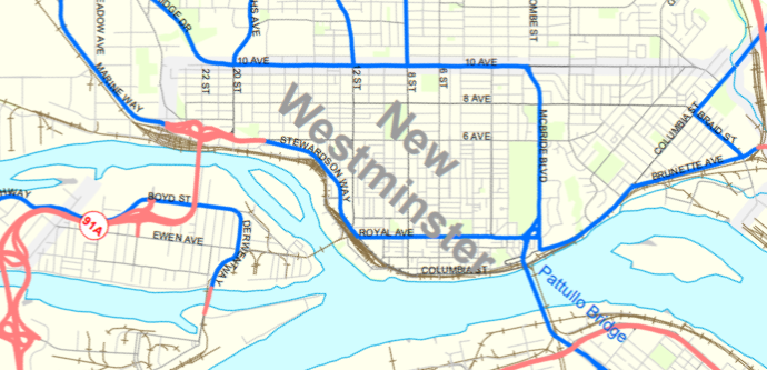
Royal Columbian Hospital is the only hospital in British Columbia built immediately adjacent to a rapid transit station and on a regional Greenway. Beyond that, it is located in a City that has made serious commitments to Climate Action, has signed onto the Declaration for Resilience in Canadian Cities, and has both an Official Community Plan (OCP) and a Master Transportation Plan (MTP) that speak to moving us past motordom. Yet, the largest employer in the region has brought us a plan that serves to entrench the private automobile as the primary form of transportation to a facility meant to serve the region for decades ahead. That is a failure to set a building into appropriate context, a failure to design, and a failure to lead.

It is 2020; we need to do differently.

Since Fraser Health first brought plans for the hospital upgrades to us a couple of years ago, the City has pointed out a fundamental design flaw. The building literally turns its back on the Skytrain station. Though the project team as tried to address this issue by creating a somewhat uninspired back entrance plan where pedestrians can go through a parking garage entrance and find and elevator to a back hallway, the plan for access shows pedestrians and transit users are an afterthought to the transportation plan.

Indeed the hospital is being built immediately adjacent to a SkyTrain Station – less than 30m from the weather-sheltered exit from the transit station. However, a pedestrian walking or rolling  to a primary entrance must travel 500m, up a hill, around the entire bulk of the building, and through a parking lot. Attempts to make this route universally accessible (with a grade less than 5%), would add significant distance in the form of switchbacks to this route. It also involves an at-grade (non-signalized?) crossing of a road that is both designated a truck access and a vehicle access to the parking garage. So it is on Transit, but turns its back to transit.

I have also spent a couple of years relating concerns about the potential impacts this project will have on East Columbia if we don’t do it right. The City’s clear and long-established plans call on East Columbia through Sapperton to serve as a “Great Street”. According to our Master Transportation Plan “Great Streets require planning and design that goes beyond the typical street function of supporting through traffic. Planning and designing Great Streets means providing characteristics that make streets destinations – places for people to be, instead of places to move through”.

I appreciate the work Fraser Health and City Staff did to assure the streetscapes along East Columbia are mixed mode and modern, but that is spackle over a flawed foundation. We need to re-align this map to assure that Brunette Avenue – acting as the regional road and regional truck route it is and is meant to be – becomes the primary connection to the Hospital for large trucks bringing goods to the hospital, and for drivers who choose to drive to the hospital from the wider region. Simply put, East Columbia cannot achieve the goal of being a Great Street if it is expected to carry the bulk of this regional traffic.

That means we need to change Brunette Avenue, and that is something that will require partnerships with TransLink (who should get this) the Ministry of Transportation (who will need to be dragged kicking and screaming), as this part of Brunette is both Major Road Network and a regional truck route. Senior Government transportation staff are going to say that installing a safe intersection at Brunette in the vicinity of the Hospital will impact Level of Service for all the through-traffic that the route serves. I do not doubt that, but wonder again whether we are using the right measures to assess the function of our transportation network. Fraser Health should be making this case to these provincial agencies, not the City. But here we are.

With all of this in mind, I asked that the City ask Fraser Health to commit to three things before adoption of the rezoning:

• A seamless and universally accessible connection to the SkyTrain Station befitting a primary entrance to the hospital as part of to the current design;
• Developing a plan to shift all transport truck access from E Columbia to Brunette Avenue; and
• Developing a plan to shift the primary access for regional automobile traffic onto Brunette Ave instead of E Columbia.

Now, an argument could be made (indeed was made in Council) that this was all too late and we cannot ask Fraser Health to change course on such a major project at this late stage. If we are unreasonable now, are we jeopardizing the entire project?

Allow me to retort.

Nothing I said at the meeting should be a surprise to the Project Team, or to Fraser Health. Every opportunity I have had to talk to Fraser Health about this project over the last few years – at ACTBiPed consultations, in the Transportation Task Force, at Council presentations, in their open houses, I have made these points. They have heard it reinforced by our Advisory Planning Commission and through our transportation planning staff. This policies driving this are baked into our City’s planning and transportation documents. We have been banging this drum all through the consultations, Fraser Health has been dancing to a different beat.

This is doubly frustrating because this is also at odds with Fraser Health’s own direction in regards to the role of motrodom in Public Health. Fraser Health knows that climate change is a public health challenge that is exacerbated by automobile dependency. As the region’s leading trauma hospital, RCH is fully aware that automobile dependency is a leading cause of traumatic injury, and automobiles are the #1 cause of death for young people in Canada and around the world. Sedentary lifestyles, asthma exacerbated by air pollution, urban heat island effects, the direct and indirect health impacts of the social and economic harm posed by automobile dependency, etc. etc. That cars are bad for public health is not a controversial idea.

So what role does such a large employer and a large service provider in the community have in moving past motordom?  When it comes to a rezoning and developing a new asset for the next century, they should look at the clear goals set out in Official Community Plans and Master Transportation Plans and try to address those. When that developer is a provincial government and provincial Health Agency, they should also determine if their plans address the Provincial Government’s own stated goals about climate, about auto dependency, about smart growth and sustainable communities. When they all coincide, we shouldn’t need a pipsqueak council using zoning laws to force/cajole community investments towards those goals.

I do recognize that Fraser Health has made some commitments to Transportation Demand Management (TDM) related to the hospital expansion project. However, those seem to have been driven by a need to address the cost of building parking, and making the case for parking relaxations. I fully support those TDM measures, and appreciate to commitment, but the design of the building and surrounding transportation network does not enhance these TDM measures, and undermines their ultimate effectiveness.

They can do better, and we need to do better. It is 2020, and the planet is in peril. This is the decade we change the status quo to address climate, or the decade where we abandon future generations to their fate. If we choose the latter here, we are going to need a bigger hospital.

Back at it

Back at it!

We had our first Council meeting today after a shortish summer break. We have yet to get through the Labour Day weekend, but back to work we are.

I want to use this blog post to point out a couple of things that happened in August that we kinda fun. For me, anyway.

I had a great chat with Christine Bruce, who runs a radio program called “Totally Spoke’d” on CICK radio (and the interwebs, or course, because it is 2020). The program is about cycling and active transportation advocacy. Christine invited me on to talk about the increased fines for dooring recently applied by the BC Government, which I talked to the New West Record about here.

Christine was an informed and fun person to chat with, and I think the conversation was a great introduction to the issue and the reasons the province made the changes. It was also a launching point to a bigger discussion about the tonne of work we have yet to do to make cycling spaces – and all active transportation spaces – safe and comfortable in urban areas. Have a listen here!

I also had a long chat with Dean Murdock (which he artfully edited down to a tight 20 minutes) who produces and hosts the Podcast Amazing Places. Dean is a former City Councillor from Saanich and is leading conversations in Greater Victoria about making public spaces better. He wanted to talk about the original capital’s Streets for People initiatives, and the efforts New Westminster is making to re-balance our public space allocation between storage-and-movement-of-automobiles and all the other uses the space can be used for. You can hear that conversation here, or wherever your favourite Podcasts are cast from. And unless you are my Mom, you will probably find more interesting episodes of his show than mine, Dean is definitely worth a follow.

Finally, I couldn’t help but stick my nose into the CBC’s Best Neighbourhood conversation/competition. Along with my fellow Browhillian Councillor Nadine Nakagawa, we made a compelling case (I think) for the Brow of the Hill. Enough that after we lost to much less worthy places, we were back on CBC to talk about the Brow. We were there to talk about how we define a great neighbourhood, and what we value in the pace that we live. It was all in good fun, but I think I’ll dig into a longer conversation about this “contest” for a follow-up Blog Post.

Calmer streets

Earlier in the year, I brought this motion to Council, asking that the City be bolder in finding ways to re-level the balance between car use and other users for public space in the City. We had already made commitments in our Climate Action goals that we are going to change how road space is allocated in the City over the next decade. Then along came COVID to shine a brighter light on some of the inequities in our communities, and cities around the world started acting more aggressively on road space reallocation as a pandemic response. The time was right for New West to accelerate the ideas in our Master Transportation Plan.

Early on, there was some rapid work to address pedestrian and active transportation “pinch points”, especially in the Uptown and on a few Greenways. The city was able to quickly create more safe public space downtown by re-applying the weekend vehicle closure plan of Front Street that we already had experience with. Uptown, the BIA asked the City to allow temporary weekend-only opening of some street space for lightly-programmed public space. Response has been pretty positive:

There is a bit of push-back on these interventions, as there always is when status quo is challenged in the transportation realm. Predictably, the traffic chaos, accidents, parking hassles and general mayhem that was predicted by more vocal opposition just didn’t occur. Staff is tracking actual data, but I have made a point to visit these areas often (COVID and working from home has made me into one of those walking-for-recreation types) and have been collecting admittedly anecdotal views of how these sites are working.

There are two more ideas that are being launched for the second half of the summer, and I want to talk about them because they came from different directions, but ended up in the same place, and are also eliciting some public comments right now (as was the intent!)

The City is piloting a “Cool Streets” program that identifies key pedestrian routes in the City for light interventions to reduce the through-traffic load and give pedestrians more space to stretch out. The way these streets were identified for the pilot is what makes this interesting, and speaks to one of my previous lives when I was briefly a GIS geek.

The goal to identify areas of the City where more vulnerable people have less access to green space, shade, and safe waling/rolling routes to parks and services. The approach very much aligns with the City’s Intelligent City initiative by using data-driven analysis to help make decisions. The City used its Geographic Information Systems (GIS) data set to identify areas that met the following criteria: higher population density, lower household incomes, larger proportion of seniors, and lower parks space per capita. Using GIS to “overlay” these layers, they identified area where many of these criteria overlap:

Once the “dense” areas of this map were identified, staff went through looking at the routes that combine connectivity to key destinations (parks and services), where grades were lower and where the most tree canopy cover was available:

They then identified priority routes for “green street” interventions (1, 2, and the west part of 3 in the map below), and extended these along streets that get to key destinations (the east part of 3 and 4):

The interventions here are very light. The roads are not “closed” to cars, but are calmed using ideas drawn from experiences in other cities from New York to Oakland to Toronto to Vancouver. The hope is to create truly traffic-calmed streets where local access by car is still available, but the space is open for people to share and program as they wish. Local streets acting like streets for locals, not as through-fares.

A second initiative was led by a community group in Sapperton. Concerned about some recent close calls on the part of the Central Valley Greenway that runs through lower Sapperton, they surveyed their neighbours and brought a proposal to staff asking if a pinching down of one block of the greenway could be trialed in light of the Streets for People motion. Again, the road is not closed, but signage was installed to discourage through-traffic and removable soft barriers installed.

Both of these interventions are temporary pilots. They cost very little to put in action, and provide valuable data to our transportation planners, while also giving the public a chance to see what changes would look like before we invest in more permanent or expanded road re-allocation.

In her great book Street Fight, Jeannette Sadik-Khan talks about successes in urban residential areas where more local and lower-key interventions like this have occurred. A major part of this is trying some things (lightly, quickly, and cheaply) as a form of consultation and data collection. This allows us to get past the baked-in institutional resistance to change that says everyone has to agree on paper before we even try the most minor change, and before we can test whether a change is a net good. The Summer Streets program in New York was her model of this – feared by many, embraced by almost everyone once implemented, with the fears proving unfounded in the long term.

All that to say, these light interventions are designed to elicit not just public participation, but public feedback. And I have received feedback already. I’ve received e-mail form people very upset that they were not consulted; e-mail form people predicting traffic chaos; and e-mail from people asking if they can do this on their street. My short answer to those questions are, respectively: this is the consultation; the sites selected were local streets, not traffic-challenged throughfares, but staff will be collecting data to assess the impacts on traffic; and not likely this year just because of timing, but if things go well, I hope these kinds of pilots can be expanded in 2021.

So, if you like this kind of intervention, let us know. If you don’t, tell us why. Staff have included in the analysis above other priority areas for Cool Streets that may be implemented in the future, including Downtown and the McBride commercial area in Glenbrooke North. As for the community-driven version, if you would like to see this type of intervention as a temporary or permanent feature of your street, start reaching out to your neighbors (maybe hold a social distance block party?) and talk about it. If you can gather enough interest, maybe the City can make something happen in 2021.  To me, local communities reclaiming space is a major part of making Streets for People again.

ASK PAT: Sidewalks

Still getting caught up on queued ASK PATs. If you have a question, click that ASK PAT spot up in the right corner there. I’ll try to answer them succinctly, but I am likely to go on a digression, which takes a while to write so I get behind and here we go again…

Jim asks—

I thought that the City had a policy for barrier free sidewalks. If you look on the south sidewalk on Seventh Avenue – a greenway – you will see that the new utility box covers resulting from the recent work were placed right in the middle of the sidewalk. I don’t think that they need to be there as I think that there is room between the sidewalk and the private property for the utility boxes. They are plastic, not metal, but they still make the sidewalk uneven and in a few weeks when the snow comes they will ice up and be a barrier.

There is a worse example in the Moody Park entry plaza at 6th Ave and 8th Street. The recent work there was capped off by a metal utility box cover that is in the main travel path for pedestrians and was installed with a slope. This one is slippery in the rain. I believe that none of these utility box covers needed to be placed in the sidewalk. So, what happened?

I’m not sure I agree with you. I suspect if a utility box cover is placed on a sidewalk, it is because it needs to be within the corridor of a significant piece of linear infrastructure, be it a pipe or an electrical conduit. More likely, they need to be at the intersection of two major pieces of linear infrastructure, which severely limits their location. I can name several unfortunately-located box covers, from the sidewalk on Eighth Street near the entrance to the Lawn Bowling Club to the half-in the bike lane force ewer main cover on Columbia Street just east of 4th. I would suggest all of them need to be pretty much where they are.

That stretch of Eighth Street has a lot going on under your feet. There is a fiber optic conduit right-of-way, a buried 3-phase electrical distribution line, a concrete Storm Sewer gravity main, two separate combined-sewer gravity mains, and two separate potable water supply mains. For all I know, there may be private utility lines as well (BC Gas, Telus, Shaw, etc.). All of them have specific offsets from each other that must be maintained, can’t be too close to property lines or under power poles or interfere with each other. Their location now is a result of almost a century of decisions about rights-of-way and avoidance of conflict and need to upgrade as the City grew. All this to say, they are really hard to move now.

Your point is taken, though, that the surface treatment of these necessary pieces of infrastructure need to consider walkers, rollers, and people with mobility challenges. They should not be trip hazards. At times they are installed to be flush and as integrated as possible to the driving lane or sidewalk, but settle differently or swell up from frost or are damaged by heavy machinery. I would suggest efforts to make them visually “blend in” are probably a bad idea, as a changes in surface texture or material should probably stand out as warnings for those with cognitive or visual impairments. They certainly should not be slipperier than the adjacent sidewalk, even when wet.

I can ask staff about what type of standards exist for these installations, and ask what we do as far as inspections after contractors install them. If you have a specific one that you think needs repair or constitutes a hazard, the best response is to report it through SeeClickFix or drop a line to Engineering Ops and see what transportation staff say.

That said, I do want to take this opportunity to address this letter to the local paper, because it is related. As the writer suggests, more people are walking because of COVID, and more people are noting places where sidewalks are in disrepair. Confirmation bias is a powerful thing, but the City has recognized the need to increase its sidewalk repair and upkeep budget for a few years now, and are putting money into the problem at an unprecedented rate.

As we implemented the Master Transportation Plan adopted in 2015, we have prioritized pedestrian spaces. A major part of this is spending the money to assure every sidewalk at every corner in the City has an accessibility ramp. This is not a minor thing, and it was not inexpensive to do, but as the first “quick win” to improve pedestrian spaces, we prioritized that spending. New Westminster is the only City in the Lower Mainland that has achieved 100% corner ramp cuts. Some are admittedly older design, and resources as now being put to updating some of these older ones to bring them to modern standards.

We are also spending more than ever on updating and improving sidewalks and crosswalks. Our current Capital Budget has more than $7 million dedicated specifically to pedestrian improvement projects. This is above and beyond the investments we are making in Greenways and Great Streets (where improved pedestrian spaces are part of the bigger project) and the improvements that we implement to coincide with lot development. This is a huge increase over what we spent on pedestrian improvements only a decade ago. We have some catching up to do, and this work is expensive, but we are getting it done.

That said there are often local spots that degrade quickly because of frost, vehicle, or root damage. If they create a trip hazard or accessibility barrier, the best way to assure fixing this ends up in someone’s work plan is to do a SeeClickFix report or contact Engineering Ops as I linked to a few paragraphs above.