tonight was School board, victory and loss on the Bottled Water issue, more on that later. For today, all I have is video and comments from Monday night’s Council discussion around the transportation issues at the proposed MUCF. Video courtesy Matt Laird (So my Mom can see I still need a hair cut, my wife can complain about all my “um”ing, and my Anonymous Stalker can pick me out of a crowd)
Yep, I’m a goof, but the answers received from staff were slightly unsatisfying. I didn’t think that this was the forum to engage in a protracted debate, but I did have a great discussion after with a VP from Uptown Property Group. Things I learned:
Moving the garage entrance to Begbie is challenged by the slope of the lot. The building lot is several metres higher in the northeast corner than it is in the southwest corner, placing the ramp over on the east side would make for a steeper ramp and not allow as much parking capacity. To hear City Staff talk about it, moving the garage cannot be done.
First off, in my consulting days, I was taught by a senior engineer to never say “it cannot be done”. It can always be done, it is a matter of priorities and costs. Having the parking entrance on the east side of the building is, in my opinion a HUGE priority, so let us see the economic argument about whether it can be done. Some of the slope issue could be addressed (and I thank Matt Laird for pointing this out) by creating the ramp parallel to the building where the angled parking on the east side of Begbie currently sits, or working the ramps into the Alexander Street end of the site. The Gentleman from Uptown pointed out that the tiny retail space on the northwest corner is a compromise due to the desire to have parking on the west side of the building, moving the entrance to the east will also improve this property, increasing the value of the building. I stand by the idea that having a garage entrance on the west side of the building is both unsightly and unsafe, and challenge the engineers and architects to come up with a better solution.
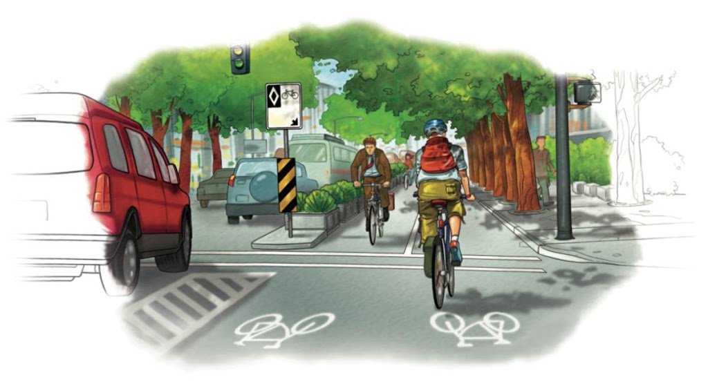
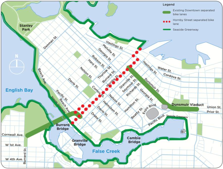
Second, with all due respect to Mr. Lowrie (who I think does a great job for the City), the response that Begbie has always been the designated bike route connecting the CVG and Carnarvon sort of avoids the issue: the original decision was wrong. Time plus wrong does not make right. This is part of ongoing discussions at the VACC, at the City’s Bicycle and Pedestrian Advisory Committee, and amongst the NWEP transportation group: the bike plan for the City consists of green lines on a map that are evenly spaced to create “coverage”, but do not reflect the reality of riding a bike. Begbie is not an appropriate bike route when 8th ave is a couple of dozen metres further west and is way more accommodating to more cyclists. The City’s Bike Plan includes Tenth Street as a major north-south route through town. The 200m of Tenth between Royal and Queens is over 13% grade! It is crossed by major traffic route at Royal (where cyclists coming down tenth will be overheating their cantilevers to avoid drifting into traffic) and a completely blind corner at the top of a steep hill at Queens. and a 13% grade. As my French friend would say: Hors Categorie! To suggest that is the correct spot for a bike route is ludicrous, it might be the most difficult and dangerous north-south route in the City for bikes. Although Begbie is not as bad as this, it is likely to see much more traffic due to the location at the CVG, near the SkyTrain, and around the new MUCF. Move the bike route to 8th, so it can actually be a bike route and not just a convenient green line on a map.
Finally, and I have to call attention to this, it is suggested in the design and was confirmed by the architect from Uptown, that the mid-block crosswalk at 8th in front of the SkyTrain station will be removed. The NWEP fought to have that crosswalk installed, and make no mistake we will fight to have it maintained. That crosswalk is an important part of the pedestrian infrastructure in New Westminster, it is heavily used, it serves to protect the lives of New Westminster pedestrians at the front of our busiest Sky Train station, and it will only become more important with the MUCF and the completion of the Plaza 88 development. It was installed to save lives, it should continue to do so.
Before that crosswalk was installed, people walking out of the Skytrain wanting to cross 8th were asked to walk up or down the street a half block, in the rain, to the corner of Columbia or Carnarvon. The mid-block crossing not only provided a more direct crossing, it offered the rain shelter of the Skytrain line. Naturally, people jaywalked, creating a safety hazard for cars and busses before the crosswalk was installed. The City wanted to install a fence down the middle of the road to solve the jaywalking problem, not recognizing that the problem was one of bad design. The NWEP fought the City, forcing them to recognize that Pedestrians had as much right to the street (especially at a Skytrain entrance!) as cars. Reluctantly, the City installed the crosswalk as a temporary measure. It is still there, it is still safe, and it is still used.
With the introduction of a left turn lane to access the MUCF, I guess the fence idea is pooched. With new retail and restaurant activities on the east side of 8th, the pedestrian traffic will only increase. Does the City think the people coming out of the Skytrain will now walk to the corner of Columbia (in the rain), wait for a light (in the rain) then cross, to get ot he MUCF from the Skytrain, or from Plaza 88? Of course they will stay under the cover of the Skytrain, and they will Jaywalk, right in front of cars pulling into or out of the MUCF. Conflict will ensue. Someone may get killed.
Again, the root of this problem is the parking entrance on the west side of the MUCF. How many compromises are we making for this one design fault? Let’s do it right.