Vacation

I took a vacation. After a busy but very rewarding year with too much work, a too-stuffed schedule, and too little recreation time, it was good to get away for a couple of weeks and chill.

Of course, I read some books about urban planning (reviews soon, if I get time) and spent a lot of time looking at the urban realm while tracing the career path of Peter Stuyvesant. Here are three thoughts.

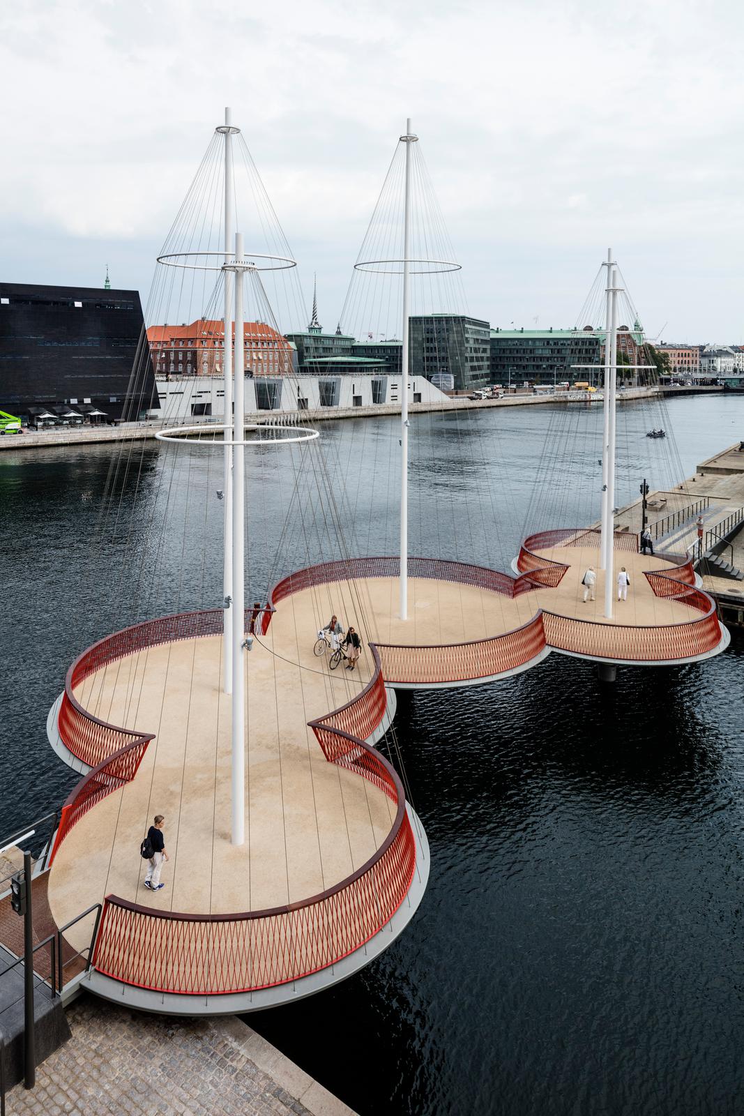
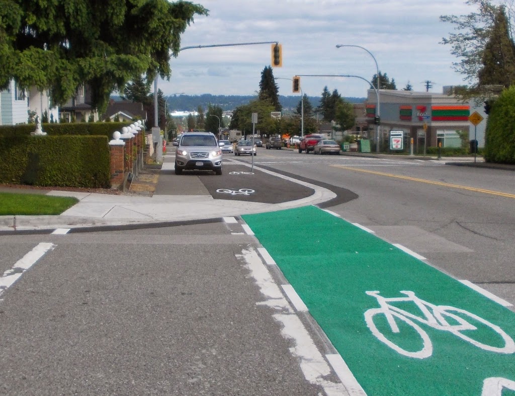
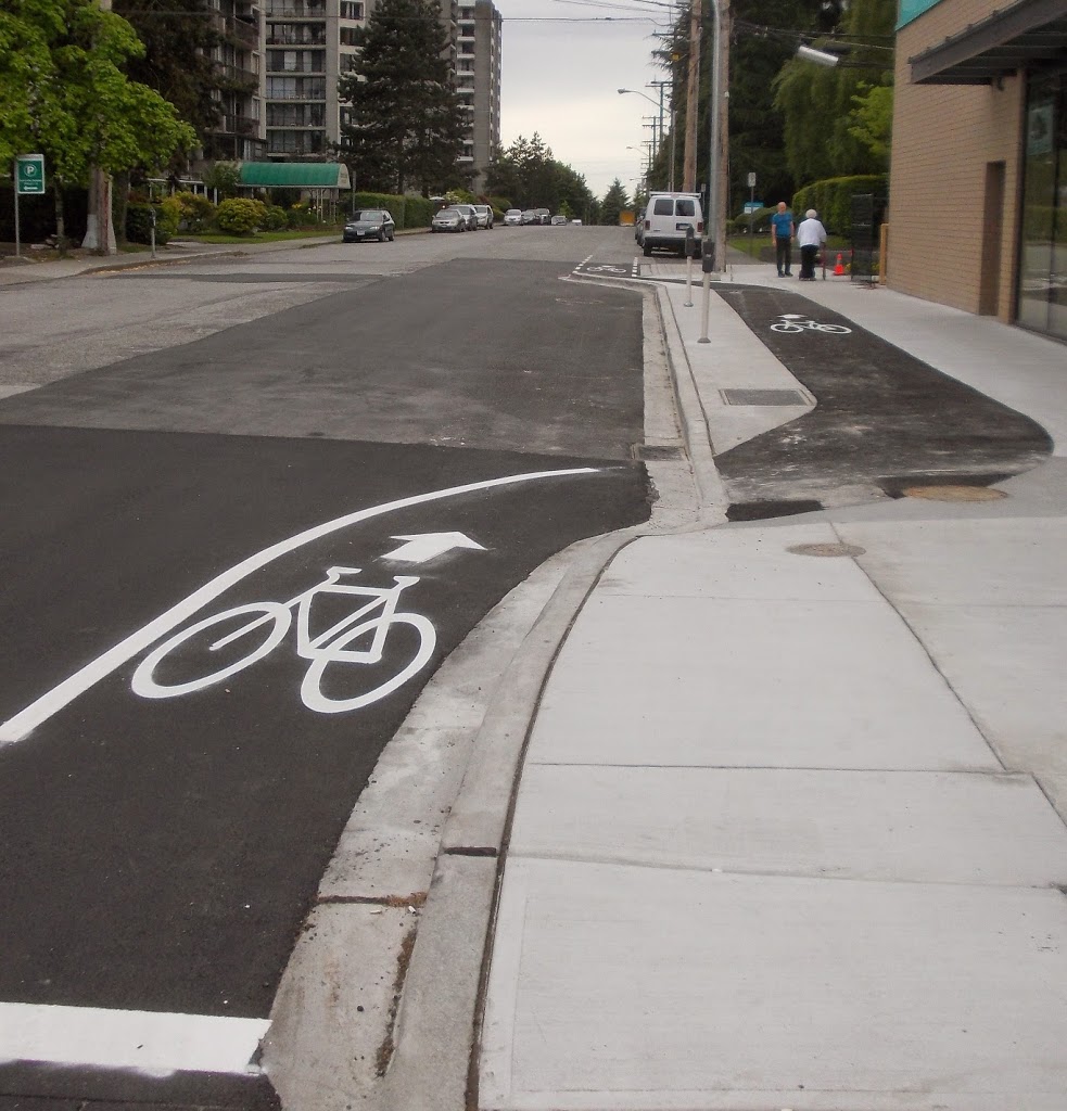
1.City Bikes are cool.

This is New York’s bike-sharing program, and while spending an unseasonably warm Christmas in Brooklyn, we had an opportunity to spin around on the almost-ubiquitous blue bikes.

vac3

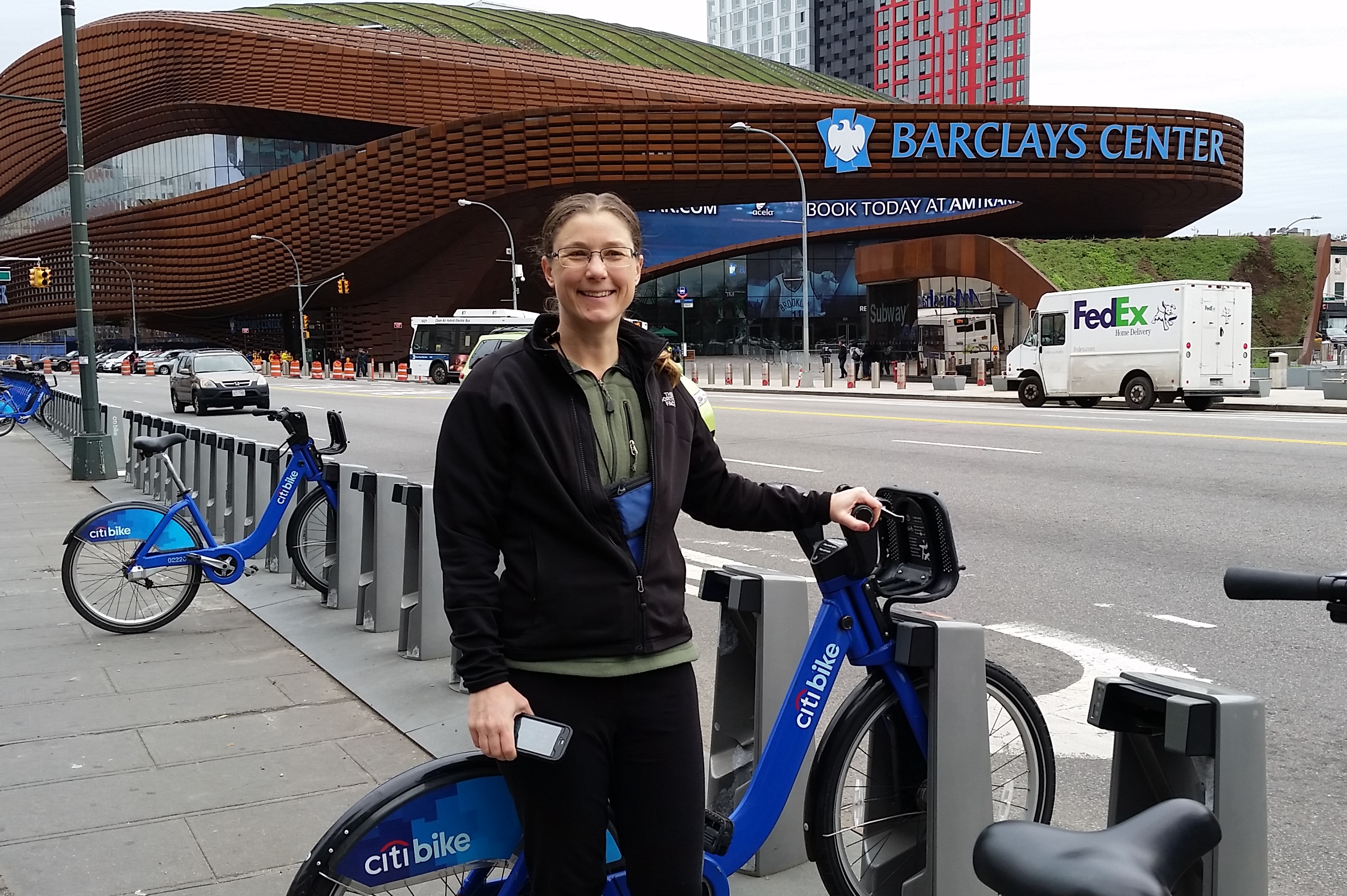
The bikes themselves are sturdy Dutch-style upright bikes with full fenders, enclosed chains (no grease to worry about), simple but effective three-speed internal hubs, drum(!) brakes, and hub-generator powered lights. Tough? The bikes are (to paraphrase Neal Stephenson) “built as if the senseless dynamiting of [Citybikes] had been a serious problem at some time in the past”. They are pretty much a perfect balance between bulletproof and efficient.

There are many options to pay, from paying for a single ride to buying an annual pass. We bought a couple of 24-hour passes for $10 each. This gave us unlimited access for 30-minute rides. We were able to ride from our apartment in Bedford-Stuy to Barclay Centre, then from Braclay to downtown Brooklyn. Dropping bikes at a convenient station (you are never more than a 5-minute ride from a station within the service area), we walked across the Brooklyn Bridge, wandered around a bit in Manhattan, picked up a couple of bikes in Little Italy, rode across the Williamsburg Bridge, dropped bikes and visited a microbrewery, etc., etc.

Actually, bulletproof and efficient pretty accurately describes the entire system. The kiosks and payment process is simple to use, and features a little digital map you can scroll around to navigate your neighbourhood, the on-line app will guide you to the nearest station (if your 30 minutes are running out), and there are very few surprises.

vac2

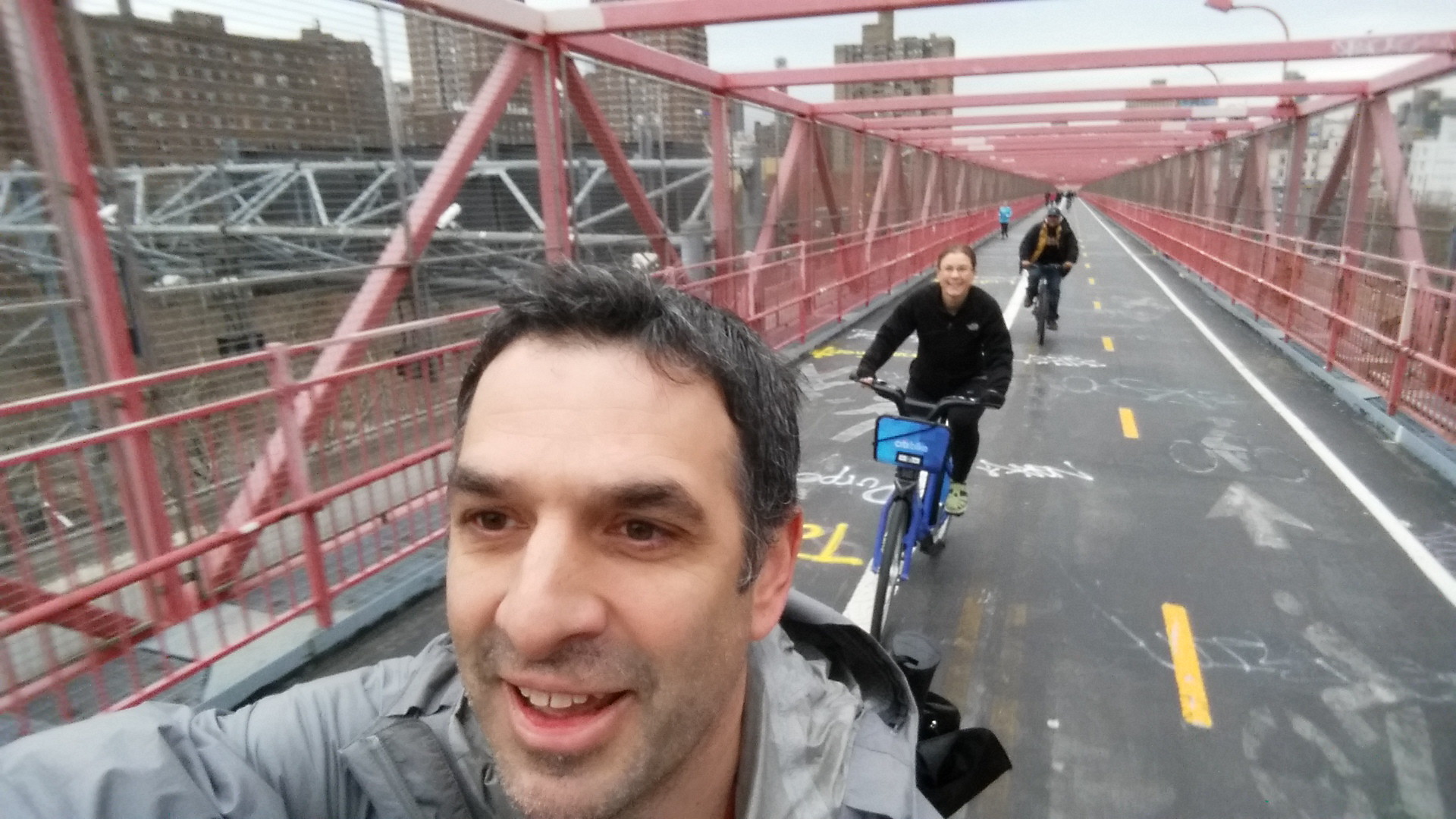
Is the system successful? 10 Million individual rides in 2015, and ongoing expansion plans to reach 12,000 bikes and 700 stations by 2017. Before anyone talks to me about my helmetless pictures above (Hi Karon!), there is no helmet law in New York, and with literally tens of millions of rides since its inception 2013, there has never been a fatality or a serious injury on a City Bike. Looking at NYC’s pedestrian and traffic fatality stats, CityBike may be the safest way to travel in the Big Apple.

Yet, globally, no jurisdiction with a helmet law has successfully launched a bike-share program like Citybikes. Every one has failed, or failed to launch. And I predict Vancouver’s will fail for this very reason.

2. Even in New York, pedestrians are serfs.

Walking Fifth Avenue from Central Park to the Empire State Building is an incredible experience. From the Plaza, past the Library and Rockefeller Center and St. Patrick’s Cathedral, through the (unofficial) centre of world shopping, it is a spectacular combination of sights and sounds and people and shopping and urban buzz. A couple of days after Christmas, I got to share it with tens of thousands of other people.

It got rather more intimate than most would probably like, because all of those people were crowded behind barriers on too-narrow sidewalks as hundreds of police spent their holidays keeping the vast expanses of asphalt between the sidewalks free for the movement of – a couple of dozen cabs and towncars.

vac7

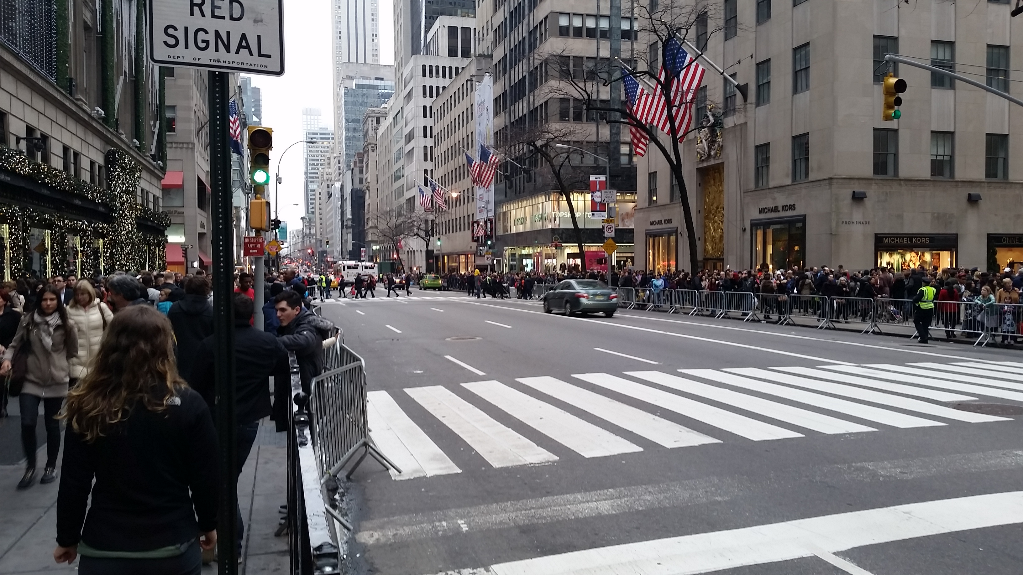
Just look at this photo and look at how the public realm is divided up. 4m sidewalks, 20m of road, and look at where the people are. Overall, New York City is one of the most walkable places on earth, and between the incredibly convenient subway system (although, I noted only about 10% of station were accessible for people with disabilities!), short distances to get any kind of shopping you might want, and a huge reliance on walking as the primary form of transportation – the guy in the town car somehow gets priority to an opulent amount of the public space. It’s bizarre.

3. Aruba may be the Netherlands, but it ain’t Dutch.

We picked Aruba for our vacation because we didn’t want adventure this year, we just wanted to chill on a beach, and according to legend, Aruba’s beaches are amongst the best. A legend I will whole-heartedly confirm.

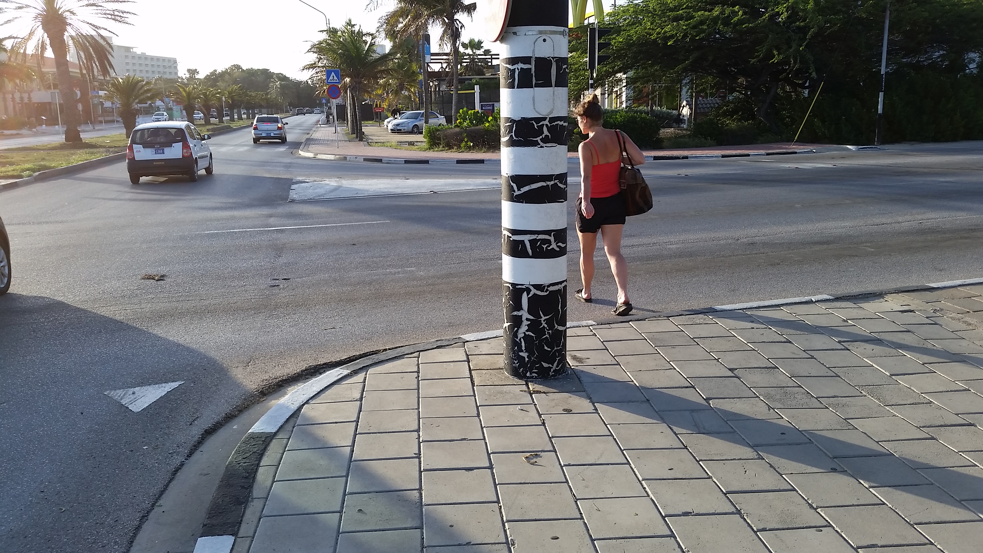
However, we were also intrigued by Aruba’s Dutch heritage (it is still part of the Kingdom of the Netherlands), and hoped to see a little of the Dutch personality of the island. Unfortunately, aside from ubiquitous Heineken and plenty of young Dutch nationals working the tourist bars and restaurants, there was not a lot of Amsterdam to be found in Aruba. For a small island with incredibly pleasant weather, It was a depressingly car-oriented community. We used the local bus service (inexpensive, predictable, convenient, almost empty) and walked most of the time, where most people used cars, truck, atvs, and motorcycles. The only cyclists we saw were of the lycra-clad sporting type. The pedestrian realm ranged from non-existent up on Malmok where we were staying to downright hostile once you got a block off of the tourist strip in the resort areas.

vac5

Maybe we should try Curacao

4. Vacation notwithstanding, it’s good to be home.

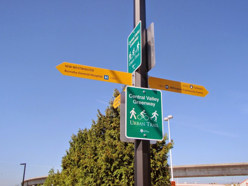
And I am realizing that New Westminster has pretty much all of the assets that Jane Jacobs mentions when talking about vibrant communities, which is a hopeful sign…

Q2Q Compromises

The Q2Q bridge is an important project for New Westminster, and one I support. It is, however, a project with major challenges, and I am glad we are at a stage where the next phase of public consultation is taking place, so we can talk about some of those challenges, and what they mean to the City.

First off, I need to put my comments on the Q2Q into context, in relation to my position on Council.

The Q2Q concept was developed long before I was elected, even before I started to rabble-rouse in the community on transportation topics. However, I have expressed strong support for the project for years, even piping up to challenge some of the past opponents of the concept. I have always believed, and continue to believe, that the Queensborough community needs to have a reliable, safe, and accessible connection to the “mainland” of New Westminster, and that connecting the beautiful waterfront greenways of Queensborough to the Quayside boardwalk will have huge benefits for both communities. When the topic came up during the election, I was quick to say I supported the project and wanted to see it built as soon as possible.

Now that I am on Council, and am (in part) responsible for getting this project done, the brutal reality of the project has set in. The bridge some of us may dream of may not be possible in this location, and the development of palatable compromises is daunting and frustrating at times. It is becoming a lesson for me about the reality of planning for community infrastructure when a local government’s power is so limited.

If someone were to ask me what I wanted to see in a Q2Q bridge, it would look something like this:

Click
(typical, ask an urbanist geek about a design, he takes you to Copenhagen)

The bridge would be approximately the elevation of the boardwalks on either side, fully accessible, would be at least 3m wide, and would have an interesting design aesthetic that creates some regional buzz when it is built. As marine traffic would need to cross, it would have an innovative swing style that was integrated in to the design, and was an eye-catcher such that the 5-minute wait for the boat to cross was not something that irritated you, but intrigued you. It would even have areas over the water where you could sit, have a picnic, drop a fish line in the water, or take photos of crossing trains, passing boats, or overhead eagles. It would also represent an easy connection for people commuting by bikes, people out for a stroll, people pushing kids in a stroller – a seamless connection across the river.

But that ain’t going to happen, because the City doesn’t own the river. Although the North Arm of the Fraser at that location is a significant industrial transportation corridor regulated by the Navigation Protection Act and Port Metro Vancouver. I cannot emphasize enough that the people who make a living moving things up and down the river would much prefer no bridge there at all, and due to the nature of the regulations, the people working the river get the say about what goes in, on, or over the river. If they don’t agree, nothing gets built.

The “they” in the case of the North Arm of the Fraser River are the Council of Marine Carriers. They use the North Arm of the Fraser to move barges, boats, booms, and all sorts of floating things. There are no alternate routes, and their business relies on it, so they are pretty motivated to keep the North Arm accessible.

If you haven’t noticed, the train bridge connecting the Quayside to Queensborough is open most of the time to marine transport, and only swings closed when a train needs to cross the river. This would not be a great situation for the Q2Q bridge if we want it to be a reliable transportation connection that pedestrians and cyclists can rely upon. We need a bridge where the default position is closed (to boats), that only swings open when the boats go by, with a cycle quick enough that it won’t cause major inconvenience for either user group.

For the bridge to operate like this, the Marine Carriers have determined a clearance of 14.5m over the water is required. This would permit enough boats to pass under without opening the bridge that a default-closed position is acceptable to the folks who work on the river. This 14.5m makes for a pretty challenging crossing for cyclists or pedestrians with mobility problems. Hence, we can’t have the bridge we want.

q2qdrawThe question then becomes – how do we get people up to 14.5m? A ramp that meets typical mobility-access standards (i.e. no more than 5% grade – and yes, I am aware and frightened that 8% grades are shown on the rendering) would need to be about 250m long, even longer if we add standard landings at set distances. This would be expensive, and create a long visual intrusion for the Quayside residents next to the bridge. Stairs wrapped around an elevator column would have a much smaller visual impact, and if we can avoid the design mistake that led to a completely unacceptable delay on the Pier Park elevator (yes, we can), the size and scale of that structure is a good estimate of what the bridge landings would look like.

This image is *very* conceptual

I would love to see some creative alternate approaches, and we may see some coming from the engineers we hire to build the bridge. The corkscrew ramps at the southern foot of the Golden Ears Bridge seem very effective to me, and are of the same scale vertically, although I’m not sure we have the footprint area to take the same approach:

geb
…and I have my doubts whether Port Metro Vancouver would allow us to build such a structure over top of the water. It has already been suggested that the structure as proposed would require the highest level of environmental review (“Type D”) which makes it sound like a pedestrian and cyclist bridge will somehow have a bigger environmental risk than a coal terminal or LNG export facility.

You may also have noticed the plans for the bridge shifted from being slightly upstream of the train bridge to slightly below. The upstream side as a little better for the City, as both landings work better, but the downstream was deemed safer for boat traffic. Unfortunately, this means the landing on the Queensborough side is going to be much more complicated (read: expensive) to build.

Alas, we are stuck with what we have. I can complain about an industry group having more power than an elected local government about how our river is used, but as we learned in the Fraser Surrey Docks coal terminal discussions, the Port does not answer to local governments, but to their own mandate, and Sunny Ways are not likely to shift their business model any time soon.

So we will do what we can to build the most accessible, most convenient, and most user friendly bridge within the constraints given us, even if it isn’t as elegant as one we might see in a place like Copenhagen.

Ask Pat: bike lockers?

Pamela asks—

Are there bylaws requiring bike lockers in new developments?

Yes. Kind of. But they may not be as useful as you might like.

The City has the weighty tome called the Zoning Bylaw that regulates pretty much every aspect of new development. If you want to build an apartment building, row of townhouses, office tower, curling rink or shopping mall, there are all sorts of regulations in there to dash your architect’s dreams. Included in those requirements are requirements for bicycle parking (Section 155, to be precise).

Before we get too deep into it, we need to define our terms, because I often park my bicycle leaned up against a parking meter, so all “bicycle parking” is not created equal. The Bylaw differentiates between Long-Term Bicycle Parking (“means a space designed for the parking of one bicycle by permanent users of a building, such as employees and residents”) and Short-Term Bicycle Parking (“a freely accessible space designated for the parking of one bicycle, available for public use during the business hours of premises in the building”). It also differentiates between a Bicycle Locker (“for the storage of one bicycle and accessible only to the operator of the bicycle“) and Bicycle Storage (“an area providing two or more long term bicycle parking spaces“).

Let’s put the short-term parking aside, because installing a couple of racks on the sidewalk is pretty straight-forward. The number of designated long-term bicycle parking spots depends on the type of development. New multi-family buildings require 1.25 bicycle spots per unit (regardless of whether that unit is a studio or a three-bedroom), and office buildings require 1 long-term bicycle space per 8,000 sqft of office space. For comparison, the City requires between 1 and 1.5 vehicle parking spaces per residential unit (depending on the number of bedrooms) and 1 parking spot per 31-50 sqft of office space.

Long-term bicycle storage must be at least 20% in the form of bicycle lockers, which must be solid-walled (not metal cages) and secure. The rest can be in a bike storage room, which must by law be painted white(!), include space for no more than 40 bicycles per room, and have secured access by key for fob.

The Bylaw is silent, however, on how those bicycle parking facilities are distributed among the residents of the building, so those decisions are made by the Developer, the Marketer, and (eventually) the Strata Board. I can find no rule that makes it mandatory to provide access to one or more secured bicycle parking spots to any specific suite, nor is there anything limiting a developer from charging for access to those secured spots. It is possible that, once built, the “bicycle storage” area could be converted to general storage, and I suspect that is what happens in many buildings.

Do you have storage lockers in the basement of your high-rise? Nothing in the Zoning Bylaw that I could find mandates their existence, and it is possible those are converted bicycle storage, if your building is a recent build. People who bought suites may have paid for access, or may have been guaranteed access, but it is, unfortunately, a buyer-beware market. Of course, the same is true for automobile parking spaces. The City designates there must be, say 1.4 per suite, but we do not dictate which suites get one spot and which suite gets two, or how much residents are required to pay for buying/leasing/using them.

As for Office buildings, we simply do not require enough in our zoning bylaw. One spot for 8,000 sqft of office is ridiculous. However, we also do not have any rules around end-of-trip facilities in commercial buildings, and this will limit uptake of cycling more than the threat of having to lock your bike up outside. If you work for a large organization like TransLink with a 150,000 sqft office (18 bike spots required!), it is easy to justify end-of-trip change rooms and showers for your several-hundred staff – actually, they are likely to demand it if your staff includes professionals under the age of 40. But if you are a smaller office tenant, leasing 2,000 square feet for your 5 employees in the same strata building, it is not viable for you to build those same amenities, and you can only hope the Owner and/or Strata see the benefit of these as a “common area” amenity.

So to answer your question, Yes, we require bicycle storage. However, we don’t do enough to make sure that storage is useful for people who want to use it.

Bicycles

No secret around these parts – I like to ride bicycles more than most people.

The last couple of years, my mountain bike has been gathering dust as I spend much more time on the road, in no small part thanks to the guys of the Fraser River Fuggitivi – a rag-tag group of Sunday morning riders, some life-long cyclists, some new to the sport, some fast, some just trying to hang on. On a good day, the FRF can be a dozen riders; on some days we only have three or four; on rainy days we stay home. Them’s the Italian Rules.

This past weekend, for reasons that are more complicated than just the serious headwind we experienced on part of the ride, I was thinking about what riding a bicycle has taught me about society. Cycling is not just a social sport, it is a socialist sport. From the Pro Peloton to a local Sunday morning ride, we work together into the inevitable wind. The weaker riders protected by the efforts of the strongest, taking their pulls when they feel able, sitting back when they don’t. Rarely do we judge those who don’t take their pull, we know when you can pull, we know when you are hurting. By working together, we all go faster for less effort. There is nothing more socialist than that.

However (and here is the beautiful part), all that working together doesn’t mean there can’t be winners. Individually, few in the FRF could have pulled off our 80+km ride on a hot windy day with the average just a tick under 30km/h like we did on Sunday, but working together we got there and got home sooner. But not before we sprinted our lungs out to see who had the most left in the tank. @Gye_Incognito managed to ride the rest of us off his wheel in that flat-back slightly-too-big-gear style of his (last year’s FRF Sprint Champ @FlyingOakes was not present, and John of the Thundering Thighs is no longer with us, so we will have to put an asterisk next to this win). The sprint was fun as much as it hurt, and there is pride and respect earned for winning it, but none of us would have gotten there together to see it won without the several-hours effort we put in together, pulling together against the wind.

Over history, bicycles have been liberating and empowering, and they have been marketed, commercialized and commoditized. They were seen both as a symbol of Maoist communism, then as a roadblock to progress in post-Maoist communism. They were effectively driven off of the streets of our democratic urban areas to foster “free movement” of people and goods, and are now a symbol (arguably, THE symbol) of urban renewal across that same post-industrial capitalist world. Meanwhile, bicycles facilitate a sport that never shies away from its pure capitalist roots – Professional Cycling is a rolling consumer road show that grinds through its workers like a commodity, but where sacred symbols (including the most sacred of all – the Maillot Jaune) are just corporate branding exercises. Still, it is full of traditions that put the team before the individual: with winners who giving their cash awards to their teammates, a culture of Domestiques and Omerta and lead-out-trains and not attacking when your opponent is down.

Bicycles are about the most efficient human-powered machines ever invented, but they are also a powerful tool for society. They bring people together for common causes, and make society move forward more efficiently. You can’t help it: cycling makes you a socialist.

They also commonly remind me how out of shape I am. Thanks for the pulls, guys.

Reflective Clothing and Infrastructure

Twitter is a pretty cool communications tool. One person can link many others to common information, ideas can be debated 140 characters at a time, and you can immediately link to a larger “community” based not on your geographic location, but your common interests.

The format also allows you to take quick jabs at cultural norms – some of them that need constant jabbing.

One example is the ongoing discussion about how the RCMP and other Law Enforcement message active transportation in the world of motordom. I could list endless examples, from “crackdowns” on helmetless cyclists on protected bike paths, the use of euphemisms like “accident involving a pedestrian”, or the constant messaging that everyone needs to be vigilant around traffic, because one of these cars (never “drivers”) could kill you. Somehow, surrounding pedestrians and cyclists are held more responsible for the operation of the 3,000-lb steel box than the person inside the steel box. The pervasive message is that the safest place to be is inside a car (despite a huge body of evidence that inside a car is the most dangerous place most people in North America ever spend time!)

There have been a couple of “incidents involving cyclists” in Burnaby of late, including one that did not involve a car, but rather infrastructure installed to reduce car traffic. Clearly, this is a sad, unfortunate event, and we don’t really know all the causative factors. This did not prevent the Burnaby RCMP from repeating the “helmet and reflective clothing” meme. We don’t know if a helmet would have helped this person (likely it would have, depending on whether the presumed head injury was to the area typically covered by foam), but there is no doubt reflective clothing would have done nothing to help this person.

What the RCMP did not suggest was that the City should assure infrastructure is safe for cyclists, be they helmet-wearing and lit up like a Christmas tree or not. One thing we know for certain is that the quality of cycling infrastructure is the best correlate to cyclist safety (much better than helmet use does).

Upon reading this story, I immediately went to Google Street View and saw the intersection where the accident took place. It is pretty ugly:

Google Street View – Click to zoom in.

A tattered old set of curb-standard concrete barriers, yellow paint faded and tattered, a single sign in the middle of the lane (the main part of which is offset 90 degrees from the direction of travel on Esmond Ave). The barriers go right to the curb, where the offset sidewalk ramps are incomplete. Simply put, there is no safe route through this intersection for a cyclist. Could this crappy piece of infrastructure be at least part of the problem?

So I took a screen capture from Google, and tweeted away that perhaps bad infrastructure was more a part of this than a lack of reflective clothing. And as sometimes happens with Twitter: the message got out. (note, the first hint I got that the reporter wrote a story around my tweet was when I read it in my twitter feed – full circle!)

For a better, and safer, solution to the intersection in question, you don’t have to look any farther than south Burnaby where we have barriers like this…

…which serve the same purpose, but with better visibility, better sightlines, logical through-paths, and are also more attractive in the streetscape.

The City of Burnaby response in the story above is familiar for anyone involved in transportation planning (allow me to paraphrase): it’s been like this for a long time; we think it is probably OK; we don’t think anyone has had an accident here before; we will look at it again.” That last part is satisfying, but the rest sounds like the excuses often heard when a bad piece of infrastructure is pointed out. To many active transportation advocates, tragedy too often sounds like something used to elicit change, instead of something we should be actively trying to prevent through change.

This is why active transportation advocates have to keep beating the drum whenever we see a potentially-unsafe piece of infrastructure.

BLOC – The Bike to Work Week edition!

My place of employment had a remarkably successful Bike To Work Week – lots of people rode their bikes in, some every day, some just one day. That is the point of BTWW- for people to take a chance and see of riding a bike works for them. In the end, our organization more than tripled the number of kilometers ridden in BTWW over last year, by creating some fun inside challenges, and a significant beer-based bet between co-workers. It was fun for all, but mostly for those of us who ride in on a regular basis.

As I have written before, my ride to work is really, really good. The bike route is, for the most part, really well designed, safe, and easy to use. However, there is one ongoing issue that I keep complaining about (and I am not alone): the lack of respect for bike routes. With the vanishingly small amount of our regional transportation investment going to bike infrastructure, can we please just acknowledge that bike lanes are for bikes- the one piece of our region’s vast expanses of pavement that are not dedicated to cars and trucks?

Here is what I am talking about, in images. And yes, every single one of these photos was taken this week during my regular bike route to or from work. I wish this was not typical, but this is my daily commute, folks. Actually, this is an abridged sample of my week.

Monday:

I’m not the only one avoiding this guy.
in his defense, how could he possibly have seen the bike lane of no parking sign? 

Tuesday:

At least it is a pictogram of a bike under him, not an actual one.
Nice picture of my commuting bike, and a no stopping sign on the bike lane.

Wednesday:

This guy put a cone up, which is nice, in a way.
Note the only construction stuff blocking this bike lane is the warning sign.

Thursday:

Note both of these pics for Thursday are from the way home, as the morning ride was too rainy to photograph.
And note this guy is a jerk… 
…but not as big a jerk as this guy who honked at me (?) as I passed him.

Friday:

Yes, he was parked. Yes, a completely separated lane. 
Note no stopping sign. 

I’m not sure  what my point here is, except that I don’t think any of these people were in any kind of risk of receiving a ticket for their illegal vehicle use, while the City of Vancouver police were using BTWW to crack down on people riding bicycles on bike lanes without helmets and Bruce Allen was ranting on the radio about scofflaw bike riders and the out of control bike lane lobby. You would figure people like Bruce would love bike lanes – if only for the free parking.

A short note from the complaints department

Let’s skip the obligatory apologies for infrequent updates here; I’m busy.

On a not-unrelated note, I was on my way to the very successful RCFM fundraiser on Wednesday night when I noted that we are soon to get our sidewalk back, as the Anvil Centre nears completion.

This is great news, as the deplorable condition around the east entrance of New Westminster station and lack of connection with the rest of Columbia Street has been disruptive for a couple of years. I look forward to the opening of the Anvil, the re-activation of that important piece of real estate as a new, expanded public space. I also look forward to a return to the debate about the need for a mid-block crosswalk at the foot of 8th Street between Carnarvon and Columbia.

We have been through this debate at least twice before, once when the crosswalk was installed, and once again when it was removed a few years later. The removal was put off until the start of Anvil construction, when the sidewalk on the east side of 8th essentially ceased to exist. Now that there will be a major destination on the other side of 8th, the obvious, direct, and dry route for pedestrians connecting between Anvil and Plaza 88 will once again be up for discussion.

Much like the recent discussion about a mid-block crosswalk on Eighth Avenue by the Massey Theatre, to make safer the preferred pedestrian route between major destinations, the idea of a mid-block crossing at the foot of 8th Ave is a measure of how serious the City is about its Pedestrian Charter.

Then on Thursday night I was on my way to the NWEP meeting in Uptown, and I notice this sparkling new piece of bicycle infrastructure on Seventh Avenue, built concurrent with the redevelopment of the new drugstore at the corner with of 6th Street:

Bike lanes are important here, because Seventh is part of the Rotary Crosstown Greenway, one of the City’s primary bike routes, connecting the West End to Uptown to Glenbrook and upper Sapperton. As far as east-west travel across the upper part of the City, it is the premier bike route, as important as the Central Valley Greenway (the connections of which I was recently lamenting).

With that context, just look at this ridiculous piece of infrastructure:

A cyclist is meant to clear the signal-controlled intersection at 6th, take a sharp right turn into the dip at the curb then up onto a sidewalk, clear the pedestrians, then take another hard left before hitting the light standard to dump themselves back into traffic immediately in front of a parked car just before two (2!) driveways where the opulent 30m of bike lane abruptly stops.

Allow me to count the many ways this installation fails. The entry point creates confusion for three modes (cyclist, turning car, pedestrians), all of whom are forced to cross each other at the single crosswalk point. The cyclist is forced to share the crosswalk with pedestrians, who are unlikely to be expecting them there when they get out of the passenger side of their car, when they go to the parking meter, or when they are simply walking on the sidewalk as pictured below. The exit back onto the street is again confusing for the cyclist and the drivers who may be either passing a line of parked cars when a bike appears, or even turning right into the driveways (see picture below) when a cyclist appears “out of nowhere” from the behind the parked cars, and hops off the sidewalk. I honestly have no idea who has right of way in that collision!

For drivers pulling out of the driveways, the pole is located perfectly to block the driver’s vision, requiring them to pull a little forward, and making it more likely they will pull right in front of a cyclist who is checking his left shoulder as he is about to hop back into traffic (note this picture has no-one in the parking spots – so this is optimum visibility).

Now I can sort of see what the thinking is – it is a Greenway, we need to accommodate bikes. The developer will pay for sidewalk improvements, so let’s get it done by him. Businesses need parking, so let’s protect the 3 precious spots. With all these best intentions, the result is actually significantly worse than if they had done nothing at all. By trying to build a “bike path” where it doesn’t work, and not connecting it meaningfully to anything, they have made the situation considerably less safe for pedestrians and cyclists.

I’m not sure if I am more angry about the danger created, or the money wasted doing it!

I look at this fiasco and I wonder why? How? What was everyone thinking? Surely at some point someone – the person creating the drawing, the person approving the drawing, the person laying the concrete, the person painting the white lines – looked and said: what are we doing here? Does this make any sense at all?

We can do better. We need to do better.

Banging my head against a (heritage) wall

I’m having a hard time finding time to write blog posts these days. There is much happening on many fronts, pretty much all good stuff, so no worries.However, this story got my gander up, so I am staying up to midnight on a work night to vent, or I’ll sleep the sleep of the angry – and that’s never good.

The crosswalk situation at McBride and Columbia sucks, and it needs to be fixed. Asking staff to do “more review” at this point (as New Westminster Council did) is a dodge, and I hope to hell no-one gets hurt on that corner before something is done. The topic of this crossing even came up during last weekend’s Jane’s Walk that passed nearby, and it was happily reported that Council was finally going to address this issue on Monday. I cannot believe the ball was dropped so resoundingly. I am astonished.

To understand my disappointment, we need to step back a bit. The crosswalk at McBride and Columbia is part of the Central Valley Greenway. This is (arguably) the premier inter-regional Greenway in the Greater Vancouver region, opened with some fanfare in 2009, as a partnership between New Westminster, Burnaby, Vancouver and Translink, with significant funding provided by both the Provincial and Federal governments. It is a 24-km low-grade route that connects Downtown New Westminster to False Creek, via the Brunette River and the Grandview Cut. This route works as the new central corridor for Greenways through three Cities. It represents the single largest one-piece investment in Greenway infrastructure in the region’s history. The CVG is a Big Deal for sustainable and active transportation types. It’s not prefect, but it is well used, and a real success story.

(Image from Let’s go Biking, where there is a good description of the route).

The CVG also happens to be the lowest-grade active link between Sapperton and Downtown – a point emphasized because of the constant lament about New Westminster’s hills making it a tough town for walking and cycling. The CVG along Columbia is low-grade, easy and safe to use (for the most part), and should be celebrated more. This is probably the most important active transportation link in the City – and will be until the not-yet-built pedestrian link to Queensborough is completed, but I run the risk of serious digression there, so let’s stay on topic.

The point of this background? Of all the intersections in the City where there may be a push-pull between accommodating pedestrian/cyclist/disabled safety and managing other factors such as throughput and heritage treatments, this is one where the emphasis must be on the active transportation users. If not here, then where?

As a transportation design issue, no-one is arguing the intersection isn’t problematic. The grades are bad, the sight-lines are terrible, the traffic is thick, and includes a constant flow of large trucks that require much larger turning radii than other vehicles. To put a poorly-operating pedestrian crossing in the middle of this mess is to invite disaster. This is why we need to throw the minimum needs in the standards book out the window, and go above and beyond to make this vitally important intersection safe for all users.

First of several Google images you can click to make bigger.

Here is the problem, and fortunately, Google provides enough different views of the intersection, we can see how it has evolved in attempts over the last several years to solve the problem.

This image shows the original design (this looks like around 2006, best I can tell, prior to the construction of the CVG), with the crosswalk (paint almost worn away) going corner-to-corner as in any typical intersection. The crosswalk was at the foot of McBride, where the road is exceptionally wide due to the need to accommodate the aforementioned Big’ol Semi turning radius. The crosswalk was 26 m long (when compared to a typical urban lane width of 3.5m, the crossing was equivalent to crossing more than 7 lanes of traffic), and not particularly well marked. There was a right-turn-only lane from Columbia to McBride which operated in synch with the usual light signals.

The primary problem with this configuration was the extreme length of the crossing, which challenged some pedestrians to make the crossing on a single signal. Another issue was that the east crossing point is 10m from where the CVG proposed to dump cyclists and pedestrians onto the sidewalk. The grade on this piece of sidewalk is almost 15%, providing cyclists, people with mobility issues, and those in wheelchairs an almost insurmountable slope upwards, and a frankly dangerous one downhill, when failing to stop would launch you into heavy traffic.

The fix that was implemented a couple of years ago was to move the crosswalk half-way up the hill and mark it more clearly (note, “zebra striping” is one of those things that no longer meets the “standards”, but would no doubt assist here). This reduced the crossing length marginally, and cut the steep slope length to make the east sidewalk more useable. The right turn light was also changed to make it turn red – no right turn when a pedestrian pushed the crossing button. They also cut a slot through the mid-road island, making the crosswalk accessible.

Problem is, moving the sidewalk up the hill makes the sidewalk essentially invisible to the people making the right turn until they are well into hill-climb acceleration mode. The variety of slope and direction factors are exacerbated by the presence of the Heritage Wall. This view in Google Earth rally shows the issue with visibility of the crosswalk and the stop line:

Potentially worsening the situation, the right-turn-only light was no longer synched with the through-traffic lights, but was pedestrian-activated, creating confusion for the half-attentive driver, especially when they can’t see the crosswalk. No surprise, the half-solution to deal with the initial crosswalk design found the problem only half solved, yet spawned other issues altogether.

A once-considered proposal to remove the corner of the wall would be another half-solution. It would indeed improve the visibility, but not fully address the slope issue, or the non-compliance issue with the right-turn only light. Staff suggested it would also require a metal railing be installed to stop corner-cutting by pedestrians. All that, and more loss of the heritage structure – not a great compromise.

The long-sought solution was to create a new opening in the wall, 3m wide or so, closer to the bottom of the hill. This would allow the crosswalk to return to the corner where visibility is optimum, but would also allow a connection to the CVG via a new paved walkway with a gentle 3.5% slope that is accessible for cyclists of multiple fitness levels, people with mobility issues, and wheelchairs. For the cost of one 3 – 5m opening in a 300m-long “Heritage Wall”, we can make this important link work for all users, and markedly increase the safety of people using this regionally-important route. Combined with a more progressive approach to pavement marking (yes, this would be an appropriate place for a greenway crossing marked with green or blue paint, similar to what you see in other jurisdictions), this has a potential to be a real success story.

I need to emphasize, this is the solution suggested by the engineering staff, working on their own best data, bolstered by analysis from their external consultants and the committee that advises on pedestrian and bicycle safety issues. This issue has been ongoing since the CVG opened in 2009, and several attempts to address it have happened over the last 3 years, as outlined in the Report to Council. Even in the Google Earth images you can see the history of these attempts that are described in the report: adjusted geometry, changes in signal operation and placement, signage changes, even directed enforcement and monitoring. The best solution from a pedestrian safety standpoint is not an issue of debate at this point, every option has been explored.

So I was especially exasperated listening to a few Councilors speculating how staff should maybe think about changing pavement markings, or adding flashing lights, or report back on other approaches, as if these are novel ideas never considered by the people who have been banging their head against the problem for 5 years. With all due respect, does the Councilor seriously think that through three years of engineering staff time, committee meetings by at least three City committees (two who are dedicated to discussing accessible transportation issues), and the hours spent by the team of professional traffic consultants hired to develop and assess the best alternatives – IT NEVER OCCURRED TO THEM TO SEE IF ADDING A FREAKING FLASHING LIGHT WOULD WORK!?!

(…deep breath… count to 10….)

Ultimately, Council made a non-decision that is actually a bad decision. To be generous, some fault for this may lie in the inability of staff to transmit the information in a way that prompted action, or even on me and my fellow advocates for safe transportation for not showing up to delegate and explain the urgency of this situation to Council. I cannot believe that Council, if considering this as primarily a safety issue (it is), would not decide to take the advice of Staff, Consultants and Committees, and fix the damn thing when they have the chance.

In my mind, the only question here is how to we make this vital crossing as safe as possible for all users, recognizing limited financial resources (which precludes things like overpasses or 24-7 enforcement of the right turn light). This is one of those situations where something has to give: we cannot maintain 100% of the heritage wall, have a safe accessible pedestrian crossing, and have a road designed to accommodate Big’ol Semis turning up the hill.

I would choose safety first.

An April bike ride report.

I like to ride bikes.

I do a lot of different bike riding types. Sometimes I commute to work on a bike. Sometimes I use a bike to get around town. Sometimes I hop on a mountain bike and go up Burnaby Mountain and ride the trails I have known intimately for more than 25 years. I used to race bikes, with a remarkable level of non-very-goodness. Sometimes I get on a road bike with friends and pound a few score kilometres off between coffee breaks.

That last one is where the Fraser River Fuggitivi comes in. FRF is an informal group of something like a dozen people, some sub-set of which meet up regularly on Sunday Mornings (in months without an “r”) at the River Market in New West and ride to a distant coffee shop. Very social, sometimes fast, always fun.

This year, the FRF took a group approach to a spring ride that has been a Vancouver tradition for 29 years: the Pacific Populaire, run by the BC Randonneurs Cycling Club. And that, I suppose, takes some definitions.

A Randonneur is a person who likes to ride a bicycle very long distances. It is neither touring (where you travel through the countryside or across the country carrying tents and sleeping bags, and enjoying the sights), nor is it racing (where people compete to get from A to B as fast as possible). Instead, they do rides called “brevets” which are measured distances (typically 200, 400, or 600 km) that must be completed in some minimum time. For example, a 600 km brevet must be completed within 40 hours. Each rider can decide how much time they spend riding or sleeping in those three days. The mother of all Brevets is the Paris-Brest-Paris, a 1200-kilometre voyage into the depths of your own soul that must be completed in 90 Hours.Madness.

A Populaire is an ever-more-rational and somewhat more social event. The Pacific Pop is an annual spring event held the first weekend in April. Although it is structured like a brevet, it is “only” 100 km. The idea is not to make record time, but to shake out the winter cobwebs and have some fun. The roads are (mostly) not closed, but some of the usually-strict Randonneur rules (mandatory fenders and tail lights, etc.) are relaxed.

Several members of the FRF took to the streets of Vancouver for the Pacific Pop this year, and with the weather marginal to good as the day went on, the day was exceptional in its pleasantness, for April in the Rain Belt. Below is a bit of a photo essay:

With a marginal forecast and an early start, it was rain coats and espresso to
enhance the pre-ride jitters.
In rainy weather, a rear fender is more a courtesy to your fellow riders than an attempt to keep dry. With a showery forecast, many of the FRF went for the Fender Mullet: Business in the back, party in the front.

The 2014 Pacific Populaire had 700+ riders, which makes for a crowded start area.
Luckily, the first kilometre or two are closed to cars, to give the riders a chance to spread out and make space. Unlike a race or a Fondo, the traffic lights were operational for the entire ride, and the entire group generally followed the rules of the road (two-abreast riding notwithstanding).
See the FRF rider gritting his teeth like Hinault on the Col de Marie-Blanque? Then note the couple behind him on city bikes with baskets, she in skinny jeans. They finished about the same time as us…
I seem to remember saying to Matt about this time: I know you feel good now, but with 80 more km to go, let’s think about saving energy.
Always as good reminder.
The control station was on Dyke Road in south Richmond, about 45km in. Here riders get a time stamp for their cards and fill up on baked goods, oranges, and Gatorade.
Then back on the rural roads of east Richmond for some serious paceline action to make up for the lost time. 
River Road in north Richmond is the regular FRF stomping grounds. The rains refused to come, but the headwind here was feeling rather unkind.
Back over the best piece of bicycle infrastructure in Greater Vancouver. I hope they had the traffic counters on for the bridge today.
As prophesied, the long road up Marine to UBC into the breeze got me. There is nothing a rider hates to see more than this: an expanding distance between your front wheel and the pack…
…and the gap begins to grow. Time to dig deep and close that gap, only because 5 minutes of big effort will make the rest of the ride so much easier…
It took more than 5 minutes, but the gap is closed, and I hook back up with the FRF folks.
Just in time for us to the finish… no “finish line” in this non-race, just a line-up for the check-in and…
A completed time card and souvenir pin, the only prizes at a Populaire…
…and the real reward of 100km in April.

MoreMilesMoreBeer. That’s the FR Fuggitivi motto.