Bike lanes are in the news a bit again, here in New West, and out in one of our higher-profile western suburbs. It got me thinking about good and bad cycling infrastructure, and I haven’t gone off on a rant on this blog for a while, so make a cup of tea, because I am going to launch off on the Worst Piece of Cycling Infrastructure Ever®, known around these parts as the South Fraser Perimeter Road (“SFPR” or Highway 17). As this will most surely be tl;dr, you can skip down to the important part here.
When some previous Minister of Transportation (Falcon? Lekstrom? meh, it doesn’t matter) was hyping the region’s biggest-at-the-time motordom project, loosely defined as “the Gateway”, they were quick to point out the benefits to cyclists. The SFPR was announced as part of the largest MoT investment in cycling infrastructure of all time. This hyperbole was supported by the entire ~40km length of this glorious new road having cycling lanes affixed.
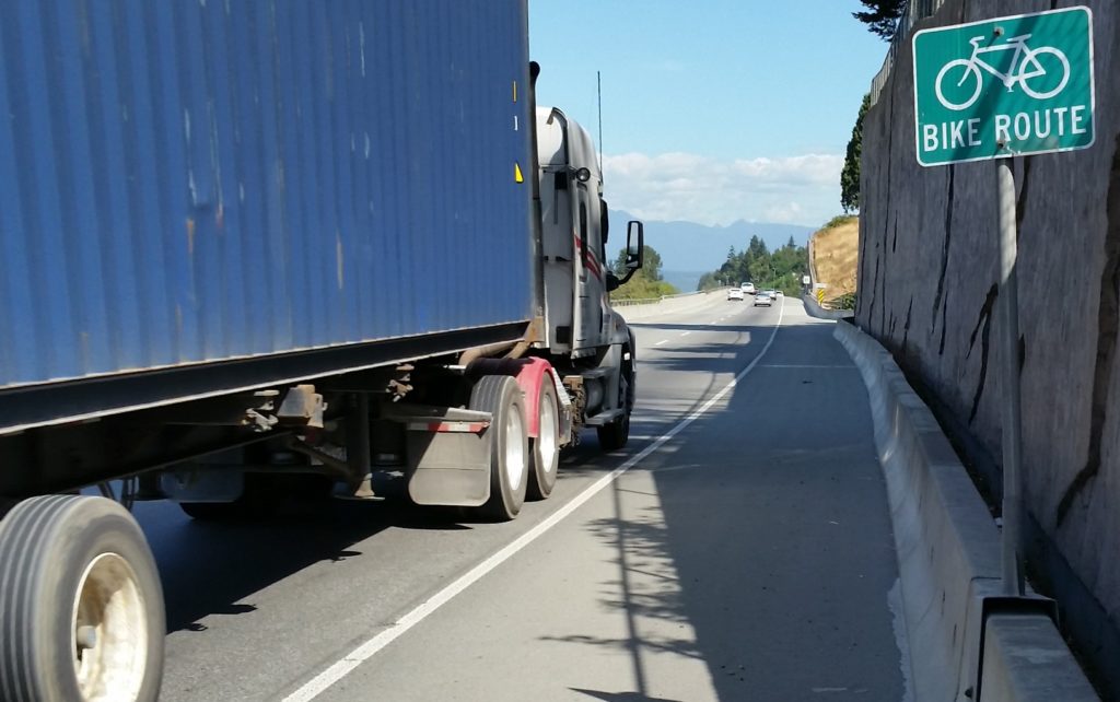
At the time, a few skeptics suggested that the shoulders of a high-speed truck route through farms and industrial areas may not be the ideal place to ride a bike, and by the time the new highway was opened, the previously-promised cyclist benefits were being seriously downplayed (hence all the dead links in that 4-year-old post above). But a Bike Route it is, to this day. There is a sign every 500m telling you so:
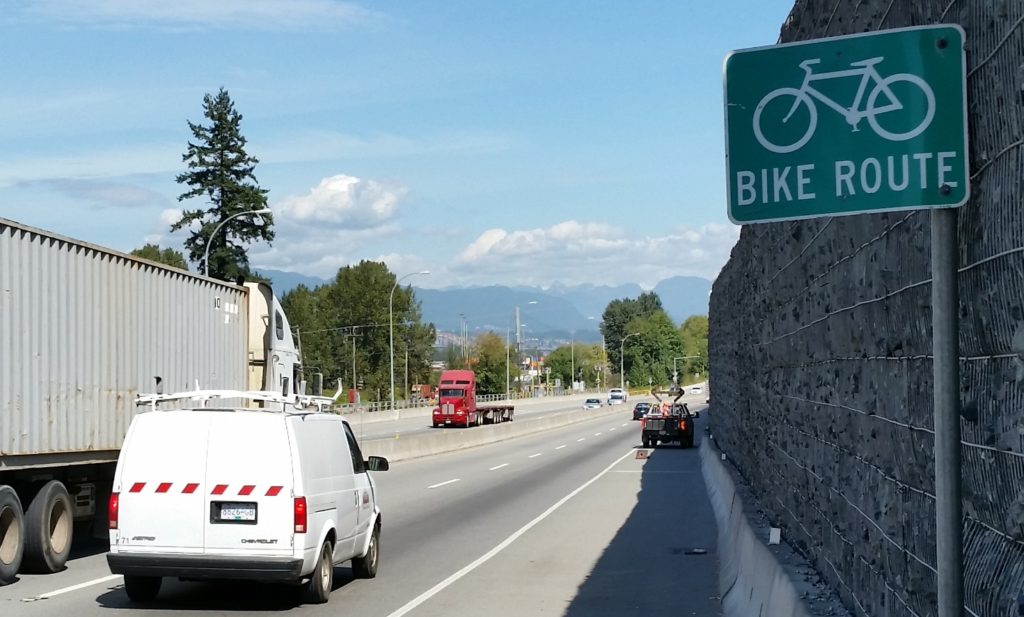
A couple of years on, the disaster of this poorly-placed, terribly-designed, and wholly-disingenuous cycling investment is pretty clear to anyone brave enough to venture onto this designated cycling route. No point dancing around the point: for cyclists of all skill levels, the SFPR is so unfriendly and dangerous that those “Bike Route” signs represent a reckless disregard for public safety.
That is a strong statement, so before I committed to it, I headed out to the SFPR with my bike to experience the length of the route in its harrowing glory, just to build up the temper necessary to commit that charge to hypertext. I went into it nervous, spent the ride terrified, and left enraged. Mission accomplished.
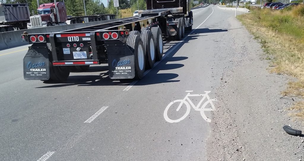
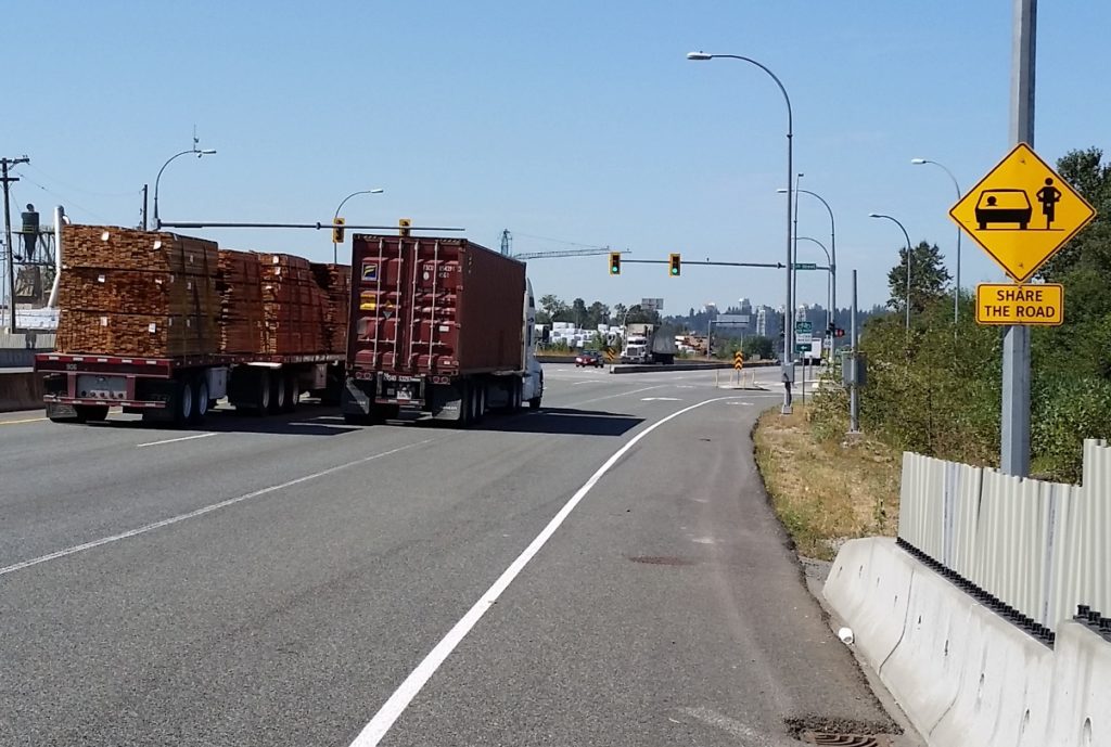
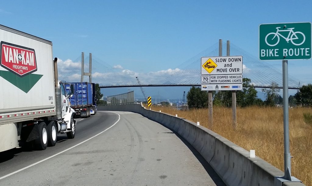
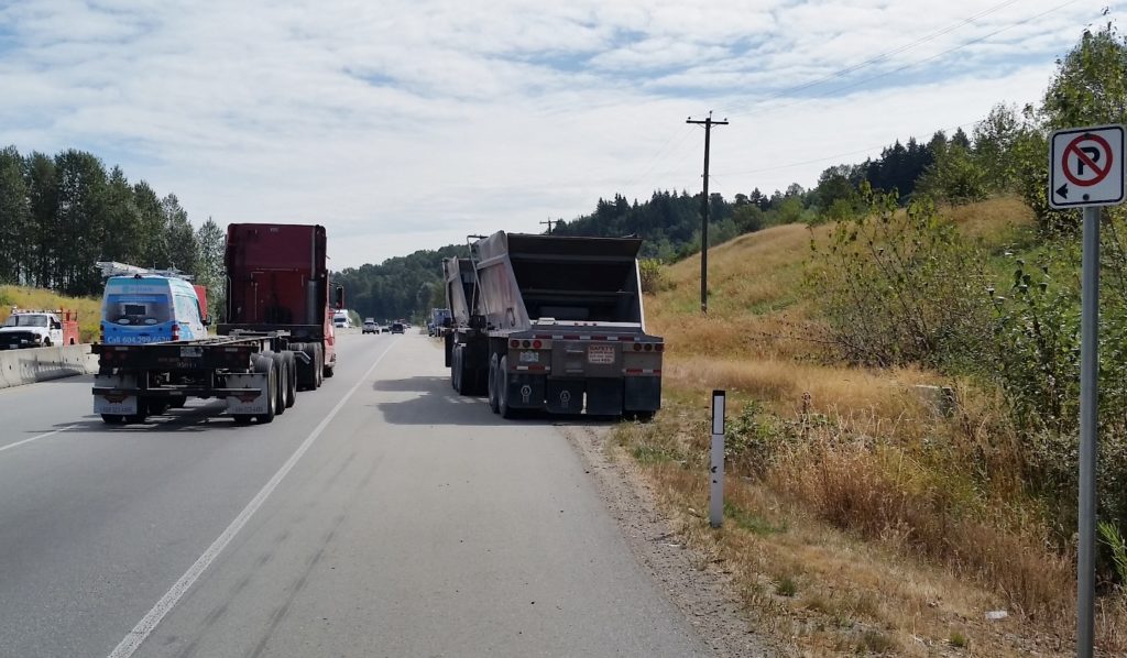
For the majority of the SFPR, the “Bike Route” is a 2.5 metre wide paved shoulder adjacent to industrial traffic moving at highway speeds. Nowhere is there a barrier protecting the shoulder from intrusions by trucks, not even rumble strips to warn drivers who may vary from their lane. The traffic is mixed, but the route was ostensibly built for and dominated by large trucks. The speed limit is allegedly 80 km/h, but speeds vary incredibly, from closer to 60 km/h around intersections (trucks accelerate slowly, after all, creating great rage moments for commuters!) to well over 100 km/h in the more open stretches.
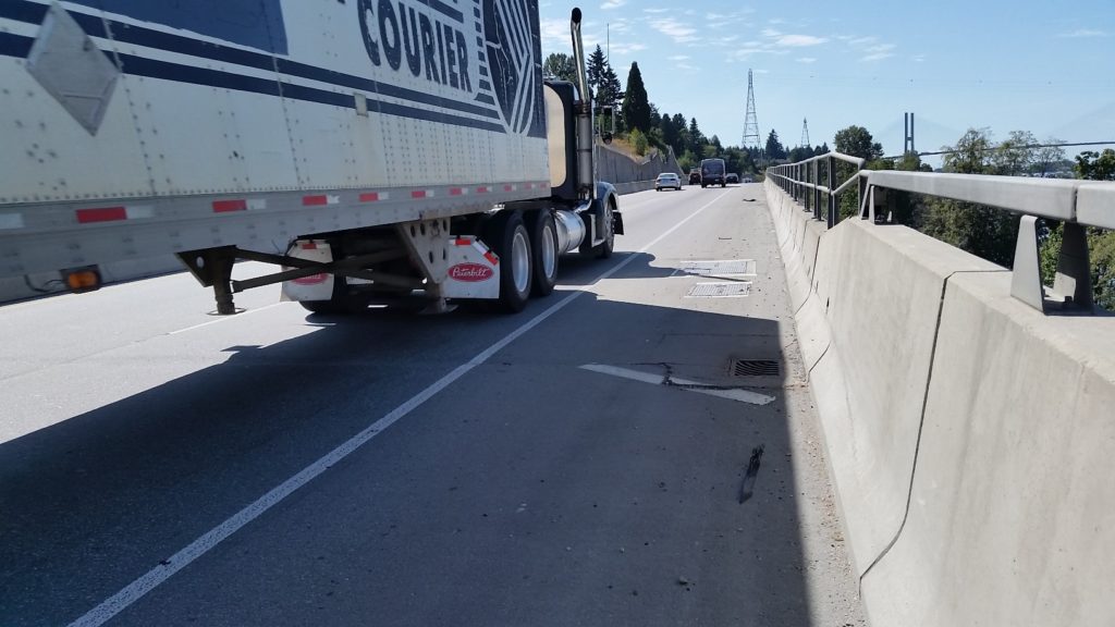
In places where there is a soft shoulder or a low jersey barrier, having 80 km/h truck traffic blow by 2 metres from your left shoulder is unsettling. Where you are between those trucks and a 4 metre-high sound barrier wall (marked by the occasional gouge from vehicle swipes) or a 10-m concrete buttress, it is nerve-rattling.
The knowledge that a momentary lack of attention by one of those drivers, or an impromptu swerve or technical problem with your bike means certain death provides a certain… clarity of thought. That thought is not “sure am glad I wore my helmet!”
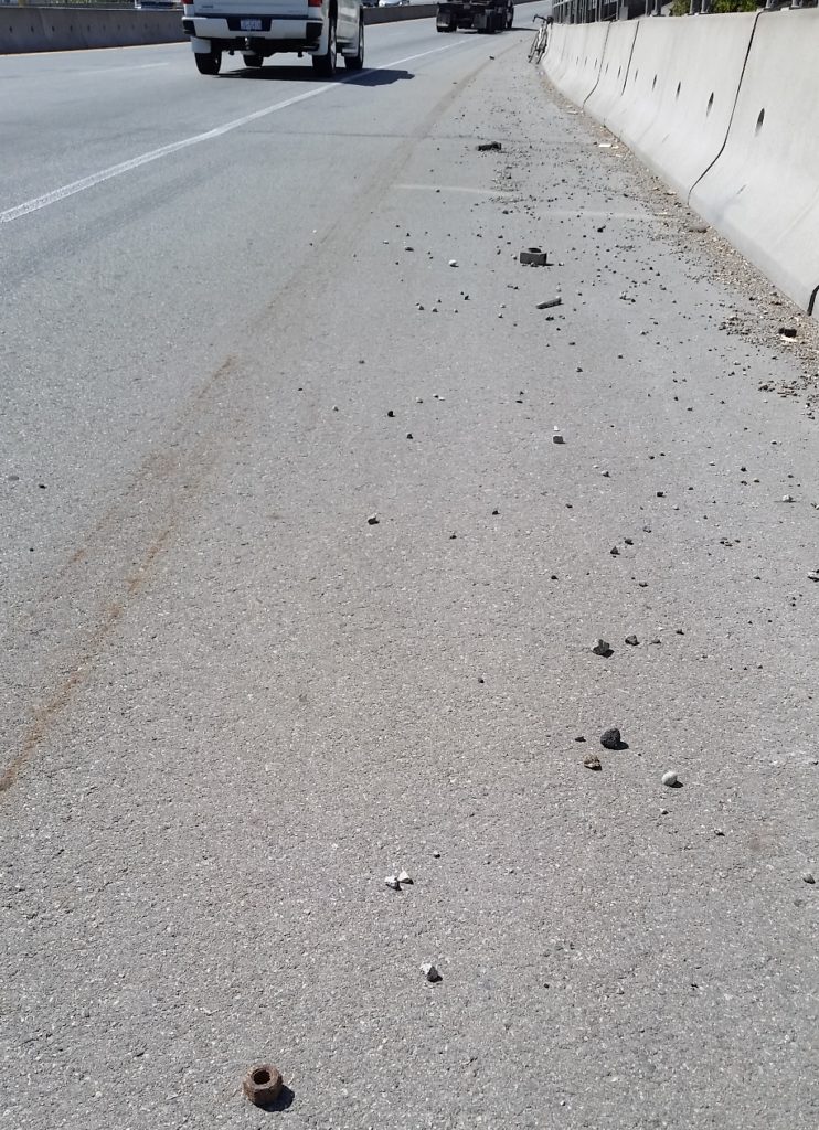
The rational move (other than to avoid the SFPR altogether, which I will get to later) is to squeeze as far over to the right and put as much space between your body and the trucks. The problem with this strategy is that the SFPR “Bike Routes” are dotted with particularly deep and treacherous rainwater catch basins, and the further you get from the traffic-swept white line, the thicker and more challenging the road shoulder debris becomes:
The road debris on this route is not surprising for an industrial truck route, unless you are surprised by the raw number of rusty and broken bolts and other important-looking parts that are ejected from trucks. Debris encountered on my ride included rocks large and small, glass, plastic vehicle parts, kitty-littered oil slicks, random lumber, nails, tire carcasses, tie-downs and bungie cords, and the occasional dead animal. These only serve to heighten the chances of one of those life-limiting impromptu swerves or technical failures. Once you realize the “swept clear” parts of the bike lanes are only done so by vehicles crossing the line at speed that you start to wonder if the route is designed specifically to kill you.
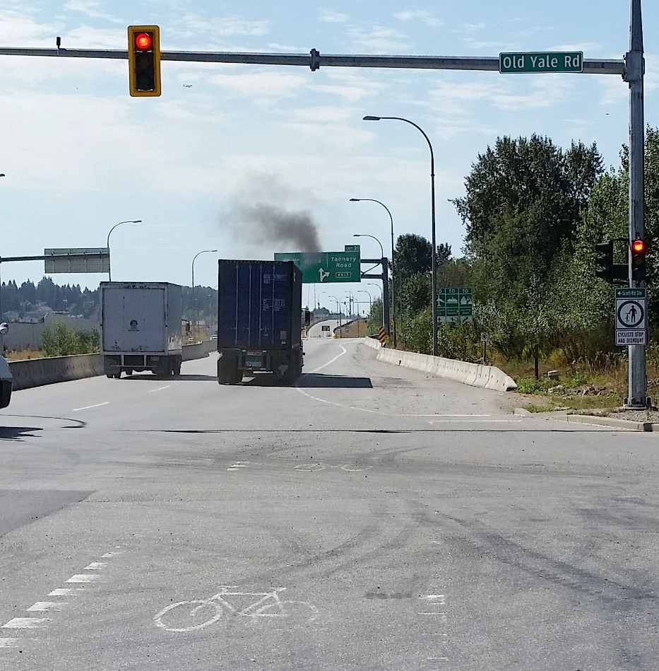
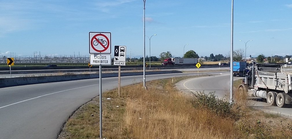
Or just designed to confuse you…
To add another layer of frustration to this alleged “bike route” is its isolation. Choose the SFPR and you are stuck with the SFPR, because it largely fails to connect to an established regional network and actively prevents you from getting on or off the SFPR where these types of connections may be obvious.
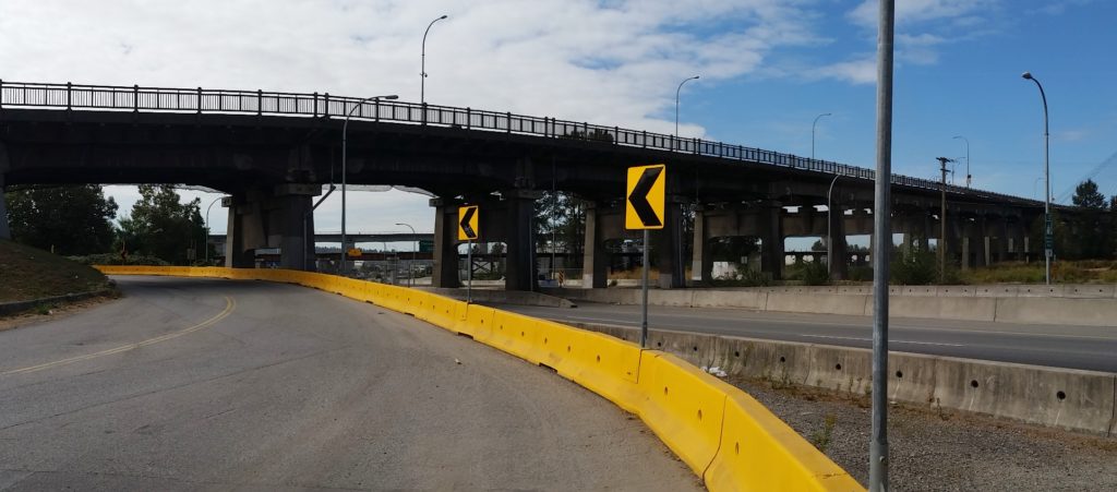
There are two locations on either side of the Alex Fraser Bridge, where a perfectly safe, low-traffic road is separated from the SFPR (one by a tall sound barrier wall) in such a way that getting out of danger’s way is impossible. For lack of a connection here, crossing this 5 foot barrier requires a multi-kilometre detour.
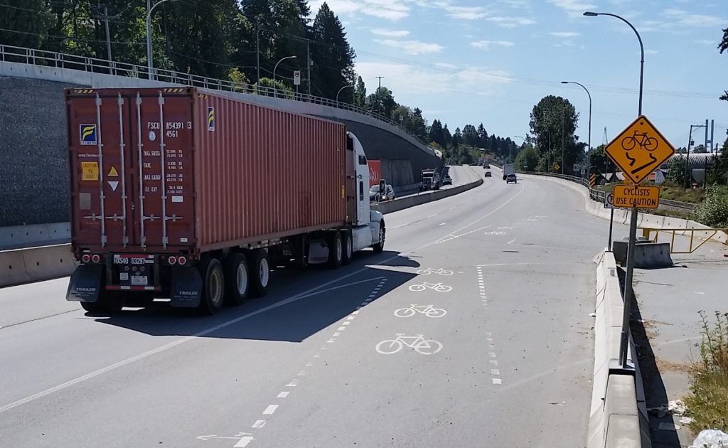
This lack of connection to regional cycling infrastructure is most obvious at the three regionally-important bridges under which the SFPR passes. The quality of the cycling paths on those three bridges is (east-to-west) really good, terrible, and not too bad, but they are all nonetheless important links. Again, either no connection has been contemplated for the bike route, or actual multi-layer physical barriers have been installed to prevent an SFPR cyclist from getting to the bridge where connections would be natural.
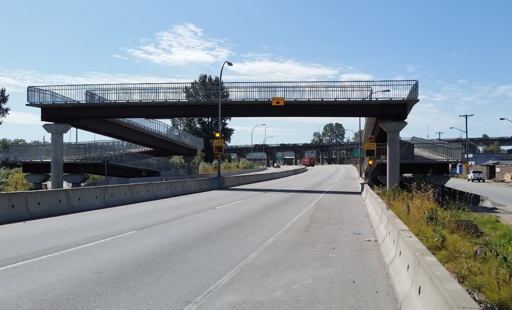
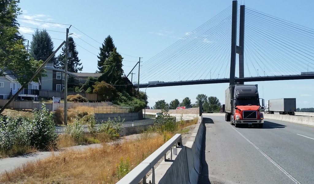
To get on the Alex Fraser Bridge from the SFPR requires a 3-km detour through two hairy multi-lane intersections. The Pattullo requires 1.5km and riding right past a pedestrian overpass, which would make for a great connection if it wasn’t barriered from access from the bike lane. The connection to the great bike infrastructure on the Port Mann is so far that is it actually a shorter distance just to ride to the terrible cycling infrastructure on the Pattullo.
So the SFPR fails at every aspect of effective cycling infrastructure: it lacks the most basic safety and comfort considerations, it lacks connections, it lacks any form of appeal. It is not surprising that during my ride of the entire 40km length of the SFPR, both ways (done over two sunny mid-week days early in the fall), I never saw a single other person on a bicycle on the entire route. However, every 500m there is one of those little green signs. Or something like this:
So it is time for the cycling community to wake up and recognize we got played. Of course, this is the Ministry of Transportation’s standard playbook, so we could have seen it coming: This “bike route” is a safety pull-off area for trucks.
We were sold “cycling benefits” of a Billion-plus-dollar piece of transportation infrastructure, and got something else: bike signs placed on paved shoulder really intended to keep trucks in the other two lanes moving if the occasional vehicle needs to pull over, or of someone just needs to park a trailer for a few hours. Aside from that, it is a gutter for gravel and trash and carcasses and truck parts to prevent them from accumulating where they may impede truck travel. This “Bike Route” is just a part of the truck route, nothing else.
(I need to super-emphasize this) The SFPR it was never meant to be a Bike Route.
So what to do? I’d like first to call upon the new Minister of Transportation to take down those “Bike Route” signs.
It isn’t her fault, she didn’t create this mess, but she adopted it by getting elected, so it is on her to do the right thing. The MoTI must stop threatening the lives of cyclists. Removing the signs and anything else that may incite otherwise-unaware bicycle users from mistakenly entering this cycling abattoir. Put an end to the ruse that this is any place for bicycles.
I could ask her for many more things – investment in cycling infrastructure for Surrey and Delta to make up for the funding-securing lies told by her predecessors, a commitment to policy changes to prevent her staff from ever doing this kind of bait-and-switch again – but those are opportunities for the future, and will require budget and policy decisions and such. She is a busy person with a huge mandate and new to the job; there will be time for those niceties later. First we must undo this mistake made intentionally by the previous government.
In the short term, someone in Minister Trevena’s office needs to call up the road maintenance contractor that bought the rights to not clean the shoulders here, and ask them to send a crew out to remove those signs. It shouldn’t take more than a day, it won’t cost any money, and it’s the right thing to do.
Excellent write up. I don’t even bike and I feel your pain.
Excellent article. I can’t imagine riding a bike along SFPR. It’s a scary enough drive at times with trucks and race car drivers competing for position.
Does HUB have a position on this?
I did this route yesterday, but instead of taking on the insanity of the SFPR, I used an access lane for the railroad, beneath the highway and nearer the river. At first it starts off as paved, but about 85% turns out to be gravel. Eventually you get to the extensive dock region but you can cruise through there no problem, the trucks are much more subdued, queueing up for delivery. There are regular No Trepassing signs but they don’t mind if you’re just passing through. I just passed one traffic attendant tellng the trucks when to proceed and he didn’t even notice me. I scouted this region extensively on Google Earth beforehand so I knew exactly where I wanted to go and exactly how things link up. Eventually you get to Tannery Road were you cross over the SFPR via an overpass. From there I just went to Scott Road Station and took transit home, but you could cross the Pattulo if you wanted and head into New West, or carry on east towards Harvie Road and the Golden Ears Bridge. Or just up heft your way up the King George Highway. I picked up a Compass card and it was terrific in getting me back to White Rock for a mere $2.30, plus $6 down payment on the card, which is refundable. I used a bike rack for the first time on the 321 bus and that went well, a few niggles but I managed it before anyone got impatient.
Anyway at one point on the service road you have to stop and cross a very minor stream bed, but it’s no trouble at all. Or you could cross the rail bridge but the stream bed is much shadier and nicer. One final point is that there is virtually no shade on this route and I got badly scorched, this being the blazing days of July. Anyway you can enter this route underneath the Alex Fraser bridge, and there’s an underpass off River Road as well. The Tidewaters Pub also has $5.10 eponymous lagers and soup/sandwich specials if you’re up for lunch.
Here’s an overview of the route: https://i.imgur.com/8Qykh2M.png
and detail on the creek bed: https://i.imgur.com/mbNKtHX.png
I heard the whole article in the voice of Rick, of Rick and Morty. I’m slow clapping now.
I made a comment which i now realize may have come off as glib and failed to convey how great i thought the article was. I said the article was totally written with the language and in the voice of Rick from Rick and Morty. It is! It’s super smart, well spoken and angry. Terribleness of the bait and switch aside, made me laugh when I wasn’t mad af.
Sometimes I read something and go, Jesus Christ, is everything always a con? The answer of course is yes.
Great article Pat and really well written. Thank you.
It is very annoying that the only way I have found to go South over the Alex Fraser then East on Highway 17 is to jump a couple of concrete barricades between River Rd and the South Perimeter Rd just past Centre St. After that, at least the road is smooth, so average speed is pretty good.